
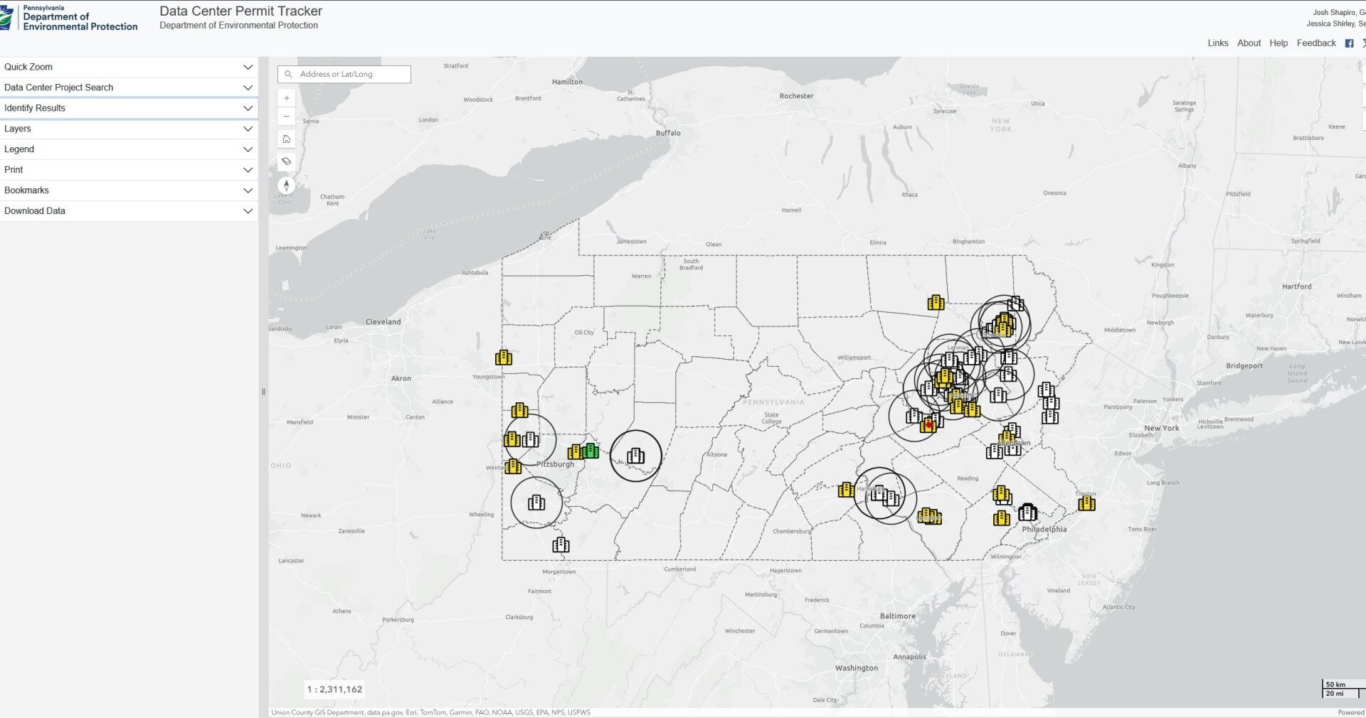
The Pennsylvania Department of Environmental Protection has a tool to track data centers.
The environmental regulatory agency quietly launched a “Data Center Permit Tracker,” releasing a department-managed map of proposed data centers throughout Pennsylvania. The map shows what, if any, permits a data center has applied for with the DEP, as well as the status of those applications in the review process. It provides a broad view of Northeast Pennsylvania’s sprawling data center landscape, including across Lackawanna, Luzerne and Schuylkill counties.
The tool categorizes data centers as either “confirmed” or “unconfirmed,” providing varying available information on each project. However, the map only shows confirmed data centers by default; to view unconfirmed projects, users have to toggle “Unconfirmed PA Data Centers” under the layers dropdown menu to get a broader overall picture of the region’s data center proposals. To access the dropdown menu, click “Layers” on a computer, or on mobile devices, tap the wrench icon on the top right of the webpage before tapping “Layers.”
The tracker went live Aug. 18 at the direction of Gov. Josh Shapiro, DEP spokeswoman Patti Monahan said Friday.
Shapiro signed his executive order the same day, requiring all data centers applying for permits with the state to comply with his Governor’s Responsible Infrastructure Development requirements, or GRID.
“Gov. Shapiro’s executive order directed DEP to create a publicly accessible map containing all proposed data center projects in Pennsylvania that have engaged with the department,” Monahan said.
The map color-codes data centers based on whether they have completed their permit reviews with the DEP. Out of the eight confirmed data center projects locally, only one has a completed review — Phase 1 of Amazon Web Services’ Salem Twp. Data Center Development in Luzerne County. Statewide, there are 23 confirmed data center projects as of Friday afternoon.
Across Northeast Pennsylvania, confirmed data centers include: Project Boson, Project Gravity and the Triboro Industrial Park Data Center in Lackawanna County; Amazon Web Services’ Salem Twp. Data Center Development, QTS Salem and Project Hazelnut in Luzerne County; and Highridge Data/Project Nebius and Amazon Web Services’ Kline Twp. Data Center Development in Schuylkill County.
The majority of projects fall into the unconfirmed category.
DEP notes on its map that it does not have a role in local zoning decisions and does not track local ordinances or permitting.
According to DEP, permits and authorizations commonly associated with large-scale data centers include:
• Earth disturbance and stormwater management (Chapter 102).
• Wetland and waterway encroachment (Chapter 105).
• Storage tanks.
• Air quality.
• Sewage facilities planning.
• Clean water.
By selecting an individual project, the tracker shows the project name and an affiliated developer or landowner, and when available, the permits a data center has applied for, with accompanying permit numbers, the date of the submission and the review status. For additional permit information, the state has a dedicated permit tracker at permit-license-status.pa.gov.
Additional layers in the map allow users to see municipal and county boundaries, school districts, state Department of Conservation and Natural Resources forest districts and state park regions, state and federal legislative districts, U.S. Census tracts and environmental justice areas. Layers can also depict protected lands and waters, including national parks, national forests, U.S. Fish and Wildlife Service lands, national wild and scenic rivers, state forests, state parks and state game lands.
To access the map, visit gis.dep.pa.gov/DataCenterPermitTracker/.