
Shower chances return Wednesday followed by more wind, rain and falling temperatures on Friday.
 PITTSBURGH —
This week’s temperatures have a little something for everyone. We are tracking two rain chances with two Impact Days. The weekend brings the coldest air of the season yet.
Temperatures: Toasty to chilly
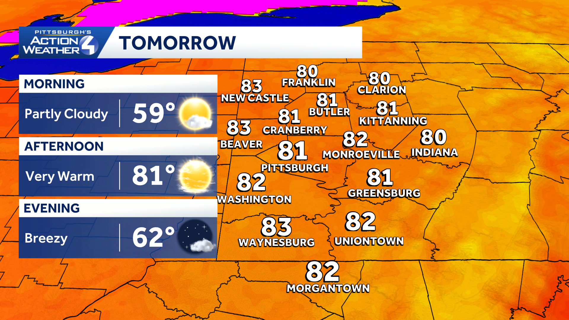
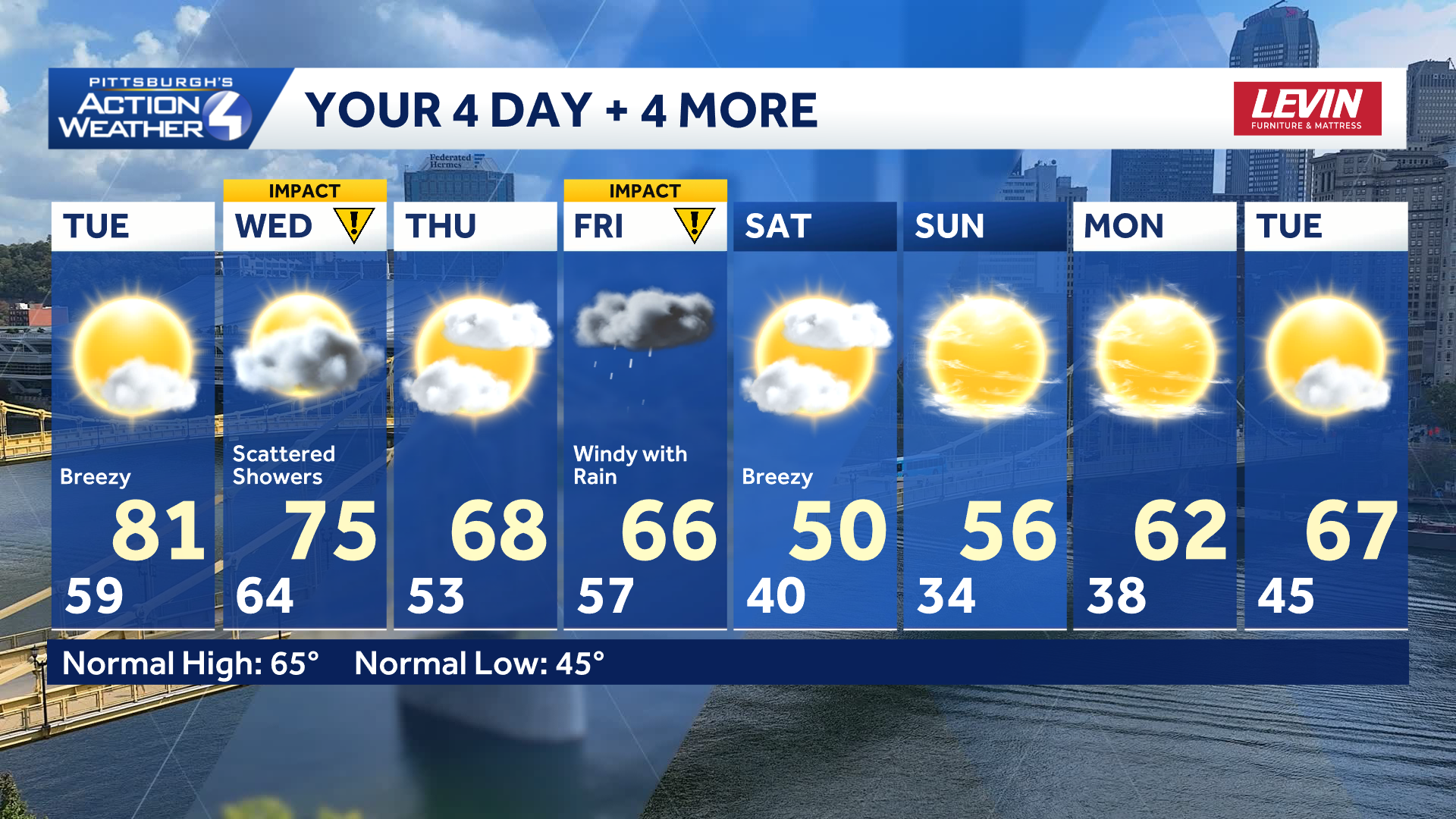
Tuesday will likely be the warmest day until next spring. Highs around western Pennsylvania will top off in the lower 80s. The warm up gets some help from a breeze and gusts up to 25 mph.
Hearst OwnedHearst
It’s the last day for shorts and the air conditioning.
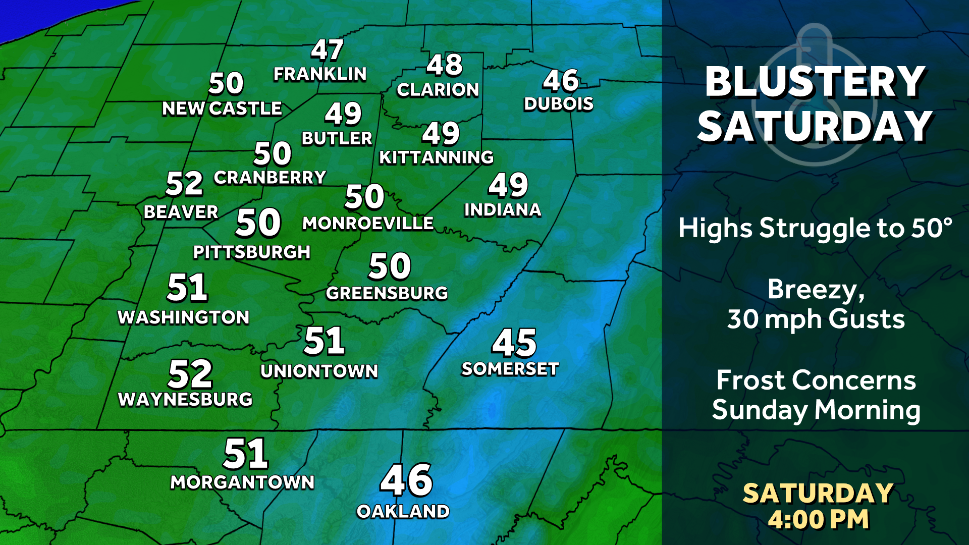
A sharp cool down is looming by the weekend. On Saturday the mercury could struggle to reach 50 degrees. And that doesn’t take account the breeze.
Hearst OwnedHearst
Saturday will be a blustery day with temperatures struggling to reach 50 degrees.
Two rain chances and Impact Days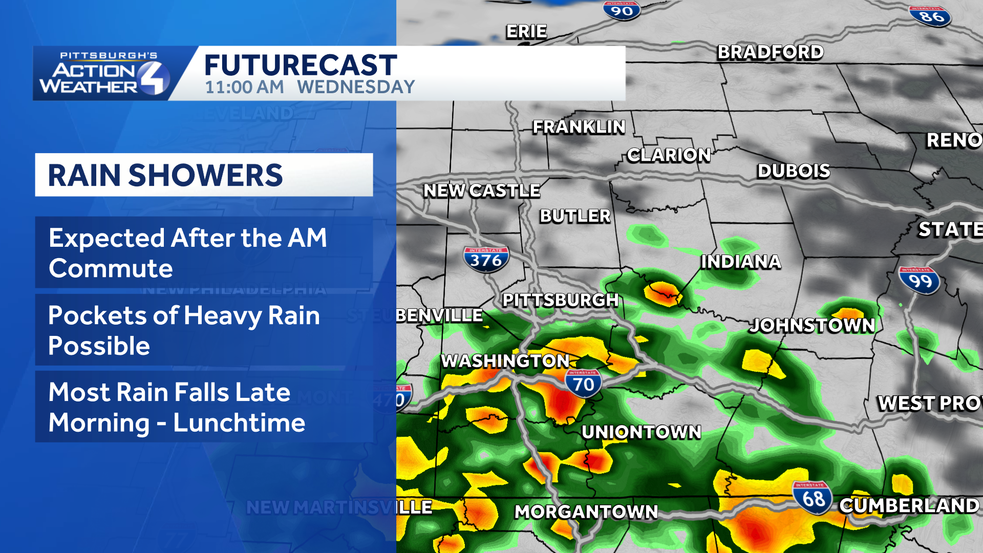
The first cold front arrives Wednesday with isolated showers and the potential for rumbles of thunder. Most of the activity clears after noon. likely between the two commutes. Thursday brings a break in the action before a much stronger front. Friday will feature not only rain but up to 40 mph winds. Much chillier air is waiting for the weekend.
 The growing season could end this weekend
Temperatures plummet behind Friday’s cold front. Many of us will likely stay in the 40s through the day on Saturday. The cold settles in Sunday morning as we wake up in the middle 30s to prompt widespread frost concerns. It is possible the first freeze of the year shows up in the Laurel Highlands and sheltered valleys.
Hearst OwnedHearst
The October chill is temporary. More seasonal air returns next week.
TONIGHT: Mostly clear to partly cloudy. Low 59°.
TUESDAY: Breezy and much warmer, sun and clouds. High: 81°, low: 62°.
WEDNESDAY – Impact Day: Scattered showers, some pockets of heavy rain. High: 75°, low: 53°.
THURSDAY: Mild with intervals of sun and clouds. High: 68°, low: 57°.
FRIDAY – Impact Day: Rain and wind. High: 66°, low: 40°.