
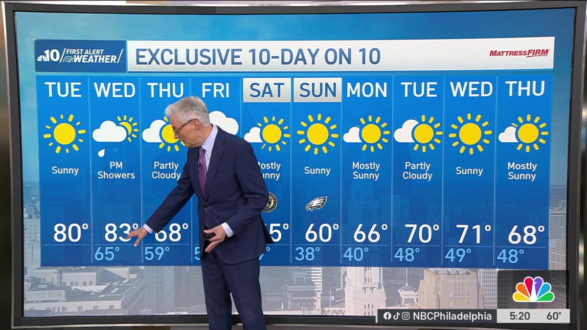
Skies are clear on Tuesday morning with temperatures back in the 50s for most neighborhoods and a pocket or two of fog possible to start, but it won’t last.
Bright sunshine takes over and sends temperatures surging into the low 80s this afternoon.
A breezy feel later in the afternoon with winds gusting around 20 m.p.h.
Wednesday turns even warmer and more humid with a high of 83° that’ll feel like the upper 80s.
After a sunny start, an approaching cold front touches off some spotty afternoon showers and the possibility of isolated thunderstorms.
That front clears out by Thursday and we snap back to Fall with partly sunny skies and a high near 70°.
A stronger frontal system arrives late Thursday night into Friday with showers and a chance of thunderstorms.
A warm front delivers the first round of showers Friday morning, then a brief peek of sunshine before the cold front pushes through later in the day. We’ll top out at 75° in between the two rounds before the cooler air rushes in for the weekend.
Saturday warms to just 55° under mostly sunny skies – it’s the gusty winds that will keep it cool.
The wind settles down Sunday with bright sunshine and a high of 60°.
Overall, a cooler than normal weekend, our average high this time of year is 68°.
Get the latest weather updates by downloading the NBC10 app and following the NBC10 First Alert Weather team.