A warm front will continue to slide north of our region to keep us mild Tuesday night.
Overnight lows will only dip into the low to mid 60s, which is not far off from our normal high this time of year. The normal high currently stands at 68 degrees.
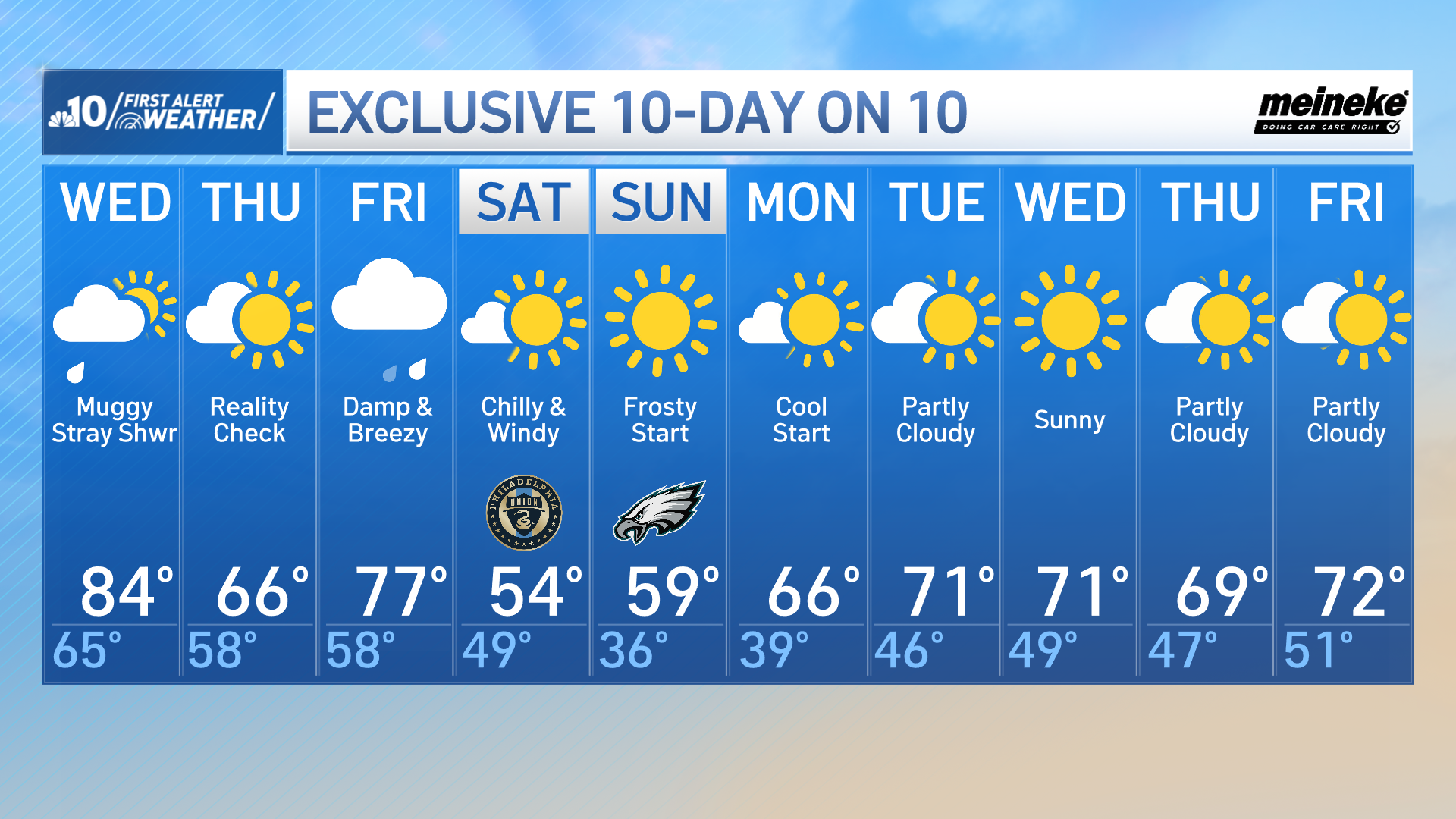
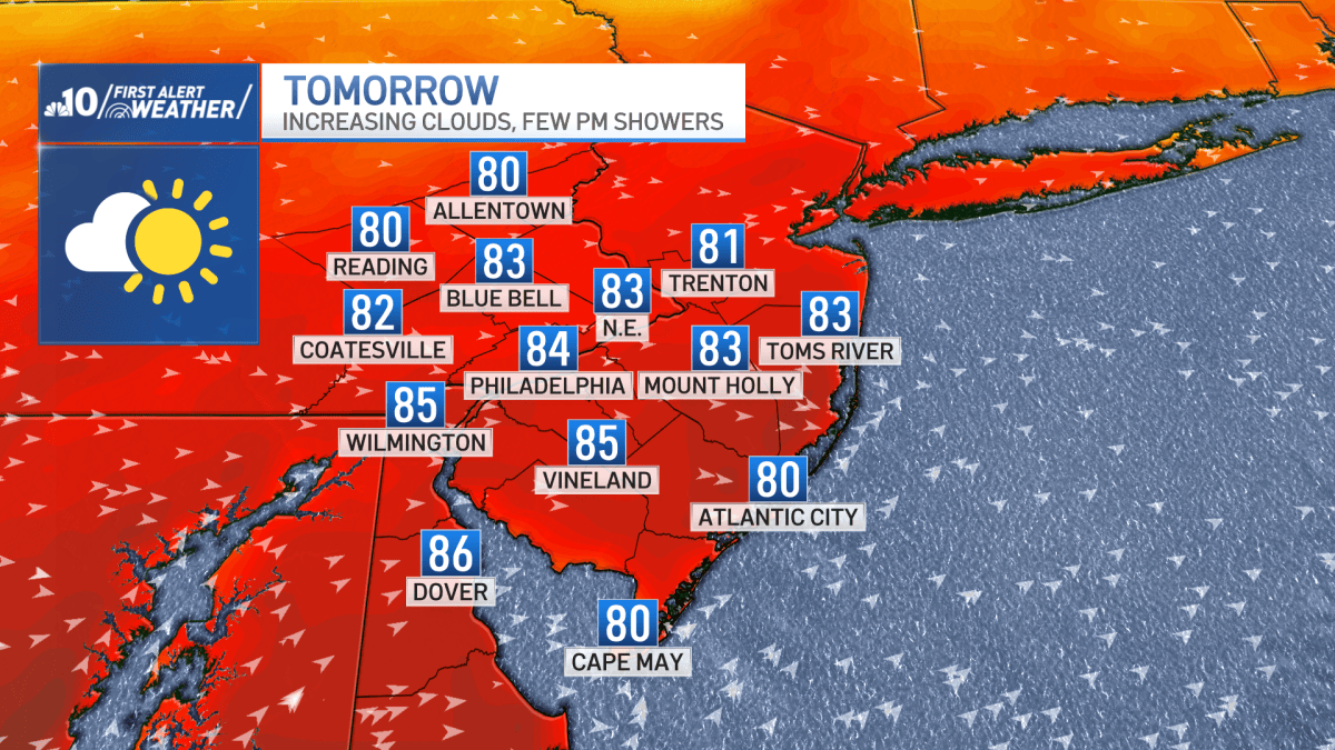
Wednesday begins bright, mild and a little muggy before clouds emerge during the afternoon ahead of a cold front that will bring stray showers and isolated thunderstorms in the afternoon and evening.
NBC10NBC10
Behind the cold front, temperatures fall back to seasonable values for Thursday.
Our weather whiplash continues for Friday.
A warm front will lift north in the morning to bring a few showers.
Warmer and breezy conditions take over with afternoon highs in the mid to upper 70s.
Despite a mid-day lull in the rain, a cold front slides through our region in the afternoon to bring a few thunderstorms.
Blustery conditions bring a dramatic drop for Saturday with highs only in the low to mid 50s.
Winds gradually diminish Saturday night allowing temperatures to fall into the 30s by Sunday morning which will create a frosty start especially for the suburbs.