

 SUSQUEHANNA TOWNSHIP, Pa. —
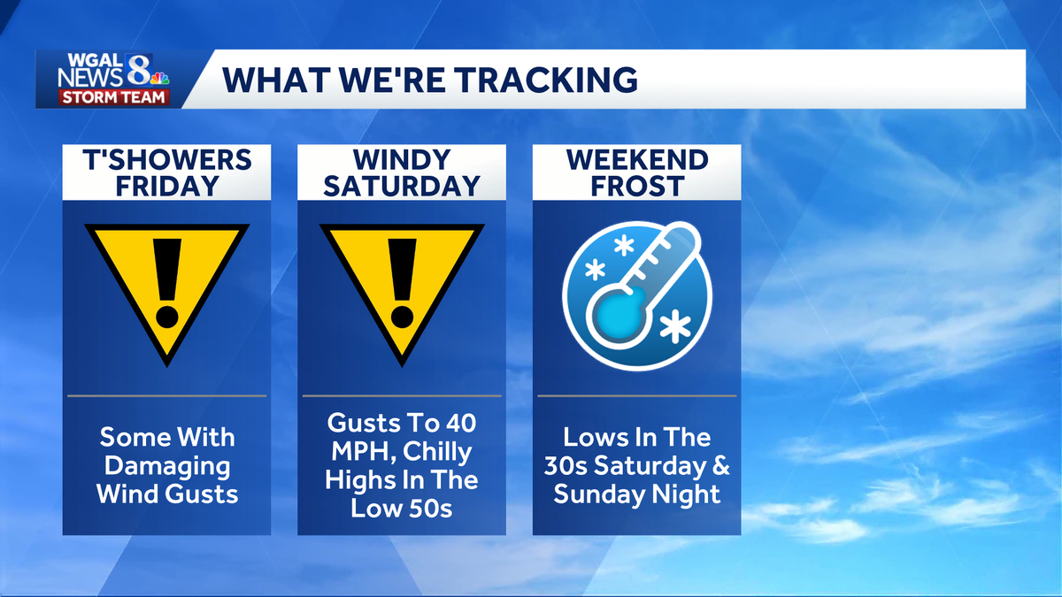
The Susquehanna Valley faces two Impact Days as thunderstorms, damaging wind gusts and the first possible frost of the season move into the region Friday and Saturday.
 Friday: Scattered thunderstorms
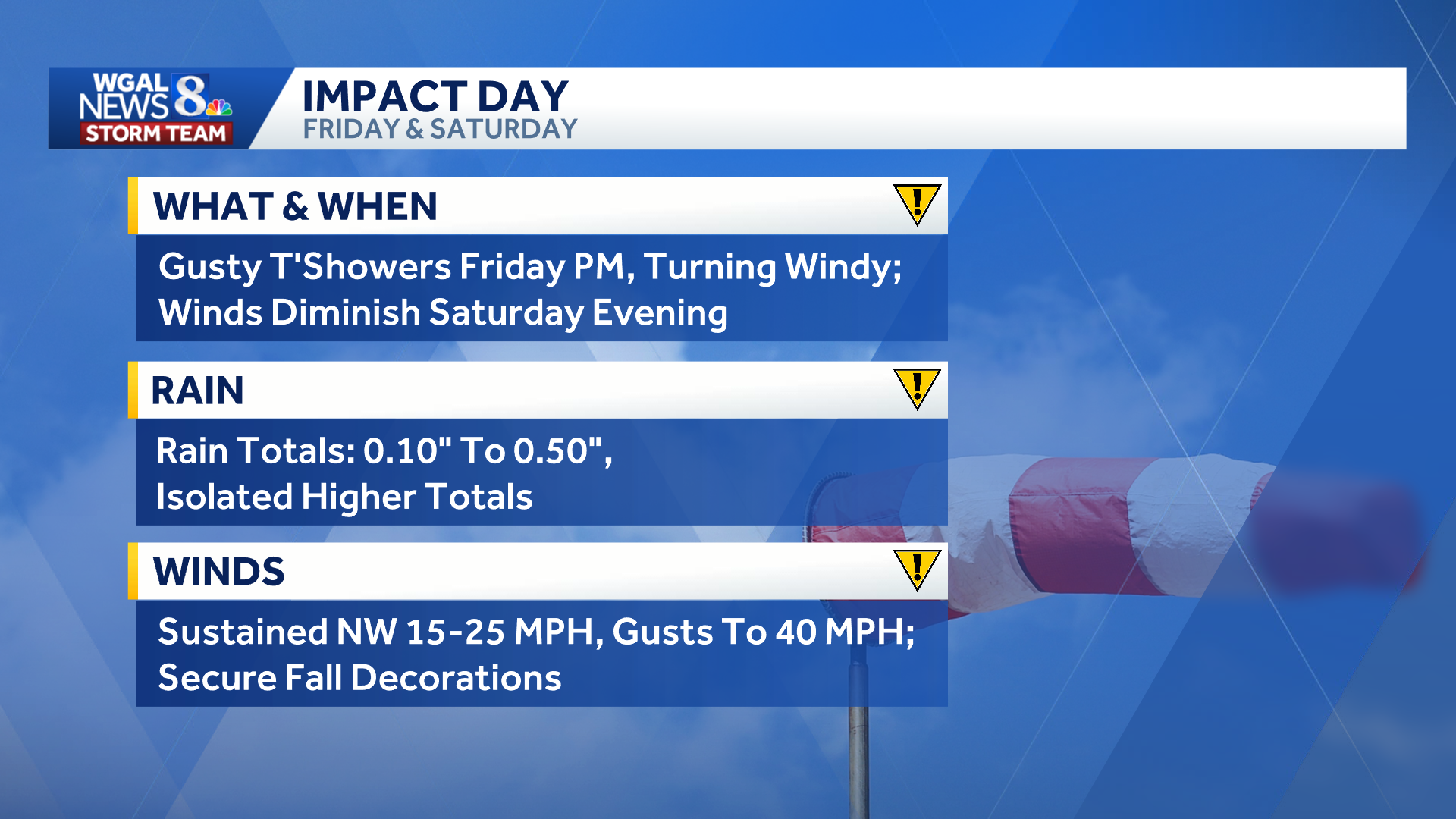
TIMING | Morning showers will end around sunrise Friday, allowing for partial clearing before clouds and scattered thunderstorms return during the afternoon and evening. Storms should move east of the area Friday evening as a strong cold front passes.
Below: Swipe through the predicted radar.
This content is imported from infogram. You may be able to find the same content in another format, or you may be able to find more information, at their web site.
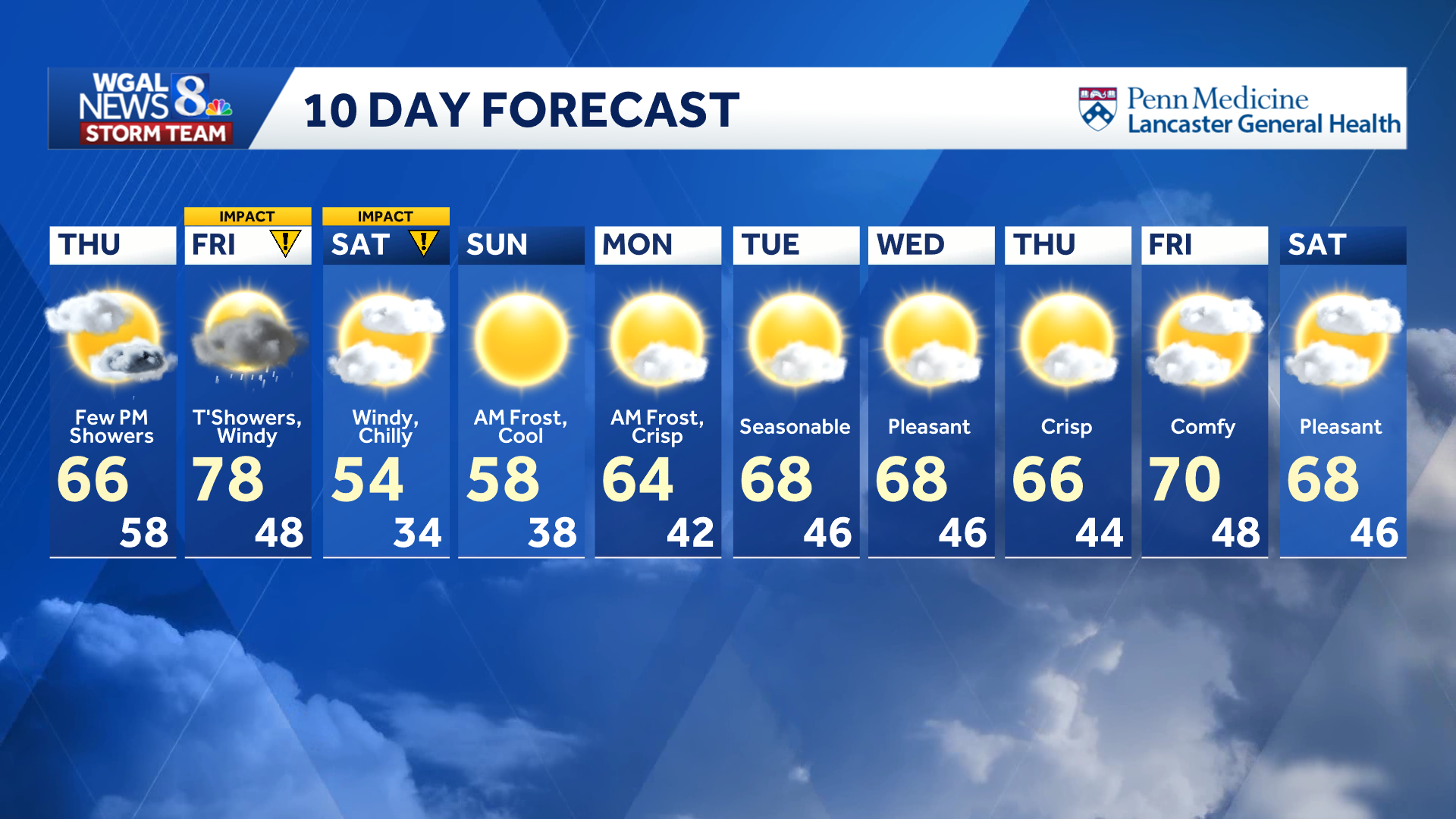
CONDITIONS | Temperatures will climb into the upper 70s, with increasingly humid conditions.
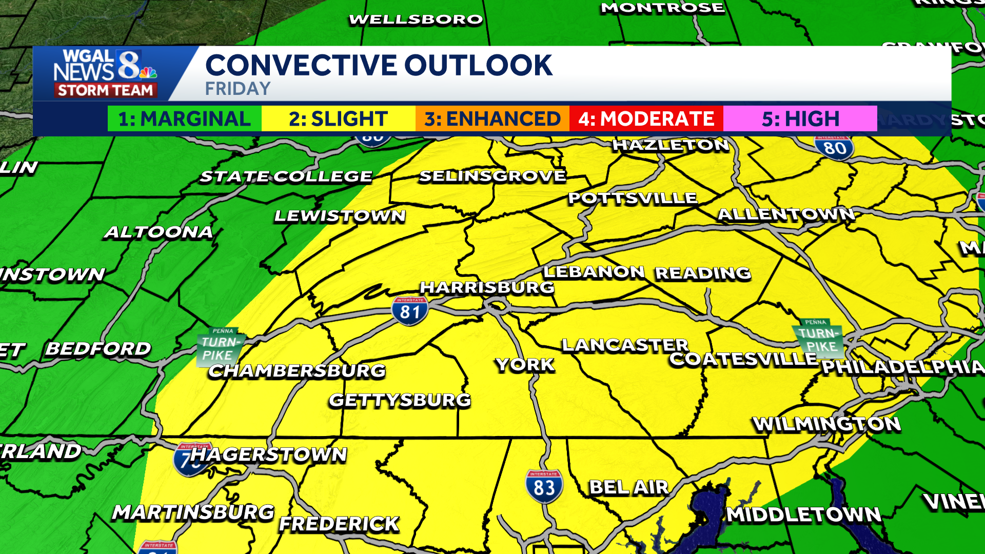
SEVERE WEATHER RISK | The Storm Prediction Center has placed much of the Susquehanna Valley under a slight risk (level 2/5) for severe weather.
MAIN THREATS:
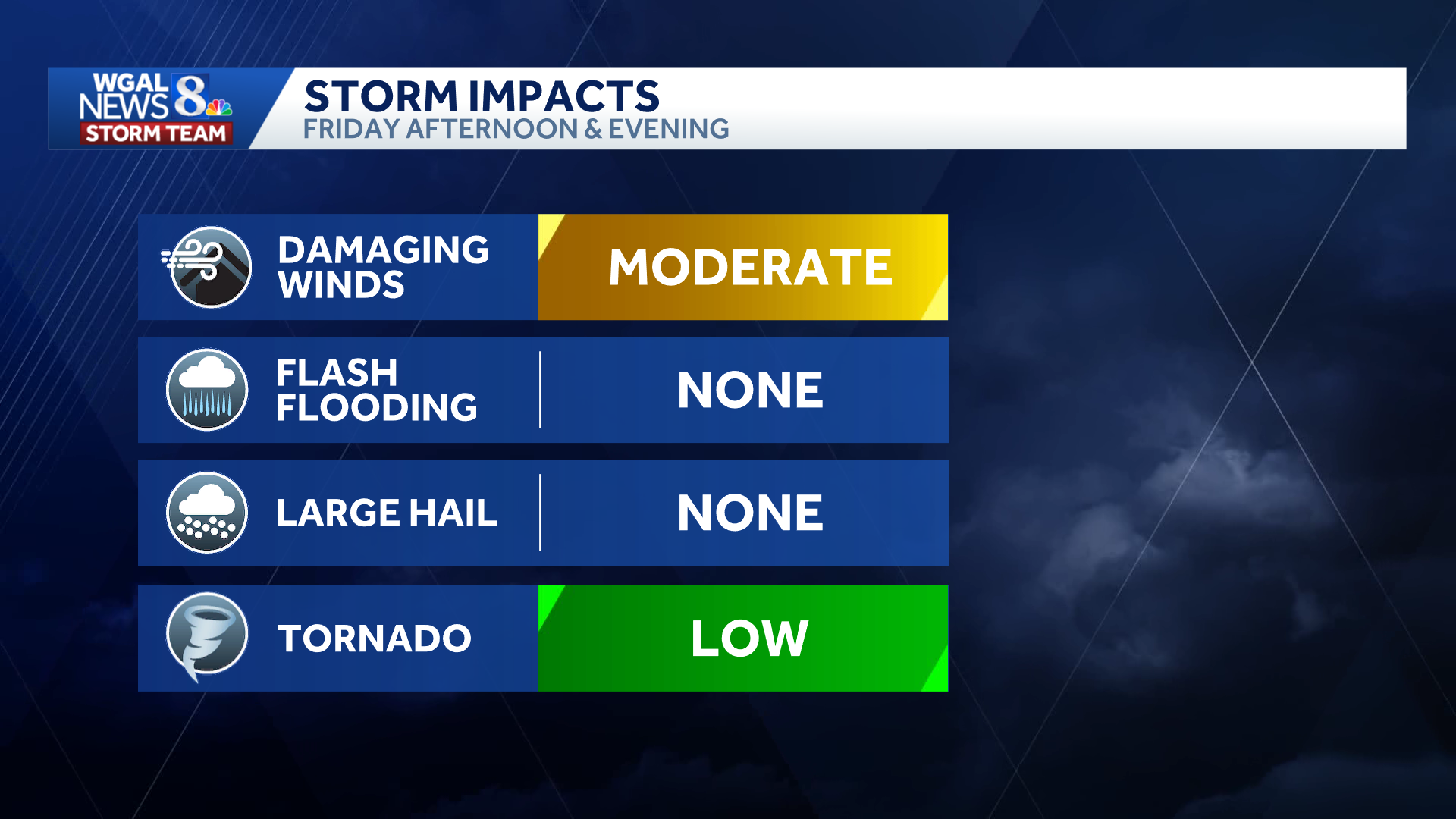
Damaging winds: Moderate threatTornadoes: Low threat, mainly east
There is currently no threat for flash flooding or large hail.
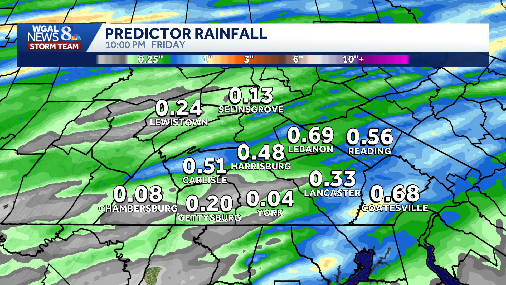
RAIN TOTALS | Most of the region will get between 0.10 and 0.50 inches, with isolated higher amounts possible.
 Saturday: Windy, chilly conditions take over
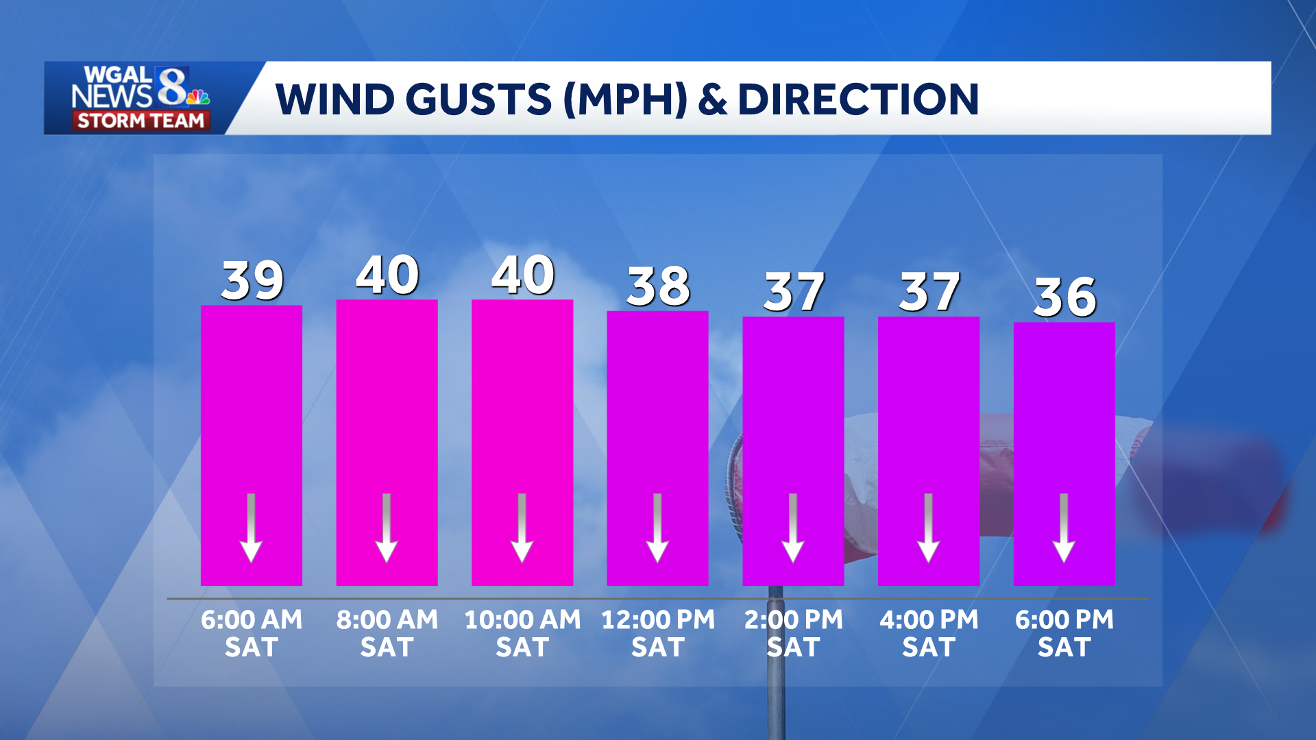
WINDS | Northwesterly winds will strengthen behind the cold front Friday night and continue through much of Saturday. Sustained winds of 15 to 25 mph are expected, with gusts approaching 40 mph.
CONDITIONS | Saturday will begin cloudy before skies gradually clear. Despite increasing sunshine, temperatures will struggle to reach the mid-50s, a drop of more than 20 degrees from Friday.
 First frost and freeze of the season possible
Winds will diminish Saturday evening as high pressure moves overhead. Temperatures will then fall into the low to mid-30s, creating the potential for the season’s first widespread frost and freeze.
Residents should consider covering or bringing in any sensitive plants.
Frost advisories or freeze warnings may be issued as the weekend approaches. The WGAL News 8 Storm Team will continue tracking the forecast and will provide updates as they become available.
Do you have photos or videos of the weather? Share them with WGAL at https://www.wgal.com/upload.