
Tuesday is going to be our first real feel of winter with the actual lows dropping into the 20s and 30s in the Philadelphia region, and wind chill temps will be in the teens and 20s.
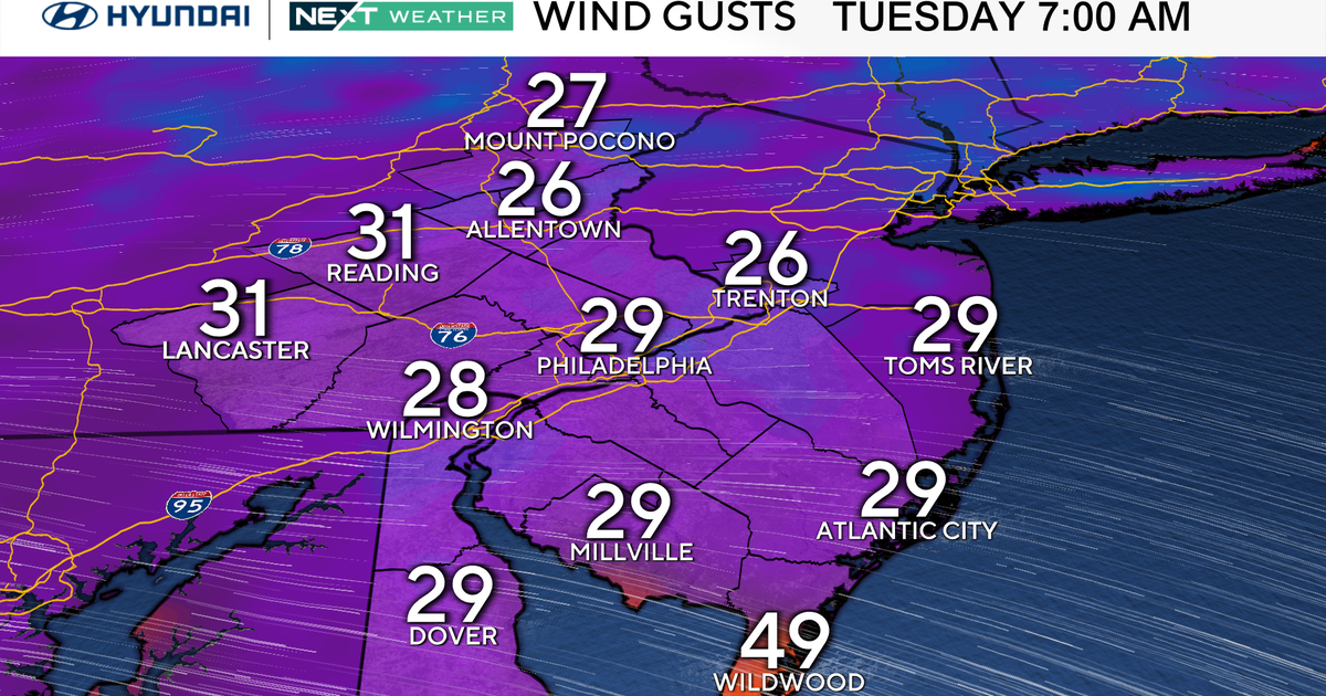
Gusts will be out of the Northwest, roughly 20-30 mph during the morning hours but increasing during the daytime up to 40 mph. Combine that with temps only in the mid-low 40s during the day, and we’ll have wind chills barely above freezing, even during the peak heating of the day.

CBS News Philadelphia
Now, if this were mid-January, it wouldn’t be a huge deal, as we’d both expect it AND be used to it, but the first of the season usually has a bit more impact. Keep in mind your sensitive plants. Yes, the growing season is over, but you may have something out on your porch that needs protection.
As for the sky cover, mostly sunny skies should prevail, but during the day, we’ll see passing clouds that could produce a stray snow flurry or two. No accumulation is expected, but be aware if heading out, especially on the roads in areas like the Poconos and Lehigh Valley.

CBS News Philadelphia
After Tuesday, we’ll get a quick rebound back to normal with highs returning to the mid and upper 50s with dry weather expected through the end of the week and into the weekend. Our NEXT Weather maker looks to be next Monday when we’ll track showers (in the form of rain).
Here’s your 7-day forecast:

CBS News Philadelphia
Tuesday/Veterans Day: NEXT Weather alert for cold. High 45, Low 32.
Wednesday: Not as cold. High 55, Low 36.
Thursday: Quick warming. High 57, Low 42.
Friday: Mostly sunny. High 59, Low 37.
Saturday: Mostly sunny. High 54, Low 36.
Sunday: Partly cloudy. High 62, Low 41.
Monday: Shower chance: High 56, Low 45.
More from CBS News