
The coldest air of the season settles in this weekend.

Friday’s weather threat includes rain, wind and plummeting temperatures.
Severe Thunderstorm Warning
All warnings have expired.
Impact Day: Gusty Winds & Rain
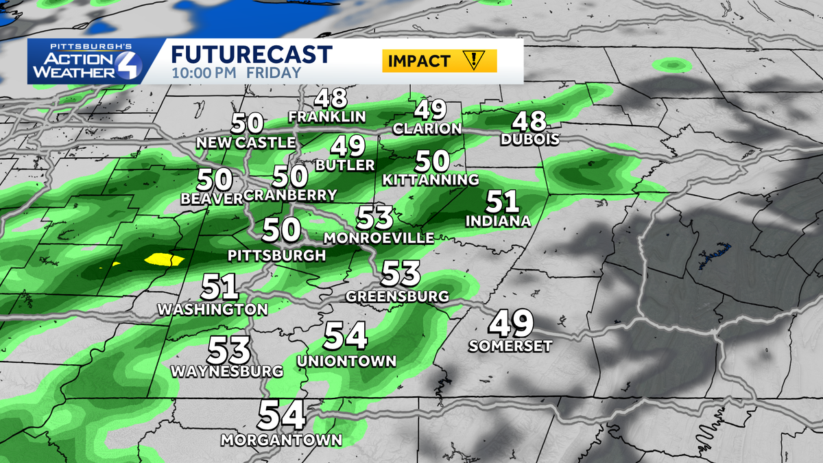
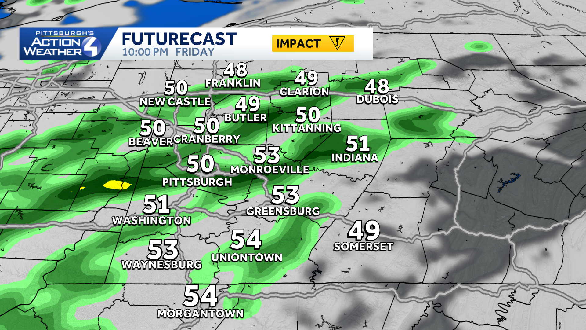
A potent cold front sweeps through western PA, prompting an Impact Day. Rain is here now and will work southeast through the early afternoon. Gusty winds will be more problematic with gusts of 30 to 40 mph and higher gusts on the ridge tops of the Laurel Highlands.
Temperatures peaked in the low and mid 70s, but are now starting to fall. Readings will be in the 50s late-day. More rain showers are on deck this evening. It will be a cold, rainy, and windy evening for high school football.
Hearst OwnedHearst
Gusty showers will continue through this evening.
The growing season likely ends this weekend
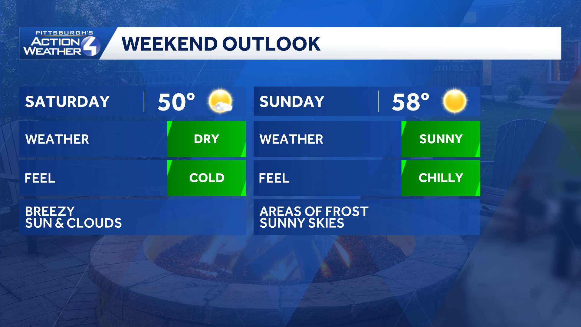
Temperatures plummet behind Friday’s cold front. Many of us will likely stay in the 40s through the day on Saturday. The cold settles in Sunday morning as we wake up in the middle 30s to prompt widespread frost concerns. It is possible the first freeze of the year shows up in the Laurel Highlands, north of Interstate 80, and sheltered valleys.
 Temperatures moderate next week
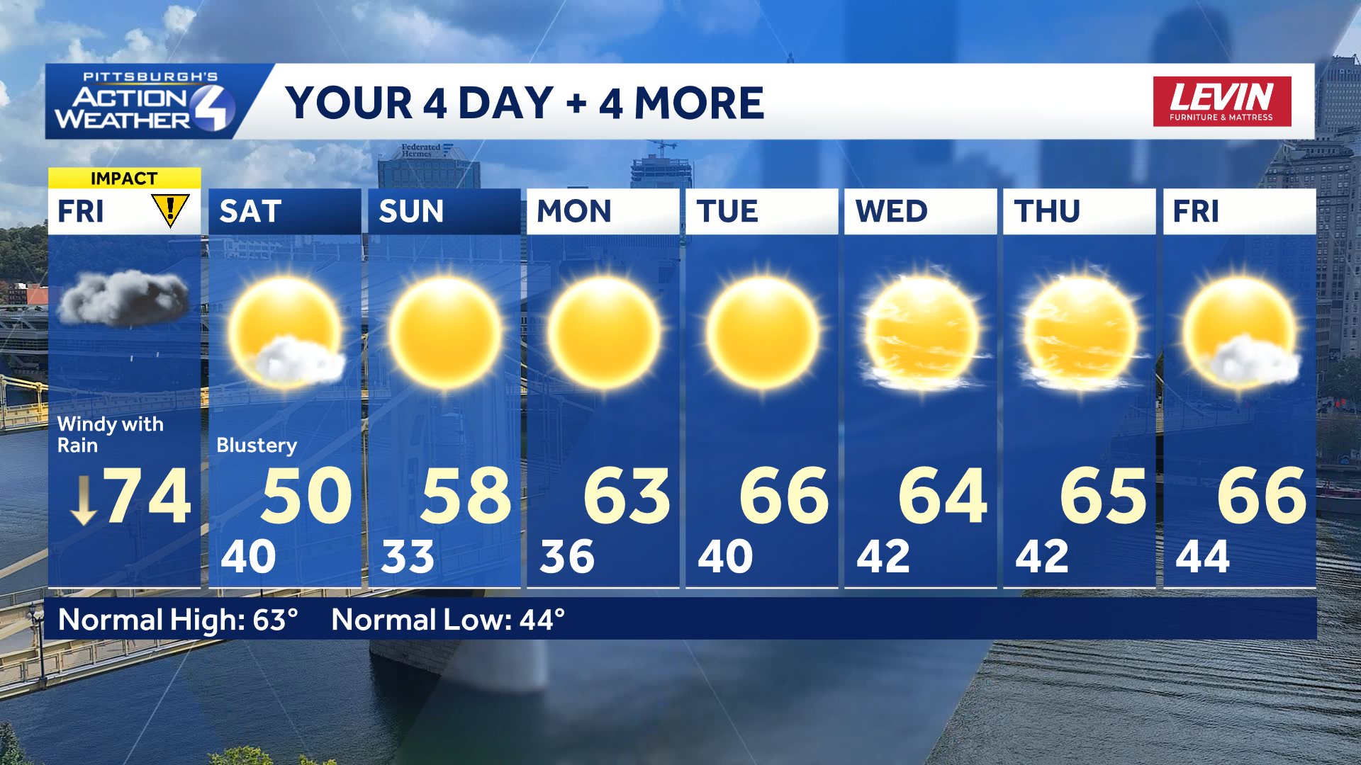
With ample sunshine, highs begin warming as we head through next week. Ample sunshine will push highs back towards the upper 60s by the end of the week.
Hearst OwnedHearst
How does a week of sunshine with highs in the 60s sound?
TODAY – Impact Day: Windy, rain, & isolated storms. Temperatures drop into the 50s this afternoon.
TONIGHT: Showers ending, breezy, and cool. Low 40°.
SATURDAY: Blustery and chilly with skies gradually becoming mostly sunny. High: 50°, low: 33°.
SUNDAY: Morning frost and freeze then ample sunshine. High: 58°, low: 38°.
MONDAY: Sunny and mild. High: 63°, low: 40°.