
A strong cold front is bringing frigid temperatures and gusty winds to the Lehigh Valley on Tuesday. There is a slight chance of snow showers near and north of Interstate 78.
Wind chills will make temperatures feel like the 30s throughout the day, with sustained westerly winds of 15 to 25 mph and gusts potentially reaching 35 to 40 mph.
The National Weather Service forecasts temperatures to rise into the low 40s following wake-up temperatures in the mid-20s to around 30 degrees and wind chills dipping into the teens during the morning hours.
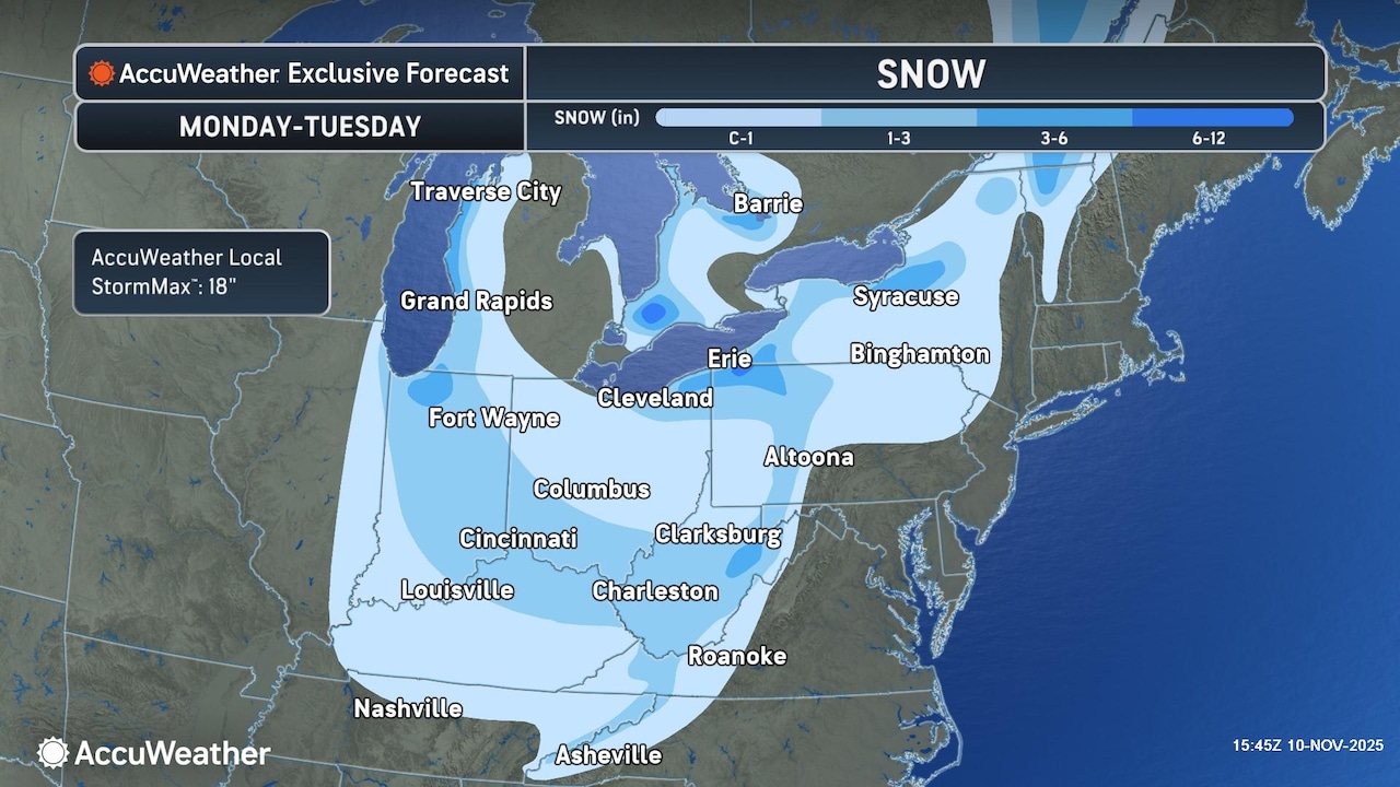
At Lehigh Valley International Airport, the weather service forecasts a slight chance of snow showers before 3 p.m. Tuesday — Veterans Day — followed by a slight chance of rain showers.
The southern Poconos have the highest likelihood of experiencing light snow showers, potentially seeing their first flakes of the season with a possible light dusting less than half an inch.
AccuWeather.com warns motorists heading west on Interstate 80 through Pennsylvania to be prepared for slippery conditions over the higher elevations.
Winds will gradually diminish Tuesday night, shifting to a southwesterly direction on Wednesday and allowing temperatures to moderate slightly, according to the National Weather Service.
Wednesday will remain breezy with winds around 5 to 15 mph in the Lehigh Valley and the potential for stronger gusts. High temperatures on Wednesday are forecast in the upper 40s to low 50s across the region. A weak cold front is expected to pass through the region late Wednesday with minimal moisture.
The extended forecast indicates dry conditions for Thursday into Saturday, with temperatures near or slightly below seasonal averages. Temperatures are expected to warm slightly on Sunday, with chances for rain both Saturday night and Sunday night.
Residents should dress in layers, secure loose outdoor items, and be prepared for significant wind chill effects throughout Tuesday and into Wednesday.
Follow your local forecast from AccuWeather at lehighvalleylive.com/weather with National Weather Service watches, warnings and other advisories available as they’re issued at lehighvalleylive.com/weather-alerts.
Current weather radar
Generative AI was used to produce an initial draft of this story, which was reviewed and edited by lehighvalleylive.com staff.
If you purchase a product or register for an account through a link on our site, we may receive compensation. By using this site, you consent to our User Agreement and agree that your clicks, interactions, and personal information may be collected, recorded, and/or stored by us and social media and other third-party partners in accordance with our Privacy Policy.