
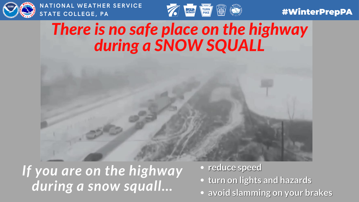
Snow squalls can lead to sudden changes in visibility and travel conditions, often leading to several accidents on the roads.

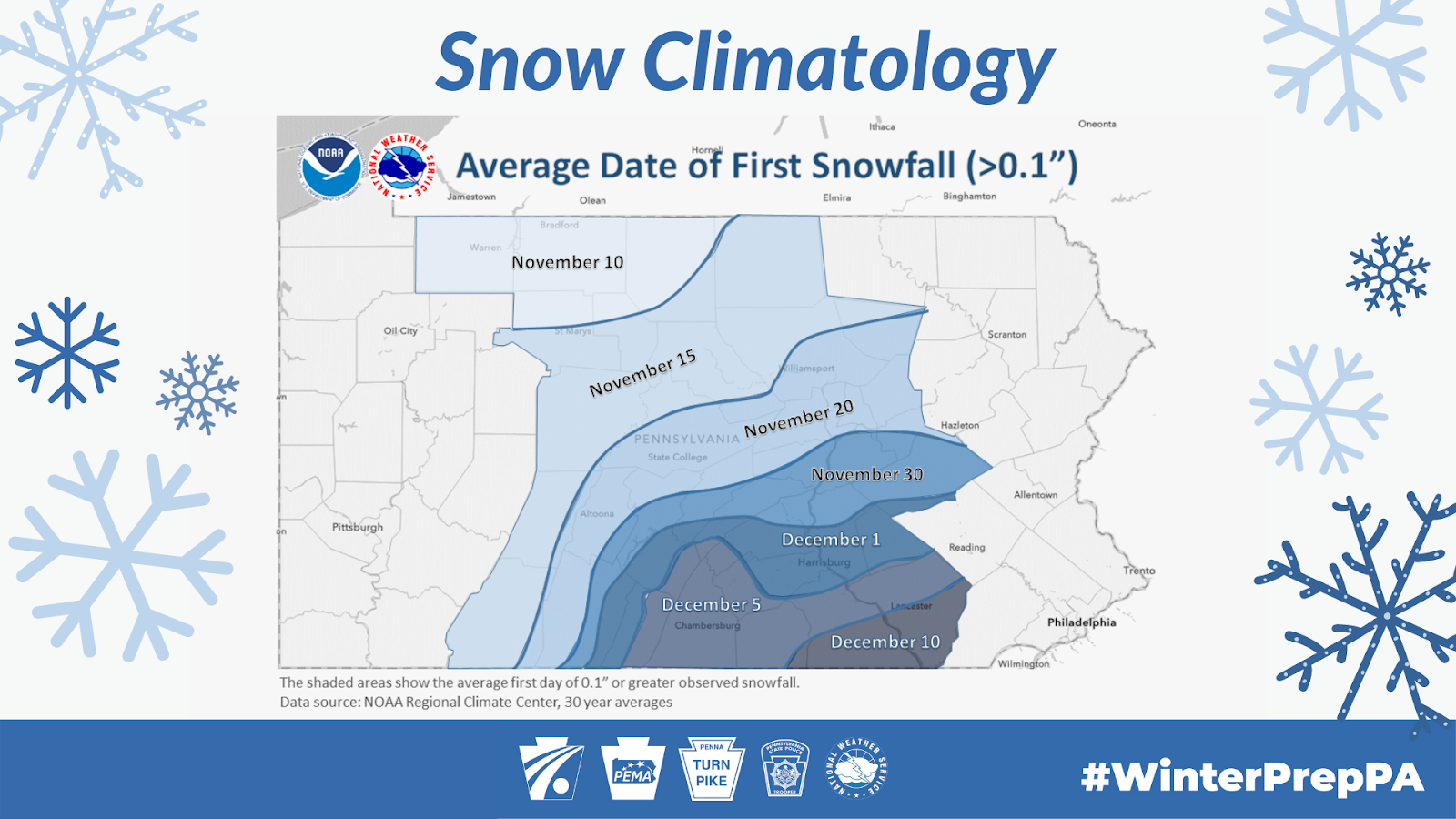
Central Pennsylvania’s first measurable snow usually arrives in late November and early December.
Hearst OwnedWGAL News 8 Storm Team
Average first measurable snowfall in central Pennsylvania.
But winter doesn’t always announce itself with an all-day storm. Sometimes it sends a fast-moving burst of snow across the highway, and visibility can vanish before drivers have time to react.
That’s a snow squall: a brief, intense snow shower, often tied to a strong cold front. It typically lasts less than an hour—sometimes just 30 to 60 minutes—and may leave an inch of snow or less.
Hearst OwnedWGAL News 8 Storm Team
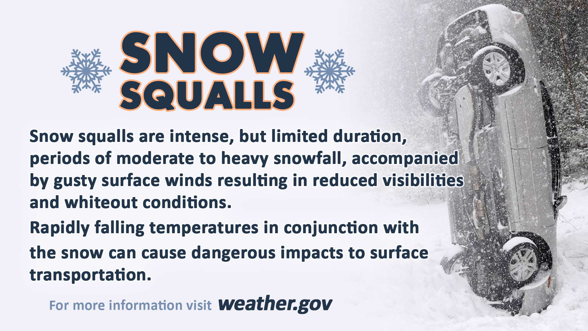
Snow squalls can lead to dangerous travel conditions with sudden whiteout conditions and slick roads.
But the snowfall total doesn’t tell the whole story. Gusty winds can blow snow across the road, temperatures can fall quickly, and wet pavement can freeze in minutes. The result can be a sudden whiteout and dangerously slick travel, even when no major winter storm is underway.
A small amount of snow, a big road hazard
Snow squalls have a long history of deadly traffic crashes. When drivers suddenly encounter near-zero visibility, some brake hard or lose control on icy pavement. One crash can quickly become a chain reaction, especially on a busy highway.
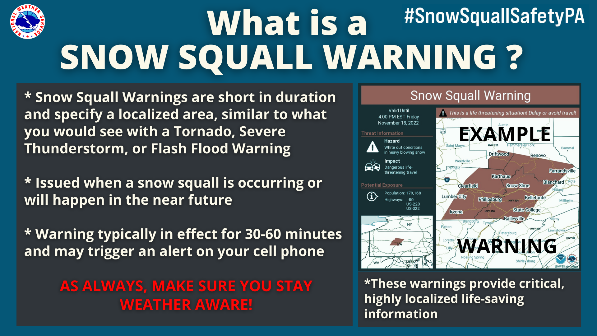
If the National Weather Service issues a Snow Squall Warning for your area, avoid or delay driving until the squall passes. These short-fuse warnings cover specific areas and are meant to give people time to act.
Hearst OwnedWGAL News 8 Storm Team
The National Weather Service will issue snow squall warnings when a snow squall threatens an area.
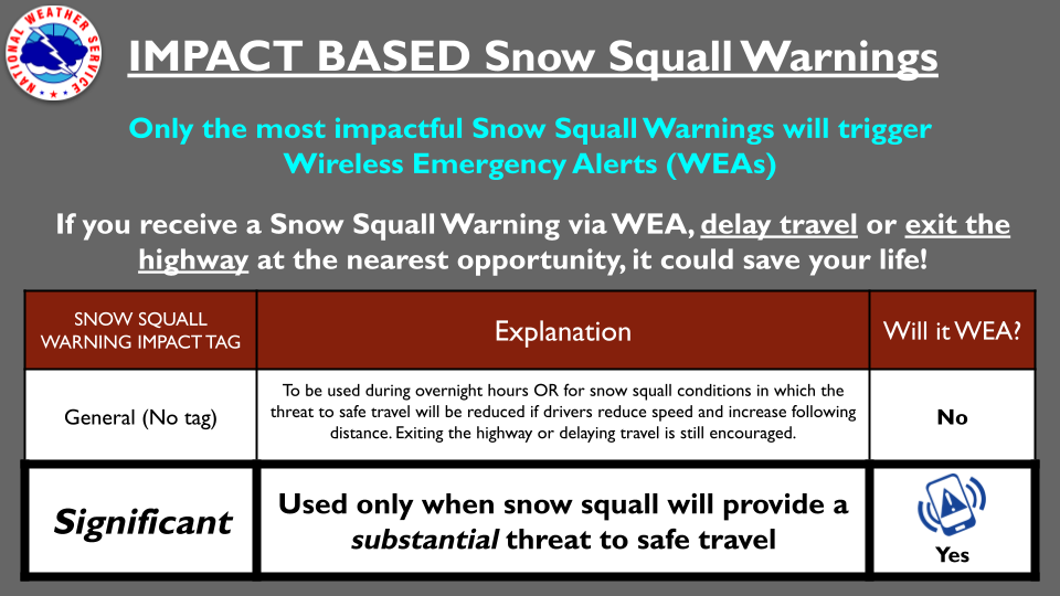
Hearst OwnedWGAL News 8 Storm Team
Depending on the situation, the National Weather Service may use a “significant” tag for snow squall warnings. This will trigger the WEA alerts on your phone (the same alerts as a tornado warning).
Already on the road when a squall hits? The safest choice is to exit the highway if you can do so safely. If you can’t exit in time, reduce your speed, turn on your headlights and hazard lights, leave plenty of distance between your vehicle and the one ahead, and don’t slam on the brakes. On slick roads, sudden braking can make you lose control or cause a crash behind you.
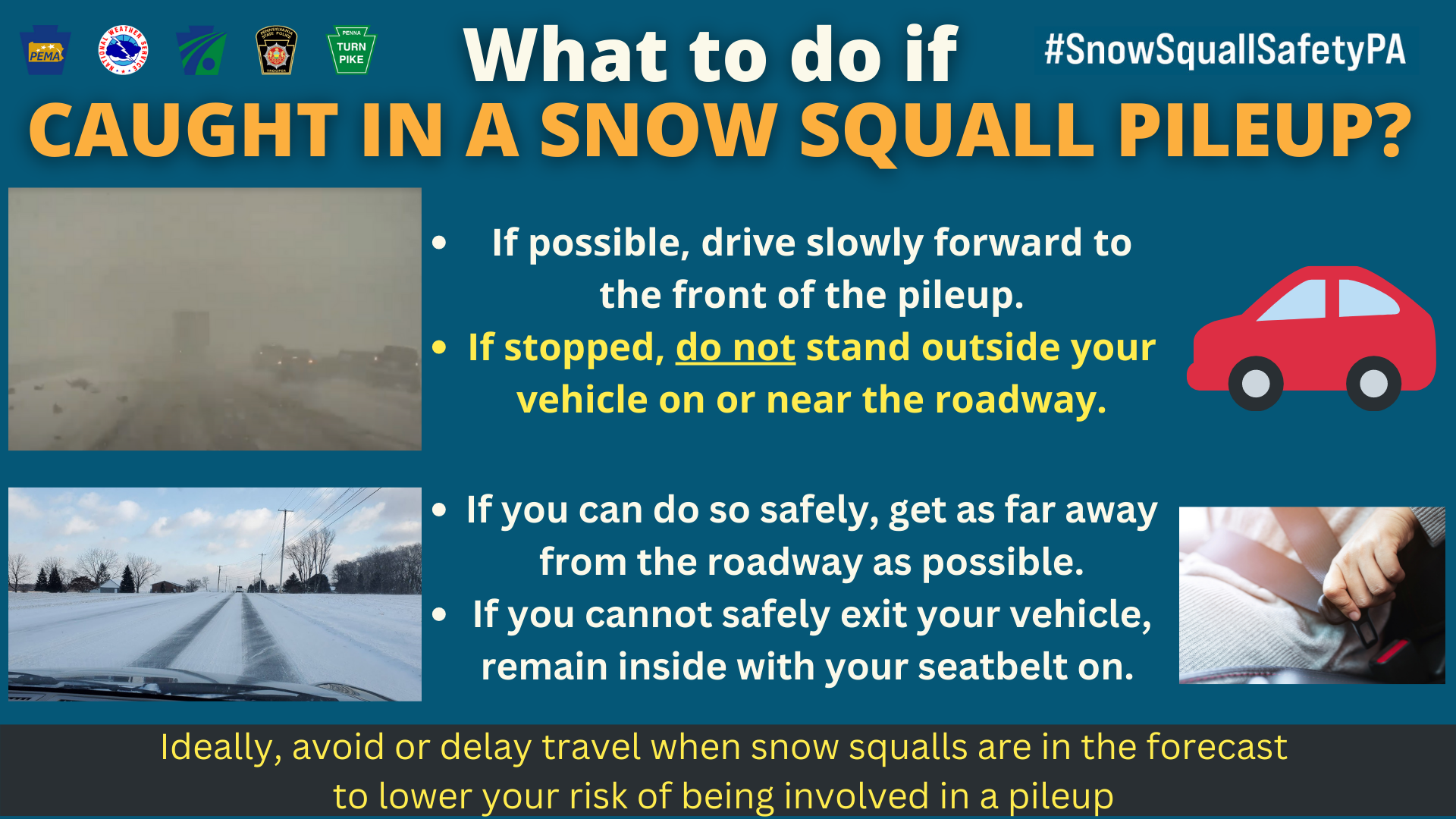
Hearst OwnedWGAL News 8 Storm Team
If caught in a pileup, do not stand outside your vehicle. Move away from the road if you can do so safely, or remain in your vehicle with your seat belt on.
Before you start your car, check the latest forecasts and warnings at weather.gov. It also helps to prepare your vehicle and keep an emergency kit in the car. The National Weather Service offers more advice on its winter safety page, and Ready.gov has a guide to a car emergency kit.
Squall, snowstorm, or flurry?
The difference is often a matter of intensity and duration. Snow squalls are short and intense, usually passing in under an hour. A snowstorm can last for several hours or even days. Snow showers come and go at varying intensities, while flurries are light and usually leave little or no accumulation.
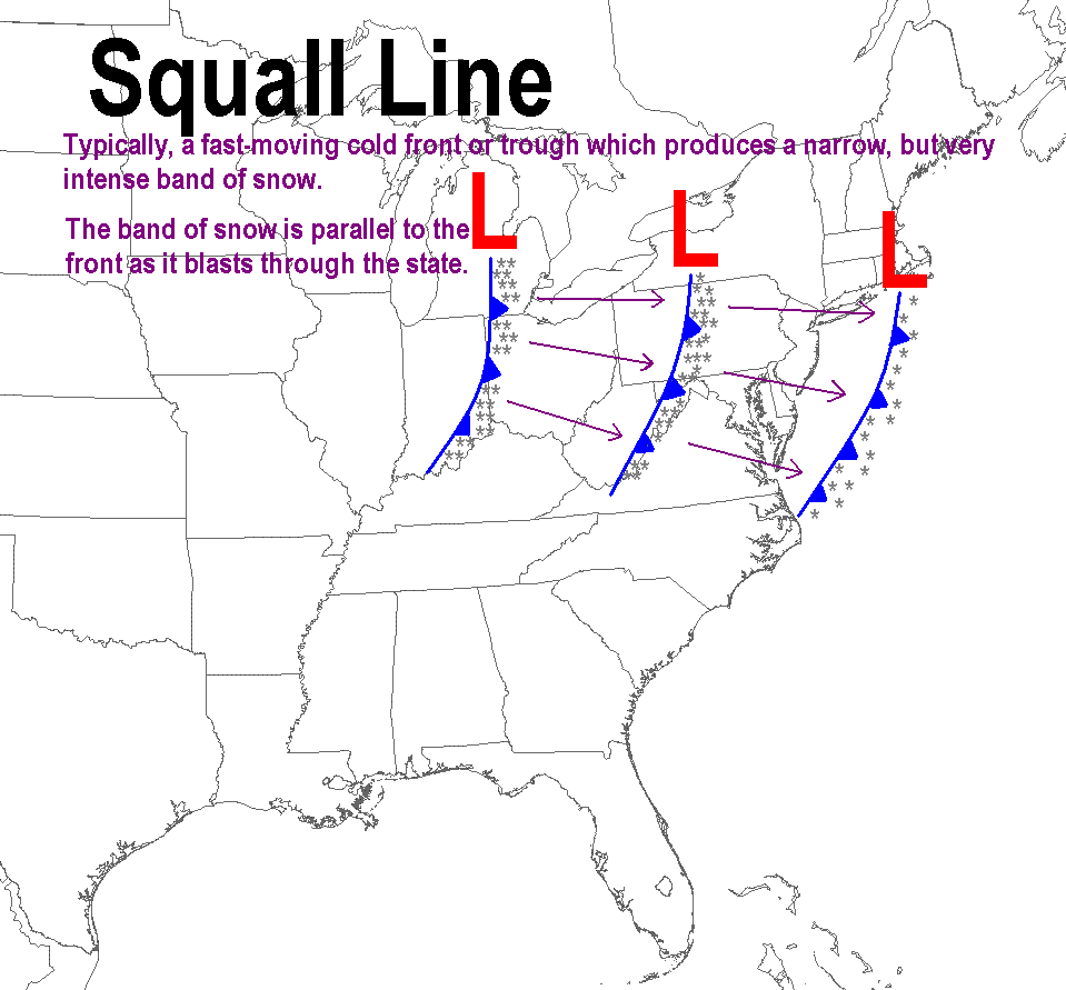
Hearst OwnedWGAL News 8 Storm Team
Squall lines often produce narrow, heavy bands of snow during the winter.
A squall can also be part of a larger feature called a squall line. In Pennsylvania, these lines can form along a strong cold front, with very cold air already in place. The unstable air produces bursts of snow much like summer thunderstorms produce bursts of rain—only winter squalls are shallower and shorter.
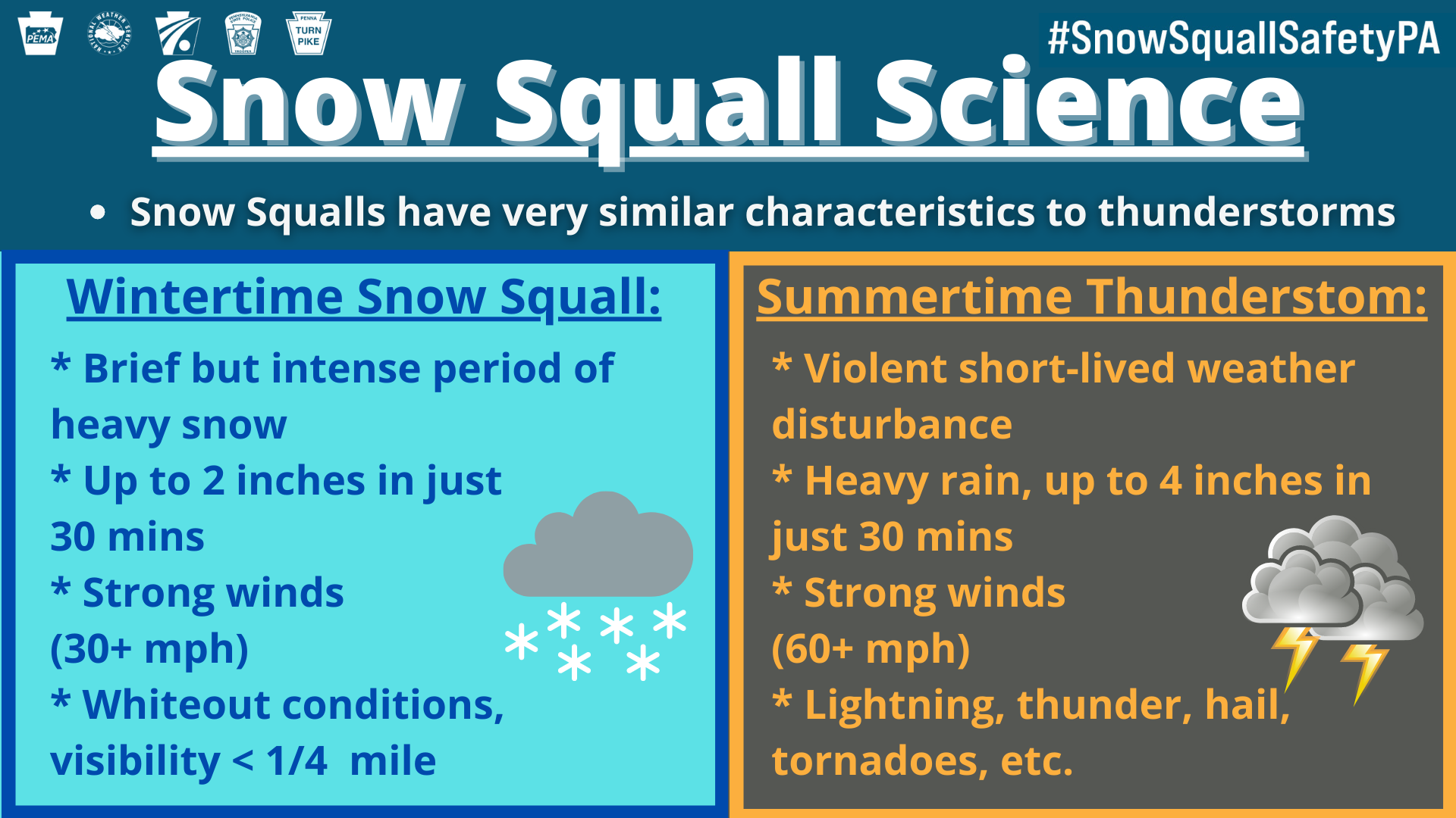
Hearst OwnedWGAL News 8 Storm Team
Snow squalls often have similar characteristics to summertime thunderstorms.
A squall line can sweep from west to east, bringing strong winds and intense snow that reduces visibility and quickly covers roads again after plows pass.
Pennsylvania gets snow in several ways
Snow squalls are one piece of the state’s winter weather story. The heaviest snows in Pennsylvania typically come from lake-effect snow, Nor’easters, Alberta Clippers, and squall lines.
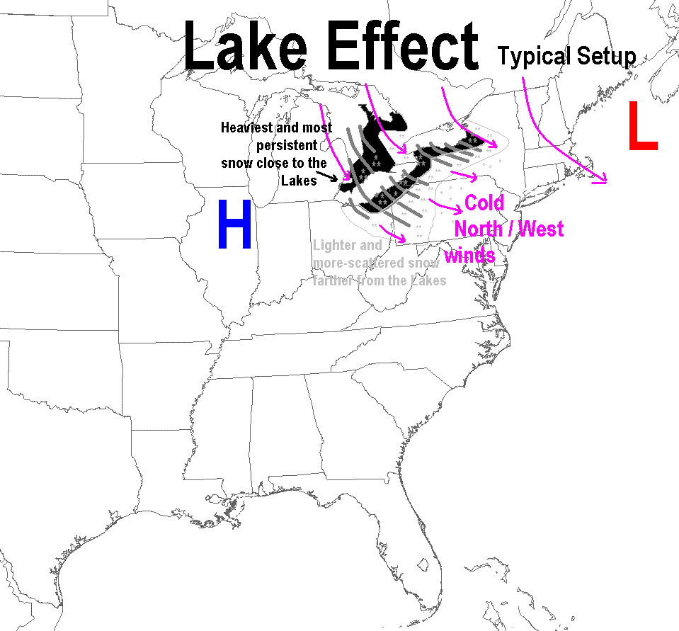
Lake-effect snow forms when very cold air moves over the relatively warmer, open waters of the Great Lakes, picking up moisture along the way. In northwestern Pennsylvania, narrow bands can park over one area and pile up snow while places just a mile away see sunshine.
Hearst OwnedWGAL News 8 Storm Team
Lake-effect snow showers can lead to snow squalls in Pennsylvania.
Nor’easters are powerful low-pressure storms that strengthen as they move north along the East Coast. They can bring heavy, wet snow to central and northeastern Pennsylvania, along with strong winds. Some Nor’easters produce snowfall rates of two to four inches per hour.
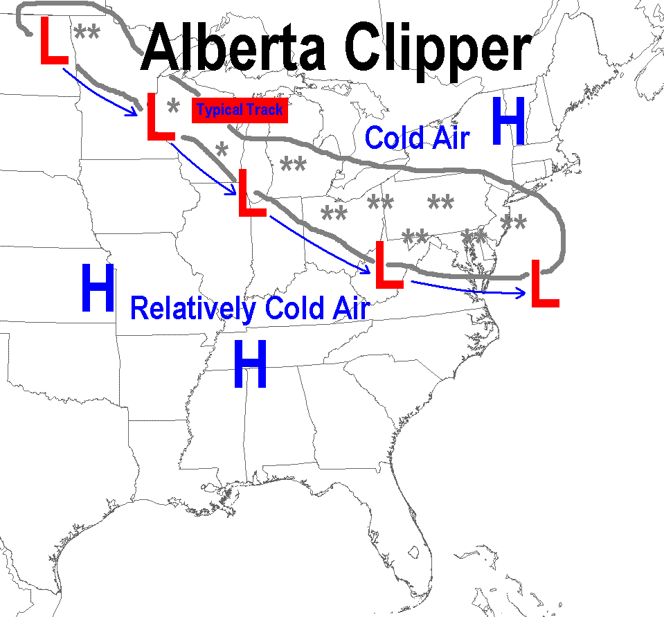
Alberta Clippers move quickly southeast from Canada across the Great Lakes. They usually bring lighter, fluffy snow across a broader area, then leave bitterly cold air behind.
Hearst OwnedWGAL News 8 Storm Team
Alberta Clippers occur often in the winter and generally produce light to moderate snowfall in south-central Pennsylvania.
Elevation matters, too. Higher ground may get snow while nearby valleys get rain or a mix, especially early and late in the season. Storm tracks and changing temperatures can make it difficult to know exactly where rain will change to snow.
Stay alert for the quick-change weather
Central Pennsylvania averages its first 0.1 inch of snow in late November, though the date varies from year to year. And whether the forecast calls for a few flurries or a major storm, conditions can change quickly once the snow begins.
GET ALERTS: Download the Free WGAL News 8 App for automatic weather alerts
The National Weather Service is entering its ninth winter of issuing Snow Squall Warnings. Knowing what those warnings mean—and being ready to pause a trip—can make a crucial difference when winter suddenly turns the road white.
For more information, visit the National Weather Service’s snow squall safety page and its guide to types of storms that produce heavy snow in Pennsylvania.