
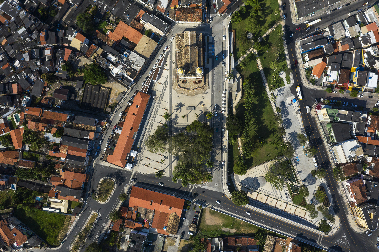
 Urban Requalification of the Colina Sagrada do Senhor do Bonfim / Sotero Arquitetos. Image © Leonardo Finotti
Beyond their buildings, infrastructure, and streets, cities can be understood as territories shaped by materials, resources, and processes of transformation that define their physical environments. As drone technology becomes increasingly integrated into architectural documentation and urban analysis, aerial imagery offers new opportunities to examine these different layers at multiple scales. As Jane Jacobs once suggested, “Cities are the mines of the future.”
From documenting building surfaces and identifying patterns in material distribution to observing how construction systems and urban landscapes evolve over time, drones can provide valuable information to architects, engineers, surveyors, urban planners, and researchers, supporting their work and informing their workflows. When combined with photogrammetry, thermal imaging, geographic information systems (GIS), and automated image processing, aerial observation is no longer limited to a single discipline or field of application. Instead, it opens up broader discussions about surface conditions, environmental performance, and material resources.

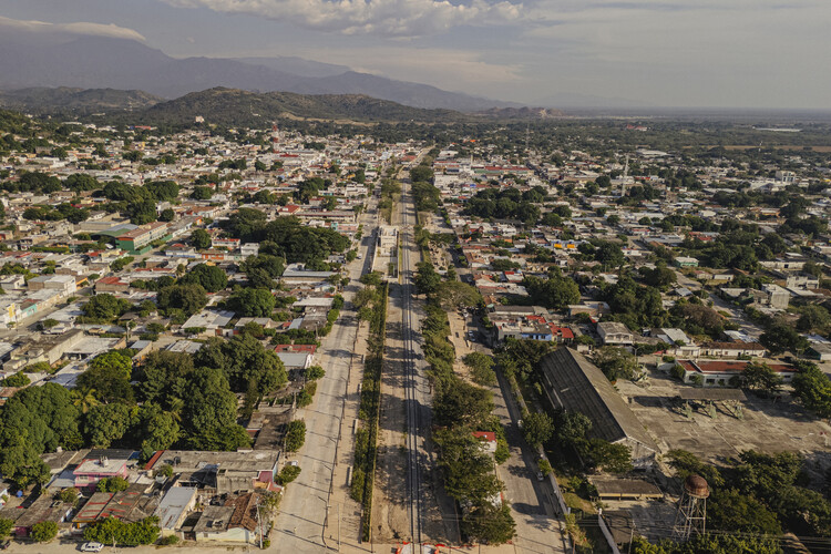 Arriaga Linear Park / Laboratorio Regional de Arquitectura. Image © Andrés Cedillo
These applications also connect with contemporary debates around circular construction, adaptive reuse, and urban resilience. By documenting what already exists, identifying areas where materials accumulate, and monitoring processes of transformation, drone imagery can contribute to a more comprehensive understanding of cities as material systems.
Related Article Material Passports: How Embedded Data Can Rethink Architecture and Design
However, transforming visual records into reliable information requires combining aerial data with specialized technical surveys. The challenge lies not only in observing cities from a different perspective, but also in understanding what their visible surfaces can reveal about the resources, topographies, environmental conditions, and processes that shape the built environment.
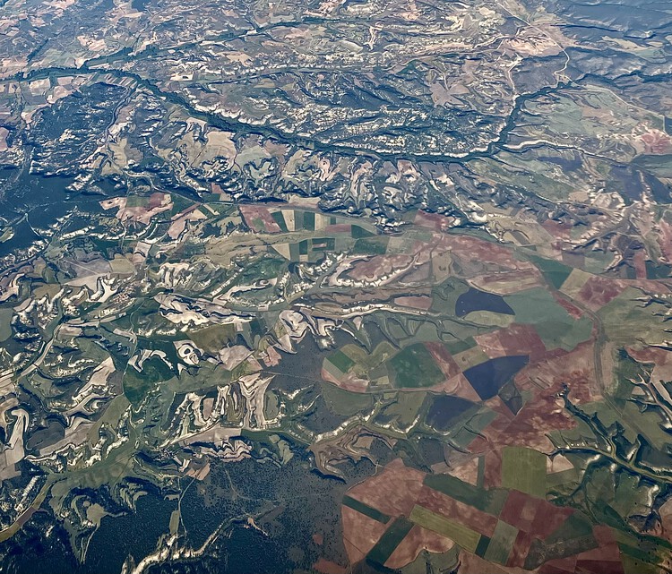 Natural topographies from the air. Image © Agustina IñiguezMapping Urban Material Resources
Large industrial warehouses, extensive green spaces, and residential complexes of varying scales can be distinguished from above, whether we are looking out from the top floor of a residential tower or sitting beside an airplane window. Aerial views make it possible to recognize the material dimension of cities through elements that, when observed from the ground, are often perceived in isolation. From a bird’s-eye perspective, rooftops, pavements, facades, industrial surfaces, and open spaces form a kind of material mosaic, revealing patterns of construction and occupation, building periods, and even design decisions in relation to their surrounding environments.
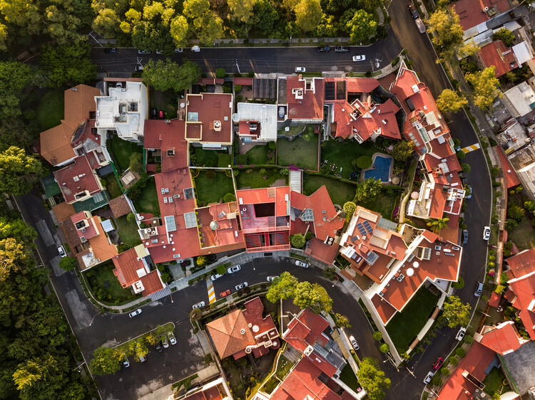 CVC House / Estudio MMX. Image © Rafael Gamo
The color, texture, and finish of a metal roof differ from those of a concrete surface, just as an impermeable pavement has different characteristics from a natural surface. Seen from above, the relationship between built surfaces (solids) and vacant spaces (voids) reveals different urban configurations and patterns, illustrating how the material composition of cities and their individual districts responds to distinct typological, economic, climatic, and construction-related conditions.
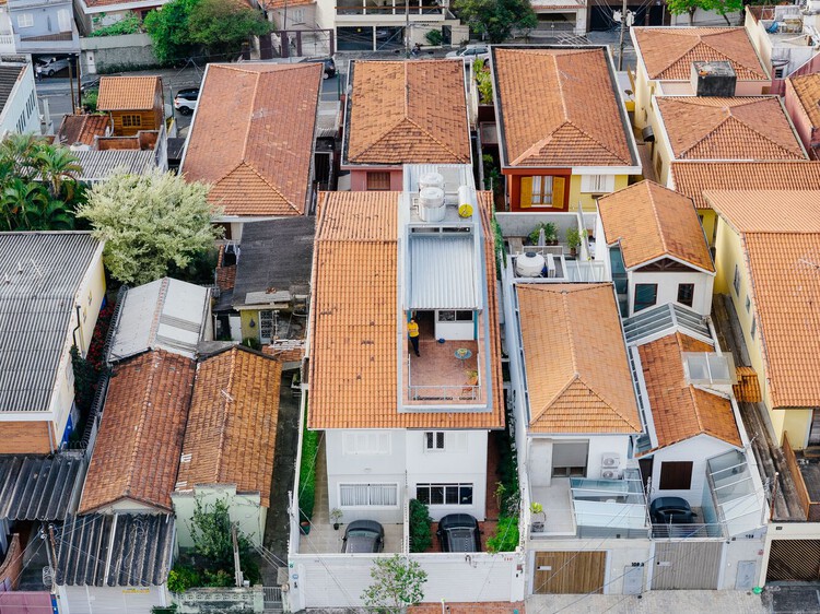 RAJ House / Ricardo Gusmão Arquitetos. Image © Manuel Sá
However, considering the city as a repository of existing materials brings other discussions into focus, including circular economy strategies, waste management, and adaptive reuse. Beyond visual identification, remote sensing and spatial data processing technologies can help locate, quantify, and assess the material resources embedded in the built environment. Nevertheless, they cannot necessarily determine a material’s exact composition, structural condition, or potential for reuse without complementary information, such as technical surveys, construction records, specialized sensors, or ground-level inspections.
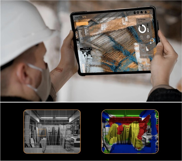 (Top): MatterSite uses scanning technologies to identify and sort the material stock of existing buildings for possible reuse. (Bottom): Raw imagery captured from the site is run through a material localization algorithm to pick out relevant recoverable materials from these views. ImageIAAC MRAC Matter Site, A. Batalle Garcia, Cebeci, Y. Irem, R. Vargas Calvo, M. Gordon. Urban mining. Scoping resources for circular construction, under CC BY 4.0
“Urban mining. Scoping resources for circular construction,” by Areti Markopoulou and Oana Taut, introduces MatterSite, a research project developed as part of the Master in Robotics and Advanced Construction at the Institute for Advanced Architecture of Catalonia (IAAC) in Barcelona. The project explores how drone photography, robotics, and computer vision systems can be combined to identify and classify building materials and components in existing structures, particularly those approaching demolition. By investigating how certain elements could retain their construction value rather than becoming mixed with waste and losing their potential for recovery, the research proposes an approach based on the prior digitization of buildings. Through automated image processing, it aims to locate recoverable materials and components, record their positions, quantify their presence, and assess their condition to inform subsequent decisions about selective dismantling and reuse. By connecting available materials with project requirements, this survey becomes more than a documentation tool: it can also help plan a building’s transformation and the management of its material resources.
When Material Surfaces and Environmental Performance Come Into Play
Connecting the material composition of cities with their environmental performance makes it possible to move beyond considering materials as isolated elements and instead examine how accumulated construction decisions influence temperature, solar absorption, water infiltration, and vegetation availability. By combining aerial imagery with thermal sensors and spatial analysis tools, researchers can investigate temperature differences across rooftops and pavements, the distribution of impermeable surfaces, the presence and continuity of green roofs, how different urban areas respond to solar radiation, and the relationships between vegetation, materials, and urban microclimates. These observations provide an architectural and territorial perspective on concepts such as urban heat islands, albedo, thermal performance, and urban permeability.
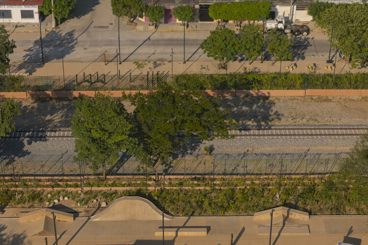 Arriaga Linear Park / Laboratorio Regional de Arquitectura. Image © Andrés Cedillo
For example, the study “Combating the Heat Island Effect with Drone-Based Thermal Visualization,” by Keenan Gibbons, proposes using high-resolution thermal imagery to examine a five-block urban corridor along Huron Street in Ann Arbor, Michigan. The research explores how different materials and exposure conditions influence surface temperatures. Using a drone equipped with thermal and RGB cameras, maps were generated to distinguish temperature variations across paved surfaces, rooftops, vegetation, and shaded areas. While vegetated surfaces and tree canopies recorded temperatures close to the ambient air temperature, sun-exposed concrete sidewalks reached approximately 11°C (20°F) above air temperature. Shaded concrete surfaces were considerably cooler than those exposed to direct sunlight, while some dark, bituminous roofing materials reached surface temperatures of approximately 82°C (180°F).
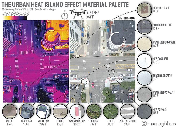 Microscale figure detailing average spot temperature readings of materials ubiquitous to the Midwest urban context at solar noon, August 21, 2019. ImageSource: Keenan Gibbons. Combating the heat island effect with drone-based thermal visualization, under CC BY-NC-ND 4.0
As Gibbons explains, heat is not distributed uniformly across the urban environment; rather, it is influenced by what lies beneath our feet and above our heads. The research highlights the significant impact of material properties on thermal conditions. Dark, dense surfaces, particularly asphalt and black roofing materials, absorb solar radiation and store heat, which is subsequently released back into the surrounding environment. In contrast, lighter-colored surfaces, vegetation, and tree canopies can reduce heat absorption and limit direct solar exposure, resulting in lower surface temperatures. Nature-based solutions also benefit from evapotranspiration, a process through which water evaporates from surfaces and is released by plants into the atmosphere, contributing to ambient cooling.
Ultimately, heat is not only distributed unevenly across urban space but also varies over time. Repeated drone surveys conducted before and after construction, and across different years, can help monitor how nature-based solutions and alternative material finishes perform under changing environmental conditions. By comparing thermal data over time, researchers can assess whether these interventions maintain their cooling potential and how their performance responds to seasonal variations, material aging, and changes in vegetation.
Tracking Material Transformations Over Time
When examining materials from an aerial perspective, periodic surveys also make it possible to track how built surfaces change, new materials are introduced, and existing infrastructure is transformed. Just as cities are constantly evolving, their material composition is continuously changing. These transformations can be observed in the replacement of existing buildings with new construction, the conversion of industrial areas to other uses, the addition of green roofs, rainwater harvesting systems, and solar panels across different urban environments, as well as the ongoing evolution of public spaces.
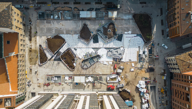 Plaza Salamero: Infrastructure, Landscape, and City / Hector Fernández Elorza. Image © Montse Zamorano
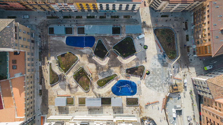 Plaza Salamero: Infrastructure, Landscape, and City / Hector Fernández Elorza. Image © Montse Zamorano
Temporal comparisons make it possible not only to observe how much a city grows, but also how its material composition changes over time. Periodic surveys allow researchers to compare different stages in the development of the same territory while also examining natural processes. Through photogrammetry, orthomosaics, point clouds, and three-dimensional models, it becomes possible to identify geometric changes, measure volumes, and document the evolution of surfaces.
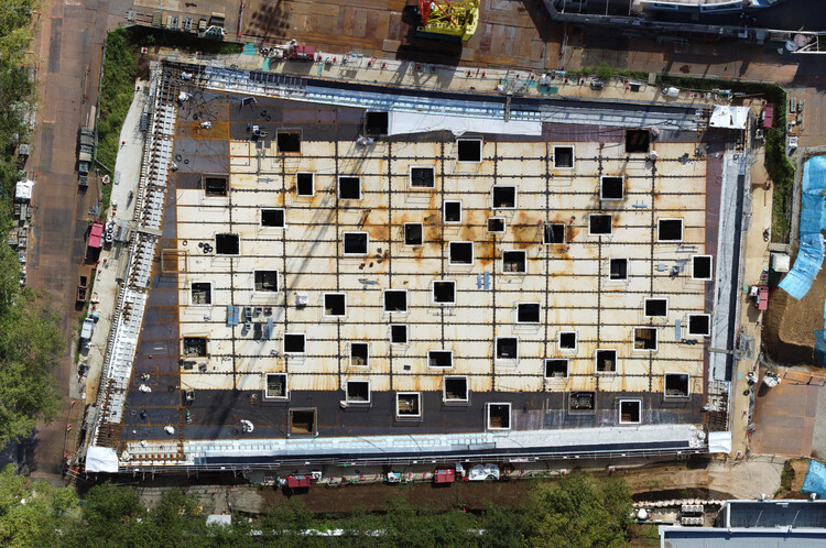 Plaza of Kanagawa Institute of Technology / junya ishigami + associates. Image Courtesy of Junya Ishigami + Associates
The study “Dune Belt Restoration Effectiveness Assessed by UAV Topographic Surveys (Northern Adriatic Coast, Italy),” by Regine Anne Faelga, Luigi Cantelli, Sonia Silvestri, and Beatrice Maria Sole Giambastiani, uses drone-based monitoring to evaluate a dune restoration project in the protected natural area at the mouth of the Bevano River, along the northern Adriatic coast near Ravenna, Italy. Coastal dunes are important ecosystems that provide protection against flooding, support groundwater storage, help prevent saltwater intrusion, provide habitats for different species, and offer recreational opportunities. However, their dynamic nature also makes these landforms particularly vulnerable to environmental changes and human activity.
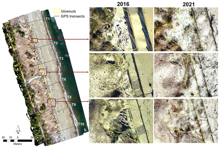 Sample blowout patterns observed by comparing the 2016 and 2021 orthomosaic images. ImageDune belt restoration effectiveness assessed by UAV topographic surveys (northern Adriatic coast, Italy), under CC BY 4.0
The study evaluates the impact of fences installed to support dune development by measuring sand accumulation and changes in vegetation cover over a five-year period. The researchers used a systematic data-processing workflow based on Structure-from-Motion (SfM) photogrammetry and Geomorphic Change Detection (GCD), comparing drone surveys conducted in 2016 and 2021. By analyzing elevation data from both surveys, the results showed that the fences effectively promoted dune recovery and growth. Significant sand deposition was recorded along the dune toe and front, covering a total area of 3,799 m², with a volume of 1,109 m³ and an average deposition depth of 0.29 m.
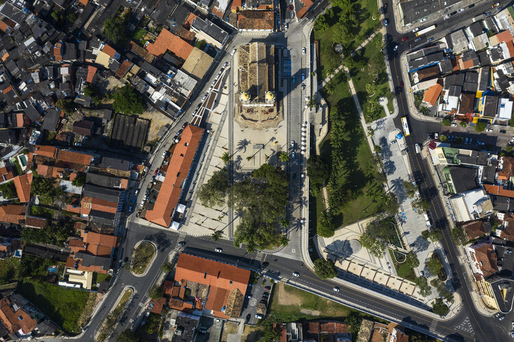
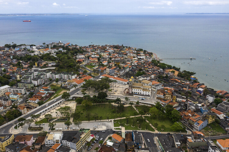 Urban Requalification of the Colina Sagrada do Senhor do Bonfim / Sotero Arquitetos. Image © Leonardo Finotti
Advances in drone technology and Structure-from-Motion photogrammetry have made monitoring geomorphological changes and estimating sediment budgets increasingly practical, both in research and in real-world applications. Beyond documenting changes in the built environment, these methods demonstrate how repeated aerial surveys can help track the movement and accumulation of natural materials, offering valuable insights into the evolution and resilience of urban and coastal landscapes.
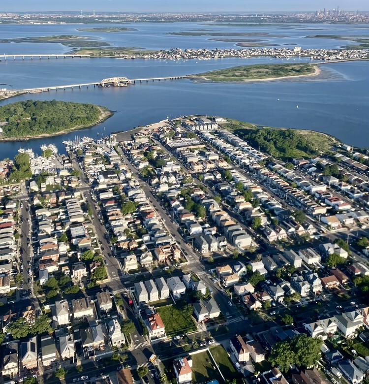 Aerial view of New York, Queens. Image © Agustina Iñiguez
The value of drone imagery extends beyond documenting the physical appearance of cities. When combined with photogrammetry, artificial intelligence, geographic information systems (GIS), and other digital tools, aerial images can become a source of “material intelligence.” By transforming aerial photographs into georeferenced maps, 3D models, and point clouds, these technologies facilitate the identification of changes in building surfaces, the estimation of material volumes, and the monitoring of resource flows across urban and natural environments. In this way, the focus shifts from simply observing the built environment to generating data that can inform material inventories, selective demolition, and circular construction strategies.
This article is part of the ArchDaily Topic: Beyond Buildings: Architectural Imaginaries and the Evolving Language of Design, proudly presented by Gendo.
Gendo is an AI design canvas built for architecture studios. Gendo supports this topic because the tools architects use to imagine have always shaped what they build. Understanding that shift matters more than any single render.
Every month we explore a topic in-depth through articles, interviews, news, and architecture projects. We invite you to learn more about our ArchDaily Topics. And, as always, at ArchDaily we welcome the contributions of our readers; if you want to submit an article or project, contact us.