
SHORT TERM FORECAST
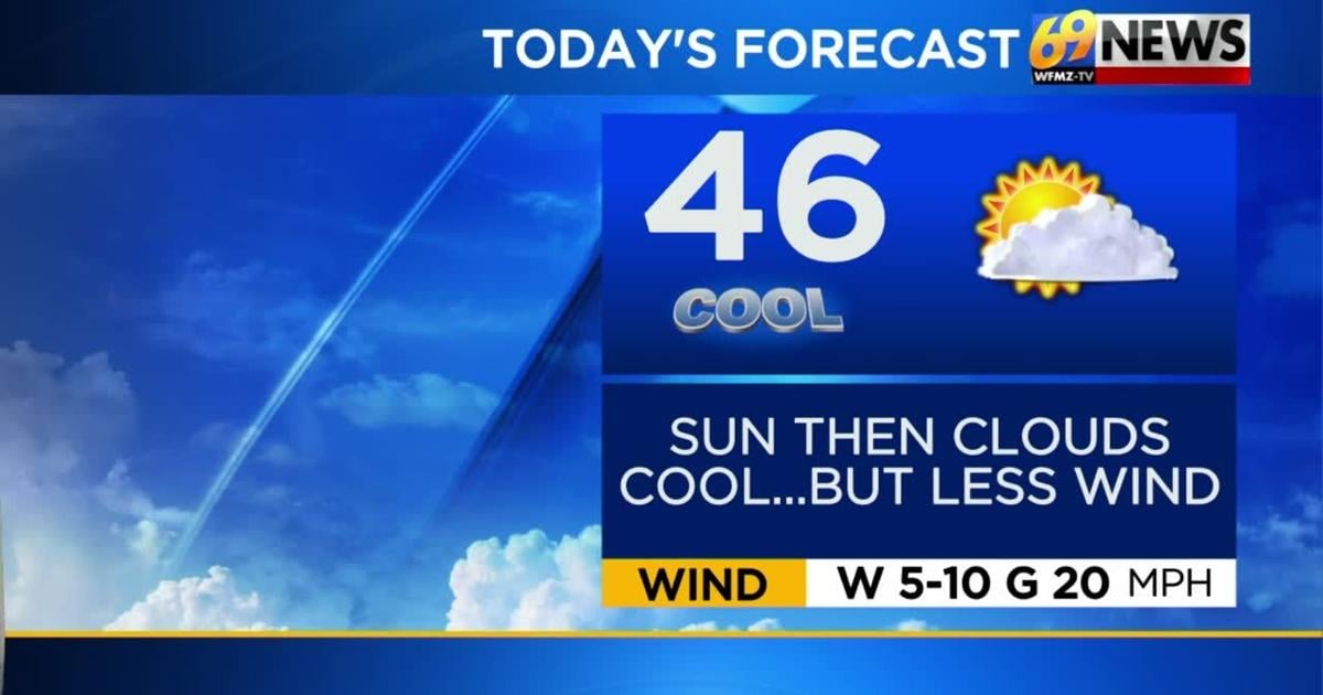
TUESDAY: Sunshine early, then clouds increase. Chilly but with lighter winds. High: 46
TUESDAY NIGHT: Mostly cloudy with a little light rain/mixed precipitation possible especially in the Poconos. Low: 33
WEDNESDAY: Mostly cloudy. Cool. High: 48
FORECAST SUMMARY
Staying quiet throughout the day today, but turning a bit messy for the overnight. A tricky overnight forecast as a weak disturbance moves just south of the area. It has the potential to bring us some rain, mixed precipitation, and possibly even snowflakes to the higher elevation areas like the Poconos. The bulk of the heavier precipitation looks to stay South of the heart of the area, but a coating of snow or at least a wet snow is possible from Berks northward.
DETAILED FORECAST
TUESDAY AND TUESDAY NIGHT
We’ll start the day Tuesday with some sunshine, then clouds will increase throughout the day and we’ll finish up with mostly cloudy skies. It will be a chilly day with highs only in the mid 40s, but again with lighter winds (west around 10mph) so it won’t be as blustery. Overnight, a weak disturbance will slide by to our south, but close enough to provide some light rain at night, steadier in southern PA, Delaware, and South Jersey. On the northern fringe where it’s just cold enough, a little wet snow is possible, mostly north of Blue Mountain in the Poconos and far northwestern New Jersey, with at most a coating of snow possible. Lows overnight will be in the low to mid 30s for most, with rainfall amounts around 0.10″ for much of our area, but as much as 0.25-.050″ well south of the Lehigh Valley.
WEDNESDAY AND THURSDAY
These will be the quietest days of the week, with light winds and dry weather from start to finish. There won’t be a whole lot of sunshine, but we should manage a little sun Wednesday, especially in the afternoon. Otherwise, a mostly cloudy sky should be the rule, but again dry. Highs will remain a touch cooler than average for mid-November, mostly in the upper 40s to right around 50 degrees.
FRIDAY AND FRIDAY NIGHT
This will be our other chance for unsettled weather this week, but this time squarely in the form of rain for everyone. Look for mostly cloudy skies, briefly milder highs in the low to mid 50s, and some occasional mostly light rain showers anytime Friday into Friday night, possibly lingering into early Saturday too, especially south and east of the Lehigh Valley. Amounts don’t look overly impressive, with around or less than a quarter of an inch of rain possible during this time.
THIS WEEKEND
Clouds and perhaps a few scattered showers will linger early Saturday, with showers more likely to linger the farther south and east from the Lehigh Valley you travel. Overall, the weekend will see a drying trend, and things will cool back down a bit as well. Skies should become at least partly sunny Saturday, and remain that way for the entirety of the day on Sunday. Highs will settle back down into the low 50s, and it could be a little breezy on Saturday as a cold front slides through and offshore.
TRACK THE WEATHER:
LINKS: HOUR BY HOUR | RADAR | TRAFFIC