
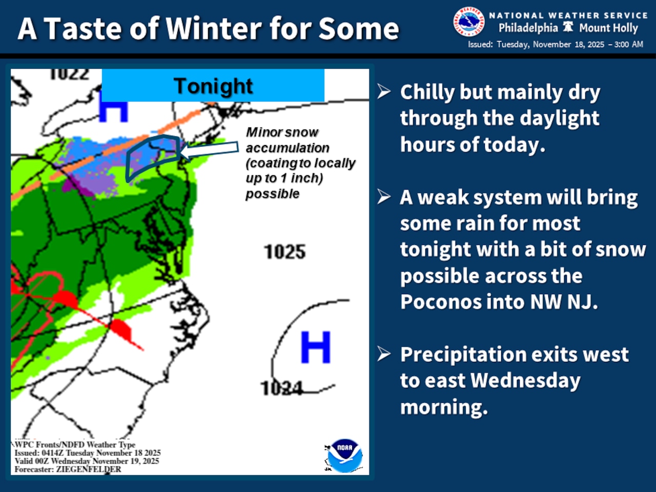
A complex weather system is set to bring a rain and potential snow mix overnight Tuesday into Wednesday to the Lehigh Valley, Pocono Mountains and northwestern New Jersey
With temperatures remaining in the 30s to upper 40s, residents should prepare for a damp and chilly midweek across the region.
The National Weather Service predicts precipitation will develop overnight, with a potential for snow mixing with rain, particularly north of Interstate 78. Temperatures are forecast to dip into the mid-30s in the Lehigh Valley, with light precipitation potentially accumulating up to a coating in some higher elevation areas.
Light precipitation is forecast to start as rain after about 11 p.m. Tuesday in the Lehigh Valley, mixing with snow after 2 a.m. Wednesday, according to the weather service.
Wednesday morning will see the precipitation moving out, with cloudy conditions persisting throughout the day. High temperatures will rise to about 50, with calm winds.
Looking ahead, the forecast suggests a warming trend with high temperatures potentially approaching 60 by Friday. There are chances for rain in the forecast Thursday night through Friday night in the Lehigh Valley region.
Scattered clouds are expected for the weekend, with seasonable daytime highs in the low 50s and nighttime lows around the freezing mark in the low 30s.
The early part of Thanksgiving Week is expected to bring continued stable, seasonable weather with high pressure dominating the region and dry conditions anticipated.
Current weather radar
Generative AI was used to produce an initial draft of this story, which was reviewed and edited by lehighvalleylive.com staff.
If you purchase a product or register for an account through a link on our site, we may receive compensation. By using this site, you consent to our User Agreement and agree that your clicks, interactions, and personal information may be collected, recorded, and/or stored by us and social media and other third-party partners in accordance with our Privacy Policy.