
A ‘Fall cool down’ ahead in Western Pa.
High temperatures slide into the lower 60s to conclude the work week.
WE ARE COMING UP ON 720. THAT MEANS IT’S TIME TO CHECK IN WITH OUR CHIEF METEOROLOGIST, MIKE HARVEY, AND YOUR CERTIFIED MOST ACCURATE FORECAST. BOY, I’M REALLY LIKING THIS WEATHER INTO OCTOBER ALREADY. YEAH, BEAUTIFUL DAY OUT THERE. WE HAVE TEMPERATURES NEAR 70 DEGREES. SOME LOCATIONS HIT 70 DEGREES TODAY. THAT WILL BE COOLER AS WE GO THROUGH THE NEXT FEW DAYS, BUT STILL GOING TO BE PRETTY COMFORTABLE OUT THERE. TOMORROW MORNING IS REALLY THE ONLY BATCH OF CLOUDS WE’RE GOING TO DEAL WITH OVER THE NEXT THREE DAYS THAT WILL BE WITH US IN THE MORNING, THROUGH ABOUT NOON, OR A LITTLE BIT LATER. THEN THE SUNSHINE COMES BACK AND IT WILL GET A LITTLE BIT BREEZY AS WE GET INTO THE AFTERNOON AND EVENING HOURS TOMORROW, MAYBE GUSTS UP AROUND 15 20MPH. THEN WE HAVE MOSTLY CLEAR SKIES, WHICH IS GOING TO ALLOW THOSE TEMPERATURES TO DROP OFF. LOW TEMPERATURES IN PITTSBURGH DOWN INTO THE UPPER 30S ON THURSDAY AND FRIDAY, SO A CHILLY START. MOSTLY SUNNY THROUGH BOTH OF THOSE DAYS. AND THEN FOR THE WEEKEND IT IS GOING TO BE A WARM ONE ON SATURDAY. WE’RE LOOKING FOR A HIGH TEMPERATURE IN THE MID 70S, AND THEN ON SUNDAY THAT’S WE’LL HAVE OUR NEXT CHANCE OF SOME SCATTERED RAIN SHOWERS MOVING INTO TOWN. BECAUSE OF THAT. SUNDAY IS AN IMPACT DAY. SO AS WE GO THROUGH TOMORROW, TEMPERATURES WILL BE FINE IN THE MID 60S, BUT THEN AS WE GO INTO THURSDAY MORNING, THIS IS WHEN JUST ABOUT ALL LOCATIONS ARE GOING TO DROP DOWN INTO THE 30S. AND AS WE GO INTO FRIDAY, TEMPERATURES WILL DROP DOWN, POSSIBLY MAYBE ONE, TWO, THREE DEGREES EVEN COLDER THAN WE’RE SHOWING RIGHT HERE. TAKING A LOOK RIGHT NOW, YOU CAN SEE THAT IT’S CLEAR SKIES ALL AROUND AND UP TO THE NORTH. WE HAVE SOME CLOUDS THAT ARE STARTING TO MAKE THEIR WAY TOWARDS US. THAT’S WHAT’S GOING TO MOVE IN AS WE GO INTO THE MORNING HOURS TOMORROW, GIVING US MOSTLY CLOUDY SKIES TO START THE DAY. HIGH TEMPERATURE OF 64 DEGREES. TOMORROW WILL BE A MILD START TO THE DAY, RIGHT AROUND 50 DEGREES IN THE MORNING. BUT THEN WE HAVE THOSE 30S ON THURSDAY AND FRIDAY, 62 AND 64. SO DEFINITELY COOL AS WE GO THROUGH THE NEXT THREE DAYS AND THEN WE REALLY WARM IT UP ON SATURDAY. 75 DEGREES FOR YOUR HIGH TEMPERATURE WITH THE RAIN SHOWERS MOVING IN, POSSIBLY EVEN AS EARLY AS LATE, VERY LATE SATURDAY NIGHT AND SUNDAY, AND POSSIBLY COULD HAVE SOME RAIN STICKING AROUND INTO EARLY ON MONDAY. IT WILL BE COOL NEXT WEEK AS WELL. TAKING A LOOK AT FUTURECAST CLOUDS IN THE MORNING. THEN AS WE GO THROUGH THE DAY WE’LL SEE SUNSHINE THAT WILL RETURN. WE TAKE IT INTO THURSDAY AND WE WILL HAVE CLEAR SKIES TO START THE DAY. IT WILL BE MOSTLY SUNNY TO FINISH OUT THE DAY ON THURSDAY. WE’RE A
A ‘Fall cool down’ ahead in Western Pa.
High temperatures slide into the lower 60s to conclude the work week.

Updated: 7:28 PM EDT Oct 14, 2025
Gradual clearing on WednesdayThe remainder of the week will feature intervals of sun and clouds along with a slight cool down. Fall cool down with areas of frostA dose of cooler fall air seeps in beginning tomorrow. It will turn breezy as high temperatures slide into the lower 60s. Thursday and Friday mornings will feature areas of frost for neighborhoods to the north and east. Frost alerts are possible for lows in the mid to upper 30s.Weekend showersTemperatures recover over the weekend. Saturday looks to be a beautiful, warm fall day with highs in the mid 70s! We are still watching the potential for showers. Sunday continues to trend wetter with periods of rain. OVERNIGHT: Clear to partly cloudy. Low: 49°.WEDNESDAY: Morning clouds, afternoon clearing. Cooler and turning breezy. High: 64°, low: 39°.THURSDAY: Patchy morning frost, more sunshine and cooler. High: 62°, low: 38°.
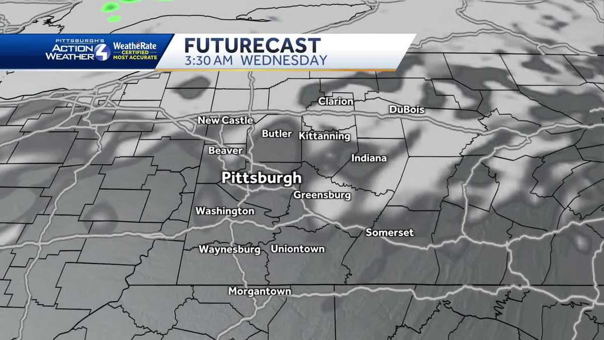
PITTSBURGH — Gradual clearing on Wednesday
The remainder of the week will feature intervals of sun and clouds along with a slight cool down.

Hearst OwnedHearst
A gradual return to sunshine this afternoon with milder highs.
Fall cool down with areas of frost
A dose of cooler fall air seeps in beginning tomorrow. It will turn breezy as high temperatures slide into the lower 60s. Thursday and Friday mornings will feature areas of frost for neighborhoods to the north and east. Frost alerts are possible for lows in the mid to upper 30s.

Hearst OwnedHearst
Areas of frost are possible both Thursday and Friday mornings.
Weekend showers
Temperatures recover over the weekend. Saturday looks to be a beautiful, warm fall day with highs in the mid 70s! We are still watching the potential for showers. Sunday continues to trend wetter with periods of rain.

Hearst OwnedHearst
Trending cooler after today. We are keeping an eye on how the rain could impact your weekend plans.
OVERNIGHT: Clear to partly cloudy.
Low: 49°.
WEDNESDAY: Morning clouds, afternoon clearing. Cooler and turning breezy.
High: 64°, low: 39°.
THURSDAY: Patchy morning frost, more sunshine and cooler.
High: 62°, low: 38°.