
A mostly cloudy Thursday will transition to a rainy Friday evening across the Lehigh Valley, with temperatures gradually warming into the upper 40s to low 50s. Light rain is expected to spread eastward Friday night, primarily affecting areas south of Interstate 80.
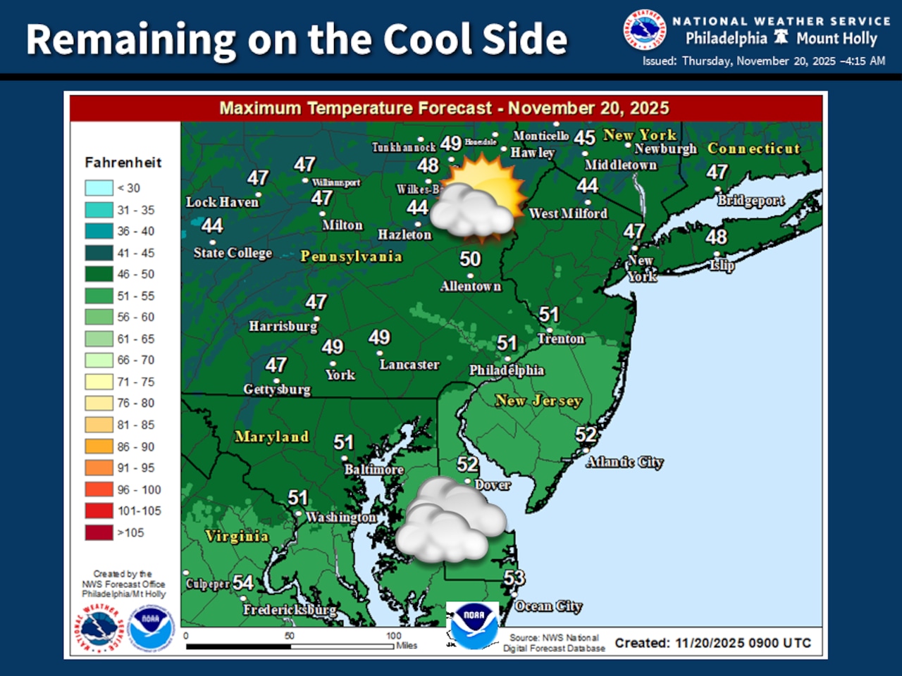
The National Weather Service forecast indicates patchy fog Thursday morning will give way to overcast skies, with temperatures ranging from the mid to upper 40s. Winds will remain light and easterly, creating a damp but mild atmosphere.
Friday’s weather system will bring increasing cloud cover and a chance of precipitation, with rain likely developing by Friday evening. Temperatures are expected to rise into the 50s, except in the Poconos where highs will remain in the 40s. The rain is anticipated to be light but widespread across most of the region.
The weekend will see conditions improving, with rain ending early Saturday followed by a partly sunny afternoon. A cold front will push temperatures downward, with Saturday’s highs slightly cooler than Friday and closer to seasonal averages. Sunday is forecast as mostly sunny and cool, with lows in the 20s and 30s rising to daytime highs in the 40s to low 50s.
Looking ahead, another potential rain system is forecast for Tuesday night, with temperatures remaining mild and precipitation likely to be rain rather than snow. Temperatures are expected to remain near seasonal averages, with nighttime lows mostly in the 30s and daytime highs in the 50s.
Current weather radar
Generative AI was used to produce an initial draft of this story, which was reviewed and edited by lehighvalleylive.com staff.
If you purchase a product or register for an account through a link on our site, we may receive compensation. By using this site, you consent to our User Agreement and agree that your clicks, interactions, and personal information may be collected, recorded, and/or stored by us and social media and other third-party partners in accordance with our Privacy Policy.