

A rainy weather system will move through the Lehigh Valley on Tuesday into Wednesday, bringing widespread precipitation and mild temperatures before a cold front ushers in significantly cooler conditions.
The National Weather Service says residents can expect scattered showers mainly after 2 p.m. Tuesday with a chance of rain continuing into Wednesday morning. Forecast rainfall totals range from one-third to three-quarters of an inch.
Tuesday morning will start with increasing cloud cover, with rain likely developing in the early afternoon. Temperatures will climb to the mid-50s to low 60s Tuesday and Wednesday, driven by warm southerly winds. Some areas might experience a brief rumble of thunder, though no severe weather is anticipated.
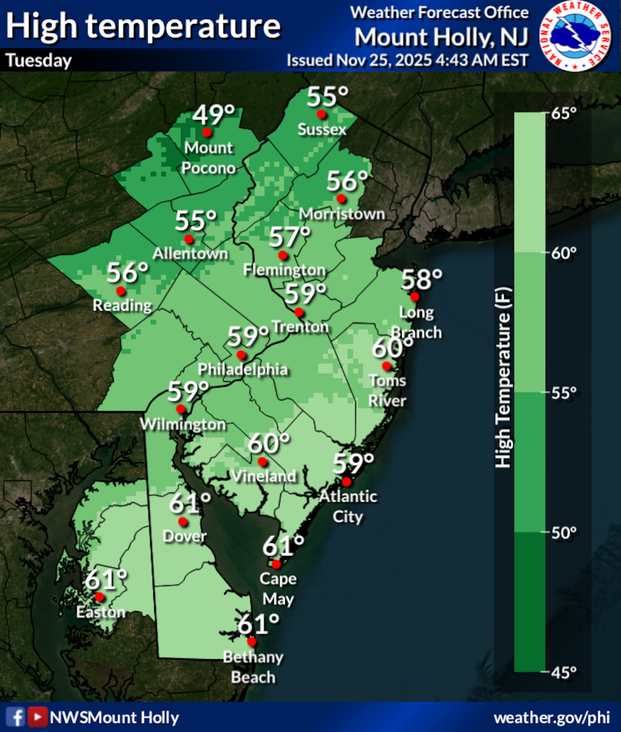 The Lehigh Valley will see mild temperatures and showers Tuesday into Wednesday, Nov. 25-26, 2025, before a cold front brings wind gusts up to 25 mph and drops temperatures into the 40s for the Thanksgiving holiday and weekend.National Weather Service
Tuesday and Wednesday are expected to see peak holiday travel ahead of Thanksgiving on Thursday. AAA projects 1.3 million more travelers will be on the roads than last year, pushing the total number of people traveling by car to around 73 million. The FAA is preparing for its busiest Thanksgiving in 15 years, with over 360,000 flights scheduled. The TSA expects to screen more than 17.8 million people.
According to an analysis by Google Maps:
Traffic on Wednesday is expected to be 14% heavier than usual between 10 a.m. and 4 p.m., with peak traffic from 1 p.m. to 3 p.m.On Thanksgiving Day, the roads will be busiest between noon and 3 p.m.When it’s time to head home, avoid driving from noon to 3 p.m. on Saturday and Sunday, when traffic is heaviest.
The cold front will pass through Wednesday evening, quickly dropping temperatures and bringing west winds around 10 mph gusting to between 20 and 25 mph. Thanksgiving Day will feel noticeably colder, with highs only reaching the 40s and wind chills making it feel even more brisk. Skies will clear, but temperatures will remain below normal for late November.
Looking ahead, Friday and Saturday will continue the cold trend, with highs in the low to mid-40s and overnight lows dipping into the 20s. Wind chills could make temperatures feel 5 to 10 degrees cooler than actual air temperatures. A few snow showers might develop in the northern Poconos, but no significant accumulation is expected.
By Sunday and Monday, temperatures will moderate, returning closer to normal with slight chances of rain developing. The extended forecast suggests a return to more typical late autumn conditions after the midweek cold snap.
Current weather radar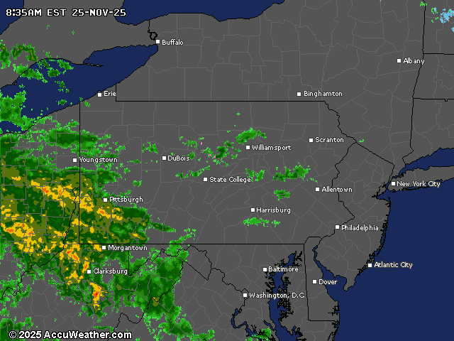
Generative AI was used to produce an initial draft of this story, which was reviewed and edited by lehighvalleylive.com staff.
The Associated Press contributed to this report.