
Snow is coming tomorrow, but how much?
It depends on where in Pennsylvania you live, according to the National Weather Service in State College.
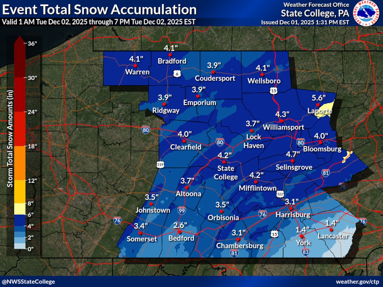
In a post on X, the National Weather Service shared images projecting the snowfall expected across the state on Tuesday, as of Monday morning.
One image showed the expected start time of snowfall, while the other listed how many inches of snow can be expected in various parts of the state.
“Tuesday morning’s commute could take a little extra time – a plowable snowfall is likely for nearly all of Central PA!” the post read.
According to the image, roughly 2-5 inches of snow are expected to accumulate in the Harrisburg area.
As of publication, the expected amount is roughly 3 inches, according to the National Weather Service’s expected snowfall forecast found on their website here.
That amount is comparable to much of the state, though central and north-central Pennsylvania may expect closer to 4 or 5 inches.
To the south and southeast, in York and Lancaster counties, accumulation is expected to be less, as snow mixes with sleet and possibly ice.
The smallest amounts expected statewide tomorrow is the southeastern portion of the state, spanning from Lancaster to Philadelphia. Those regions may see less than an inch of snow, though early Lancaster area projections were as high as 4 inches.
Meanwhile, the northeastern reaches of the state may see 5-8 inches or more of snow, particularly from the area around Scranton to the New York border.
Similarly, the Erie region may be hammered with snow, with estimates around 3-6 inches but potentially as high as 8, judging by the color-coded map.
“Accumulating snowfall will result in slick & snow-covered roadways on Tuesday morning,” the image reads. “Hazardous travel likely – use caution!”
To see the full range of snowfall predictions, including both high end and low end projections, visit the National Weather Service website here.