
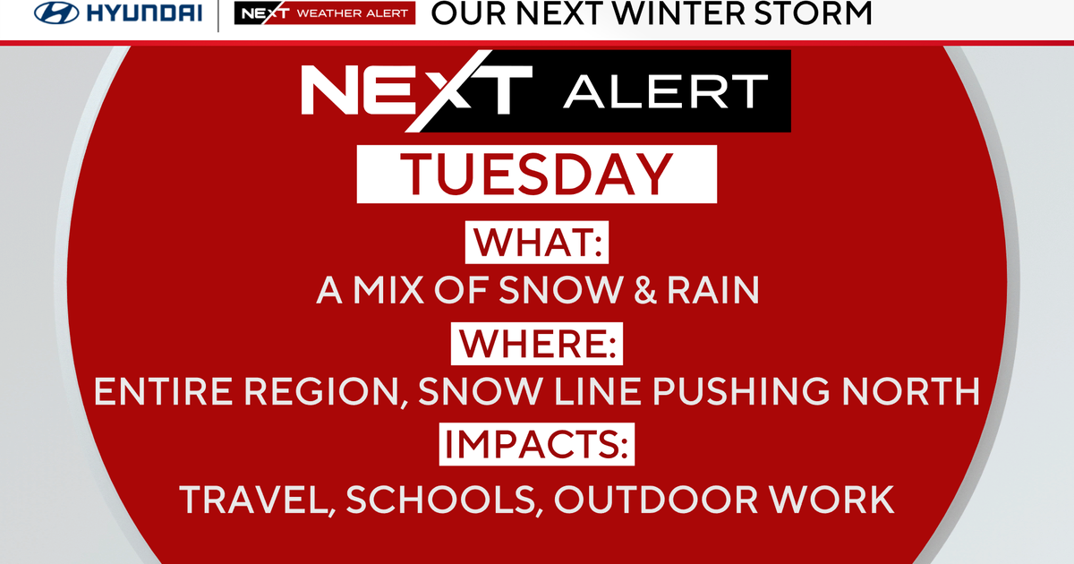
Widespread precipitation will move into the region before daybreak Tuesday morning, but most of the Philadelphia area and points south to the Jersey Shore will be left with just a cold rain for the majority of the day.
The precipitation will start as snow farther to the north and west of Philadelphia, but anywhere south of the I-78 corridor will see a transition to mainly rain through mid-morning.
Some schools in the Philadelphia region will open two hours late Tuesday.
What’s NEXT
A storm system will move out of the Southeast and spread precipitation into our region before daybreak Tuesday morning. The storm system looks to be a little warmer upon arrival, meaning that the I-95 corridor, much of the eastern Pennsylvania suburbs and areas south into New Jersey and Delaware will likely only see rain with this system. There could be a few wet snowflakes mixed in with the rain during the initial arrival of the precipitation, but that will likely be very short-lived.

CBS News Philadelphia
As you get a little farther north, generally north of the Pennsylvania Turnpike, you could see a little more snow during the pre-dawn hours, but that snow will also change over to rain pretty quickly. This will cause any light snow accumulation to melt quickly and give way to a steady rain for the remainder of the day.
The Lehigh Valley and into the Poconos have a better chance of seeing mostly snow, but even these areas will likely see some rain or sleet mix in with the snow around midday. By the middle of the afternoon, the precipitation will start to clear out and likely be completely finished before 4 p.m.

CBS News Philadelphia
Regardless, Tuesday morning will be heavily impacted by this storm system, making for some challenging travel through at least the first half of the day. The system will then pull away Tuesday night, with temperatures dropping back into the 20s, which will produce the concern for black ice for the morning commute Wednesday.
The remainder of the week remains well below normal with chilly temps. A push of even colder air Friday will hold temperatures below freezing for most of the day before another system brings the chance for winter weather Friday night into early Saturday morning.
How much snow and rain will parts of Philadelphia region get Tuesday?New Jersey coastal plain and shore: All rain (1.00-1.25 inches) – Rain ends by 4 p.m.I-95 corridor & Pennsylvania suburbs: Few wet snowflakes at precip onset (4 to 6 a.m.), but mostly rain. It will be three-quarters of an inch to an inch of good soaking rain. Rain ends by 4 p.m.Lehigh Valley: Starts as all snow before sunrise. Could see some light accumulation (1-2 inches) before rain and sleet mix in and snow begins to melt. Precipitation ends by 3-4 p.m.Poconos: Snow arrives a couple of hours before sunrise. Mainly showers continue most of the day (3-6 inches). Could see some sleet or rain mix in before precipitation ends. Precipitation ends through mid-afternoon.Here’s your 7-day forecast:

CBS News Philadelphia
Tuesday: NEXT Weather Alert for snow and rain. High 41, Low 30.
Wednesday: Sunny, cold. High 42, Low 30.
Thursday: Partly sunny. High 43, Low 30.
Friday: Very cold. High 33, Low 21.
Saturday: Snow and rain chance. High 37, Low 29.
Sunday: Partly sunny. High 42, Low 30.
Monday: Partly cloudy. High 33. Low 27.