
A second winter storm could impact eastern Pennsylvania later in the week, according to forecasters, ringing in December with tumultuous weather.
The chance for snow will come Friday night, the National Weather Service said. Potential accumulation and totals are still unclear and are dependent on the track of the storm over the coming days.
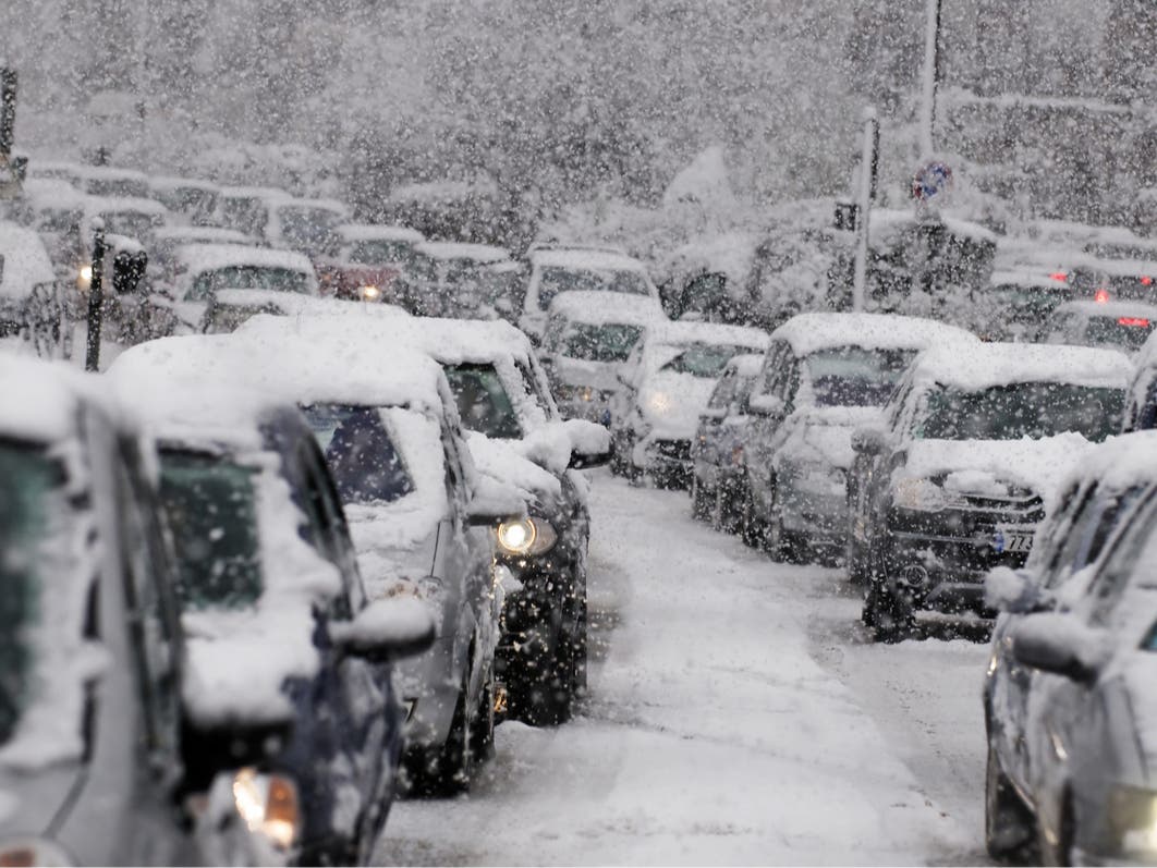
It comes after much of the northeast was hit by a strong winter storm on Tuesday. The storm began as snow and wintry mix in many areas, but could turn to rain as the day continues, the National Weather Service said.
Find out what’s happening in Across Pennsylvaniafor free with the latest updates from Patch.
Friday’s inclement weather will be facilitated by a shift in the polar vortex sending frigid air across the eastern seaboard, with low temperatures dropping into the teens Thursday.
“The snow may be brief and sporadic, associated with the Arctic blast, but it can accumulate several inches, leading to slippery conditions,” Accuweather says. “Travelers on highways and airways should be prepared for potential delays. Some school delays, early dismissals or cancellations are also possible.”
Find out what’s happening in Across Pennsylvaniafor free with the latest updates from Patch.
The strength of the storm will be dependent upon how strongly the Arctic front is pushed across the country and into the storm front developing in the south. If the storm moves quickly, it could blast straight out to sea with limited impacts.
“However, should the cold air sit back just a bit in the Northeast and let the storm strengthen as it nears the Atlantic coast, it could turn into a heavy snow accumulation from the southern Appalachians and Piedmont all the way to the interior mid-Atlantic and much of New England,”
Accuweather meteorologist Bernie Rayno said in a statement.
Generally clear conditions are expected for the weekend after that storm front, with highs in the low 40s and lows in the mid 20s expected over the weekend, forecasters said.
Here’s the full forecast in the Philadelphia area for the coming week, according to the National Weather Service:
Tuesday
Rain, mainly before 3 p.m. High near 41. North wind 5 to 10 mph. Chance of precipitation is 100 percent. New precipitation amounts between a half and three quarters of an inch possible.
Tuesday Night
Mostly cloudy during the early evening, then gradual clearing, with a low around 29. Northwest wind 10 to 15 mph.
Wednesday
Sunny, with a high near 41. Northwest wind around 5 mph.
Wednesday Night
Mostly clear, with a low around 28. Calm wind becoming southwest around 5 mph.
Thursday
Partly sunny, with a high near 41. West wind 5 to 15 mph.
Thursday Night
Mostly clear, with a low around 19.
Friday
Mostly sunny, with a high near 33.
Friday Night
A chance of snow. Mostly cloudy, with a low around 26. Chance of precipitation is 30%.
Saturday
Partly sunny, with a high near 42.
Saturday Night
Partly cloudy, with a low around 29.
Sunday
Partly sunny, with a high near 40.
Sunday Night
Mostly cloudy, with a low around 25.
Monday
Mostly sunny, with a high near 34.
Get more local news delivered straight to your inbox. Sign up for free Patch newsletters and alerts.