
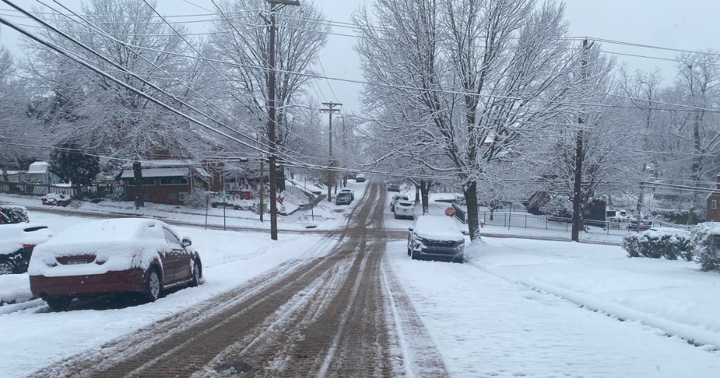
A winter storm hit western Pennsylvania on Tuesday morning, leaving a blanket of snow across the entire Pittsburgh area.
The official measurement at the Pittsburgh International Airport came in at 3.6 inches. A widespread 2 to 4 inches was forecasted, and according to maps from the National Weather Service, that’s about how much most people got.
Using reports from the public and trained spotters, NWS Pittsburgh put together a map showing accumulation across the region. Most areas got 3 to 4 inches, with some areas like Freedom, Meridian, Dunbar and Indiana hitting 5 inches. A few spots also saw lower accumulations between 1 and 2 inches.
Thank you everyone for the reports! Here is a preliminary snowfall total map based on that information as accumulating snowfall comes to an end.
For tonight, keep an eye out for patchy ice as any melting snow may refreeze on untreated surfaces. pic.twitter.com/W8QwoGC08S
— NWS Pittsburgh (@NWSPittsburgh) December 2, 2025
The snow fell heavily in the morning, making for a tricky commute for many drivers. Crews said rush hour traffic also meant it would take a bit longer to clear the roads. While PennDOT traffic cameras showed most major routes clear by noon, NWS Pittsburgh is reminding drivers to keep an eye out for patchy ice because melting snow may refreeze on untreated surfaces.
A winter weather advisory has since expired for most of the area, but it remains in place for the higher elevations southeast of Pittsburgh, where the NWS says occasional freezing rain and drizzle may lead to light ice accumulations.
Looking ahead, a quick dusting of snow is expected on Thursday morning. After that, the skies will clear and temperatures will start to dip. Friday will bring temperatures in the single digits, and the wind chill will make it feel close to zero degrees in some areas.
More from CBS News