A sharp cold front will sweep through the Lehigh Valley on Thursday, bringing significantly colder temperatures and gusty northwest winds.
Residents should prepare for a rapid temperature drop, with daytime highs only reaching the mid to upper 30s Thursday before remaining below freezing on Friday in the Lehigh Valley. At Lehigh Valley International Airport, a low of 10 is forecast overnight Thursday into Friday morning.
Up first, Wednesday is forecast to be sunny with highs in the mid to upper 30s and west wind around 5 mph.
Any wet spots remaining from Tuesday’s wintry mix may have become slick with black ice, particularly north of Interstate 78 where the greatest amounts of frozen precipitation fell, according to the National Weather Service. Rising daytime temperatures are expected to melt any icy spots, before temperatures drop below freezing into the mid-20s overnight into Thursday morning.
The National Weather Service forecasts west-northwest winds gusting 25-35 mph during Thursday afternoon, creating wind chills that will feel much colder. Snow showers are possible in the Poconos and higher elevations of northwestern New Jersey, though widespread accumulation is not expected. The Lehigh Valley and surrounding areas should anticipate clear but increasingly cold conditions as the high-pressure system moves in behind the cold front.
By Thursday night, temperatures will plunge dramatically, with single-digit readings possible in the Poconos. Fortunately, winds are expected to diminish after sunset, which will help limit extreme wind chill effects. Residents are advised to dress in layers, protect exposed skin, and take precautions to prevent pipes from freezing.
“This Arctic air outbreak can be attributed to a displacement of the polar vortex,” AccuWeather Lead Long-Range Meteorologist Paul Pastelok says at accuweather.com.
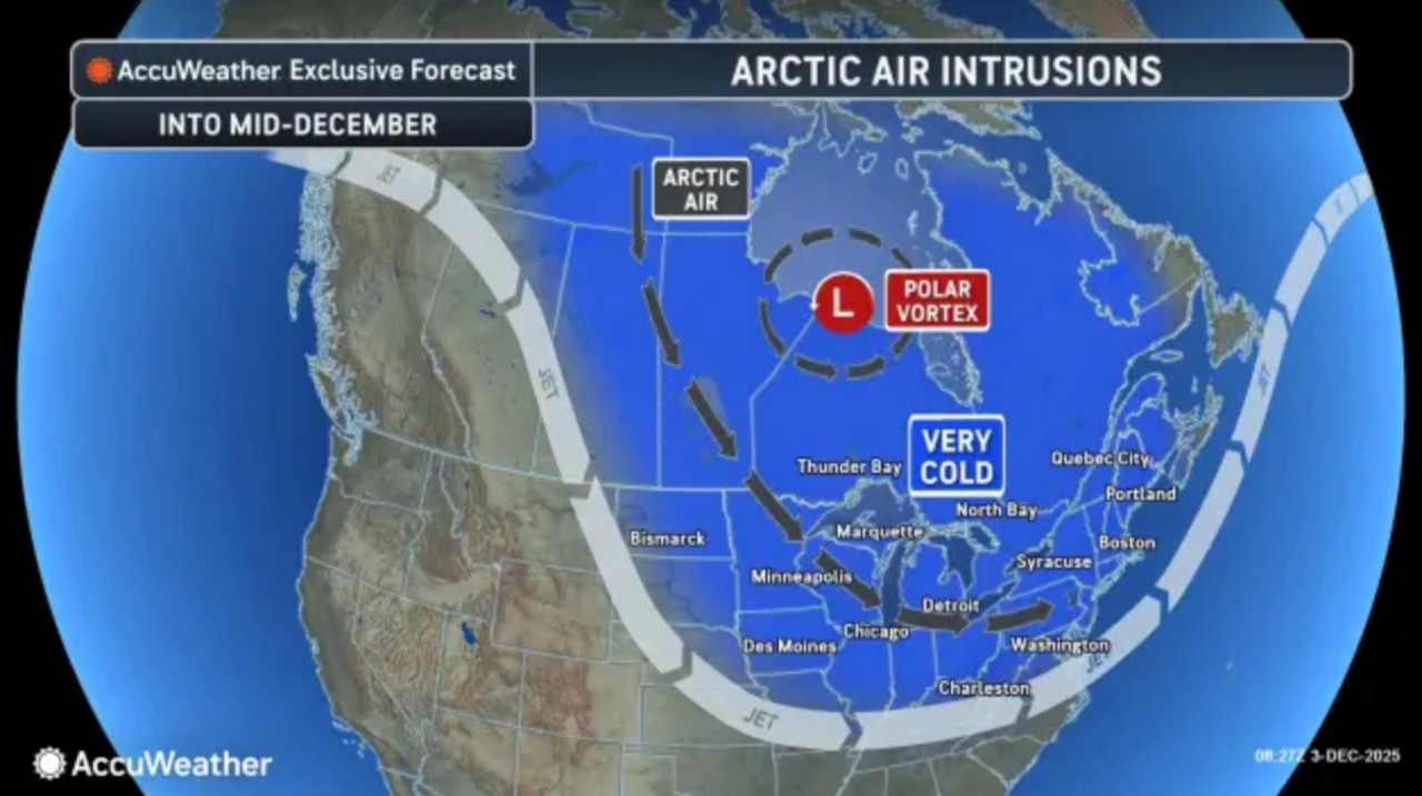 Arctic air arrives Thursday, Dec. 4, 2025, with gusty winds and below-average temperatures continuing through next week.AccuWeather.com and National Weather Service
The cold pattern is expected to persist into Friday, with high temperatures struggling to reach the upper 20s in the Lehigh Valley. A potential winter weather system may develop late Friday into Saturday, primarily affecting southern and eastern regions, with the Lehigh Valley potentially seeing light snow or a wintry mix.
Long-range forecasts suggest continued below-average temperatures through early next week, with a slight chance of precipitation Sunday through Tuesday. Residents should stay informed about changing weather conditions and be prepared for winter-like conditions in the coming days.
Current weather radar