
Brisk Thursday, then record-challenging cold possible tonight in south-central Pennsylvania
High temperatures on Thursday will reach the upper 30s before dropping into the teens overnight Thursday and challenging record lows Friday morning. Temps remain below average this weekend while remaining dry. Next week we’re tracking an active pattern, allowing more chances for possible snow.
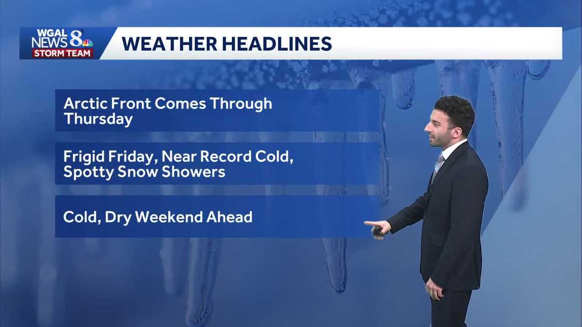
READY TO DRINK COCKTAILS. AN ARCTIC FRONT IS SLATED TO COME THROUGH THE SUSQUEHANNA VALLEY AS WE GO THROUGH THIS AFTERNOON, AND ALSO INTO THE EVENING, AND THEN ONCE WE GET INTO FRIDAY, I’LL TELL YOU WHAT THE COLD AIR, THE FRIGID AIR IS GOING TO BE SETTLING IN OVER THE VALLEY AS WE GET INTO TONIGHT, INTO FRIDAY, WITH NEAR RECORD COLD TEMPERATURES IN TERMS OF OVERNIGHT TEMPERATURES, WILL WILL BE SEEING POSSIBLY DOWN TO THE LOW TEENS OR TO THE LOW TEENS WHERE WE’RE IS WHERE WE’RE GOING TO BE GOING TOWARDS. WE COULD SEE A SPOTTY SNOW SHOWER OR TWO AS WE GET INTO OUR FRIDAY. AND THEN LOOKING AT THE WEEKEND AHEAD LOOKING COLD, AND IT’S GOING TO BE DRY. SO FOR THIS AFTERNOON, EXPECT SOME DECREASING CLOUDS. WE’VE GOT MOSTLY CLOUDY SKIES RIGHT NOW, BUT WE’LL BEGIN TO BEGIN TO THIN OUT IN THAT OUT OF THAT CLOUD COVER AS WE GET INTO LATER THIS AFTERNOON. STILL REMAINING BLUSTERY, THOUGH I’LL SAY INTO THE UPPER 30S WILL GO. 26 IS BEGINNING TO THIS EVENING FEELING VERY COLD OUT THERE WITH MOSTLY CLEAR CONDITIONS. THE WINDS WILL BEGIN TO DIMINISH AND LOOK AT THE TEMPERATURES FOR TONIGHT. GETTING DOWN TO 12 DEGREES, POSSIBLY AS WE GET INTO THE OVERNIGHT PERIOD. THAT’S NEAR RECORD LOWS, BY THE WAY. WE’LL CHAT ABOUT THAT HERE IN JUST A MINUTE. BUT IN TERMS OF PICKING THE PERFECT TREE FOR TODAY, AS WE GO THROUGH THE AFTERNOON, JUST MAKE SURE YOU BUNDLE UP FOLKS. IT’S IT’S MOSTLY CLOUDY NOW, BUT WE’LL BEGIN TO CLEAR AS WE GET INTO THE EVENING WITH PARTLY CLOUDY SKIES BY 5:00. AND THEN BY 9:00 SEEING MOSTLY CLEAR CONDITIONS. BUT CURRENT TEMPERATURES ARE INTO THE 30S RIGHT NOW. BUT THAT’S GOING TO BE CHANGING AS WE GET INTO AS WE GET INTO THE NEXT SEVERAL HOURS, YOU CAN SEE THE VERY COLD AIR MASS UP TOWARDS OUR NORTHWEST. THAT’S GOING TO BE STARTING TO COME IN, AND THAT’S THAT COLD FRONT IS GOING TO BE STARTING TO MOVE THROUGH AS WE AS WE GET INTO LATER THIS AFTERNOON. YOU CAN SEE HIGH TEMPERATURES FOR THE NEXT SEVERAL DAYS STILL REMAINING BELOW AVERAGE. BUT AS WE GET INTO FRIDAY, OUR FORECAST IS DOWN TO THE LOW 30S IS WHERE WE’LL BE GOING INTO FOR THE AFTERNOON. AND CURRENT WINDS OUT OF THE NORTHWEST. YOU CAN SEE AN 18 MILE PER HOUR BREEZE IN LANCASTER, A 22 MILE PER HOUR BREEZE IN LEWISTOWN. SO FACTOR BOTH THE AIR TEMPERATURE AND THE WIND SPEEDS IN, AND IT’S MAKING IT FEEL A LOT CHILLIER OUT THERE. YOU CAN SEE BY THE MID WE’LL GET INTO THE UPPER 30S BY 3:00 THIS AFTERNOON. BUT THEN ONCE WE GET INTO LATER IN THE EVENING, EVEN THOUGH WE HAVE TEMPERATURES GETTING INTO THE UPPER 20S, FEELING LIKE THE TEENS BY 7:00, EVEN 9:00, AND THEN CLOSER TO 11:00 THIS EVENING, GETTING DOWN TO FEELING LIKE 12 DEGREES. BUT THE AIR TEMPERATURES FOR TONIGHT. WE ARE ALSO EXPECTING TO BE HITTING 12 DEGREES. YOU CAN SEE FOR HARRISBURG TEN DEGREES, POSSIBLY FOR CARLISLE, A TEN DEGREE AIR TEMPERATURE FOR LEWISTOWN, AND THAT WE’RE CHALLENGING A RECORD IN TERMS OF DECEMBER 5TH. NOW, LAST TIME WE WERE 12 DEGREES WAS BACK IN 1926 WHERE FORECASTING 12 DEGREES FOR TONIGHT. SO THAT’S SOMETHING THAT WILL BE WATCHING. AND THAT’S WHY WE HAVE IT AS AN IMPACT NIGHT FOR TO OR FOR AS WE GET INTO THE OVERNIGHT PERIOD FOR THE VERY CHILLY TEMPERATURES. STORM TEAM LIVE RADAR NETWORK THOUGH, ALL THANKS TO HIGH PRESSURE JUST SEEING. WE’LL START TO SEE SOME OF THE CLEARING SKIES. AND ONCE THAT COLD FRONT COMES THROUGH, THAT’S WHAT’S GOING TO BE ALLOWING FOR FOR THE VERY CHILLY TEMPERATURES. NOW YOU SEE THERE’S SOME SNOW TOWARDS OUR SOUTH, NOT REALLY EXPECTING A WHOLE LOT OF ACTION IN TERMS OF THAT SYSTEM. THAT’S TO OUR SOUTH. MAY SEE A FEW ISOLATED AFTERNOON EVENING SNOW SHOWERS FOR FRIDAY COLD THOUGH, AS WE GET INTO SATURDAY AND SUNDAY, AND A BIT OF AN UNSETTLED WOR
Brisk Thursday, then record-challenging cold possible tonight in south-central Pennsylvania
High temperatures on Thursday will reach the upper 30s before dropping into the teens overnight Thursday and challenging record lows Friday morning. Temps remain below average this weekend while remaining dry. Next week we’re tracking an active pattern, allowing more chances for possible snow.

Updated: 12:22 PM EST Dec 4, 2025
Temperatures will top out around the upper 30s this afternoon, still below average for this time of the year. An Arctic front is expected to pass through the Valley this afternoon, allowing a chance to see a few flurries and a much colder end to the work week. Winds will also pick up as the front approaches.Low temps will approach record-challenging levels, in the upper teens for Thursday night, coming close to the record of 12 degrees set in 1926. Then Friday’s highs might not get out of the 20s in some areas!We’re watching a system that will slide to our south Friday evening through Friday night. It may produce flurries or light snow showers. However, the system will pass to our south, limiting how much snow we will see. Areas south of the PA Turnpike have the best chance of seeing some snowflakes. A light dusting is possible, but most areas will not see accumulation. If you are heading into the Baltimore or Washington, DC areas on Friday, be on the lookout for slick spots as minor accumulation in these areas is possible.Highs will be about 10 degrees below average this weekend, in the upper 30s. Look for a partly to mostly cloudy sky for Saturday & Sunday.Next week, unseasonably cold weather continues, as highs hover in the 30s. A series of clippers may bring snow showers on Tuesday into Wednesday, and a chance of rain/snow showers on Thursday.Have a great Thursday!~ Ryan
Temperatures will top out around the upper 30s this afternoon, still below average for this time of the year. An Arctic front is expected to pass through the Valley this afternoon, allowing a chance to see a few flurries and a much colder end to the work week. Winds will also pick up as the front approaches.
Low temps will approach record-challenging levels, in the upper teens for Thursday night, coming close to the record of 12 degrees set in 1926. Then Friday’s highs might not get out of the 20s in some areas!
We’re watching a system that will slide to our south Friday evening through Friday night. It may produce flurries or light snow showers. However, the system will pass to our south, limiting how much snow we will see. Areas south of the PA Turnpike have the best chance of seeing some snowflakes. A light dusting is possible, but most areas will not see accumulation. If you are heading into the Baltimore or Washington, DC areas on Friday, be on the lookout for slick spots as minor accumulation in these areas is possible.
Highs will be about 10 degrees below average this weekend, in the upper 30s. Look for a partly to mostly cloudy sky for Saturday & Sunday.
Next week, unseasonably cold weather continues, as highs hover in the 30s. A series of clippers may bring snow showers on Tuesday into Wednesday, and a chance of rain/snow showers on Thursday.
Have a great Thursday!
~ Ryan