
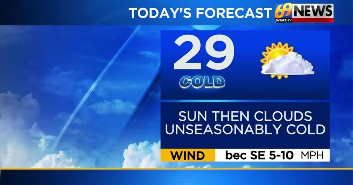
TODAY: Increasing clouds and chilly; spotty PM snow shower. High: 29
TONIGHT: Mostly cloudy and cold. Low: 20
SATURDAY: Partly sunny and cool. High: 38 Low: 22
THE BIG PICTURE
Temperatures have been below normal since Thanksgiving Day and look to stay consistently cold through the weekend and into next week as well. An area of low pressure will slide to our south and east Friday which may bring a few flurries or a snow shower for areas to our south mainly. High pressure will follow for the weekend and temperatures will turn more tolerable but still below normal both days. A cold front will arrive Sunday night which will bring back colder air to start next week. So, temperatures Monday will hopefully make it to 30 degrees before nighttime lows drop to the teens again Monday night. Yet another cold front will move through midweek which could bring another round of wintry weather.
FORECAST DETAILS
FRIDAY
After a very chilly start Friday, temperatures will continue to struggle as afternoon highs only hit the upper 20s and lower 30s. Some sun will start the day Friday before an increase in the cloud cover as the day unfolds. There can be a snow shower this afternoon, especially south of the Lehigh Valley as a storm system passes to our south.
FRIDAY NIGHT AND WEEKEND
A weak low pressure system will pass offshore to our south and east, and bring some extra clouds and perhaps a snow shower or some flurries Friday night if it comes close enough. After a frigid start Saturday morning with temperatures in the teens again, temperatures will turn more tolerable over the weekend but still remain unseasonably cold. Highs both days will be in the mid to upper 30s with nights.
EARLY NEXT WEEK
High pressure will stick around as the new week begins but it will also be paired another shot of colder air. So afternoon highs Monday will likely make it to near 30 degrees amid a mix of sun and clouds. Nighttime lows Monday will plummet back down to the frigid teens. The series of cold fronts will take us into midweek with another one that would bring some wintry weather Tuesday night into Wednesday.