
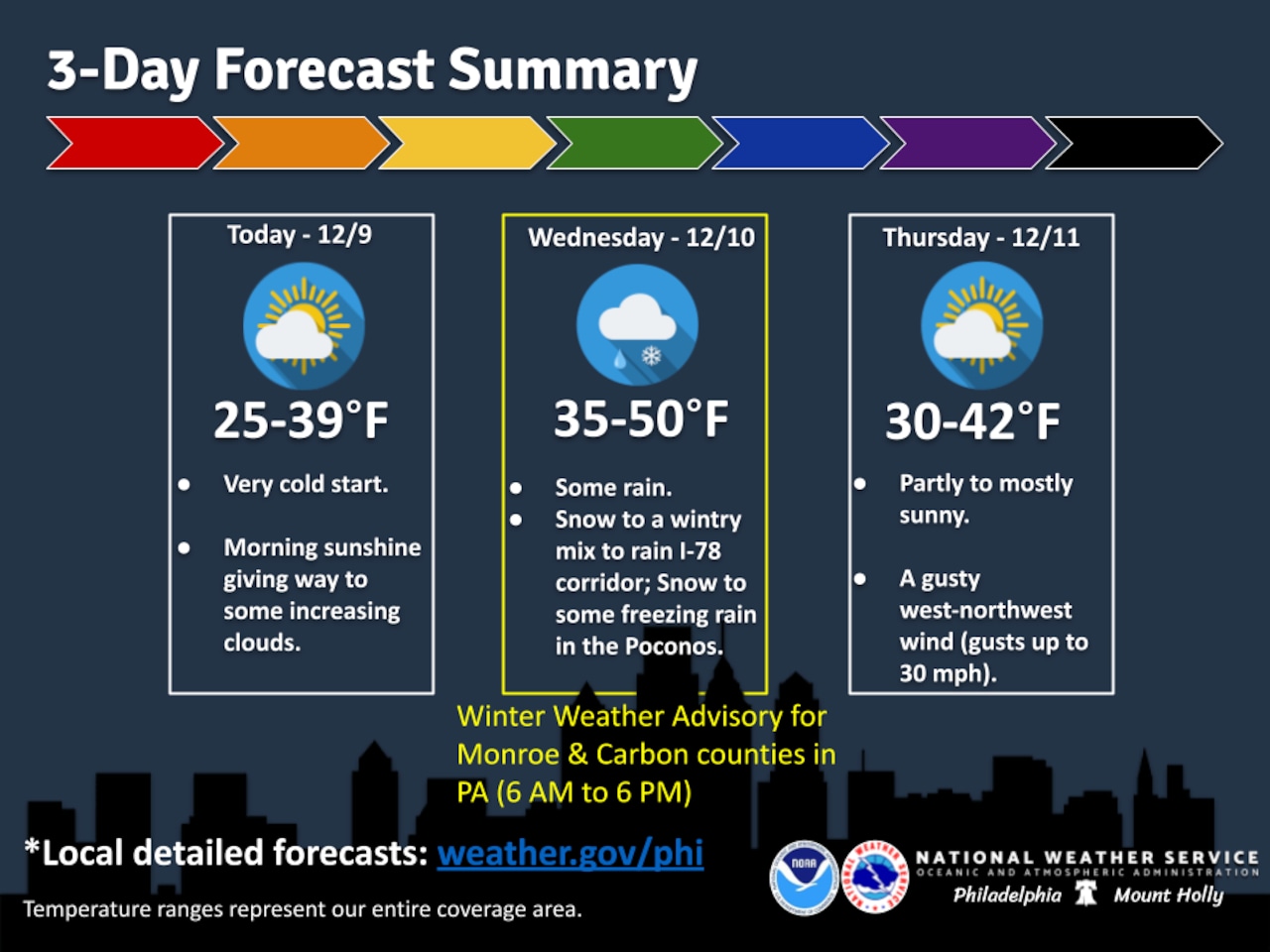
Near-record cold dominated the weather Tuesday morning for the Lehigh Valley, ahead of the chance for a dusting of snow Wednesday expected to transition to rain in the early afternoon.
To the north, a Winter Weather Advisory has been issued for Carbon and Monroe counties in the Pocono Mountains region, with snow and potential wintry mix expected Wednesday morning that could create hazardous travel conditions.
Temperatures on Tuesday are expected to rise into the low 30s in the Lehigh Valley after a morning low of 8, according to preliminary climate data from the National Weather Service. The record low for the date, Dec. 9., is 7 — set in 1989 and 2002. Increasing clouds are forecast with calm winds becoming southerly around 5 mph in the afternoon. Low temperatures in the mid-20s are forecast overnight into Wednesday morning.
On Wednesday, the National Weather Service forecasts precipitation will begin before 10 a.m., starting as snow in the Lehigh Valley before transitioning to a wintry mix that may include freezing rain. Accumulations of up to 1 inch are likely, with higher snow totals expected in higher elevations of the southern Poconos, potentially reaching 2 to 4 inches.
Temperatures will remain well below normal Wednesday, with highs struggling to reach the low 30s in the morning and climbing to the low 40s by afternoon. Southerly winds will increase to 10 to 15 mph with gusts up to 25 mph, helping to push warmer air into the region and change precipitation from snow to rain by Wednesday afternoon.
The cold pattern will continue through the weekend, with another arctic air mass expected to bring significantly cold temperatures early next week. Daytime highs will remain below average, with wind chills potentially dropping into the teens by Friday morning and single digits in the Poconos.
A series of quick-moving weather systems will keep temperatures cold, with potential for additional light snow or flurries possible Thursday, particularly in the Pocono region. Residents should be prepared for winter driving conditions and continue to monitor local weather updates.
Current weather radar
Supervising reporter Kurt Bresswein contributed to this report. Reach him at kbresswein@lehighvalleylive.com.