
Snow is on the way once again for much of Pennsylvania.
The National Weather Service has issued a winter weather advisory for northern and western Pennsylvania.
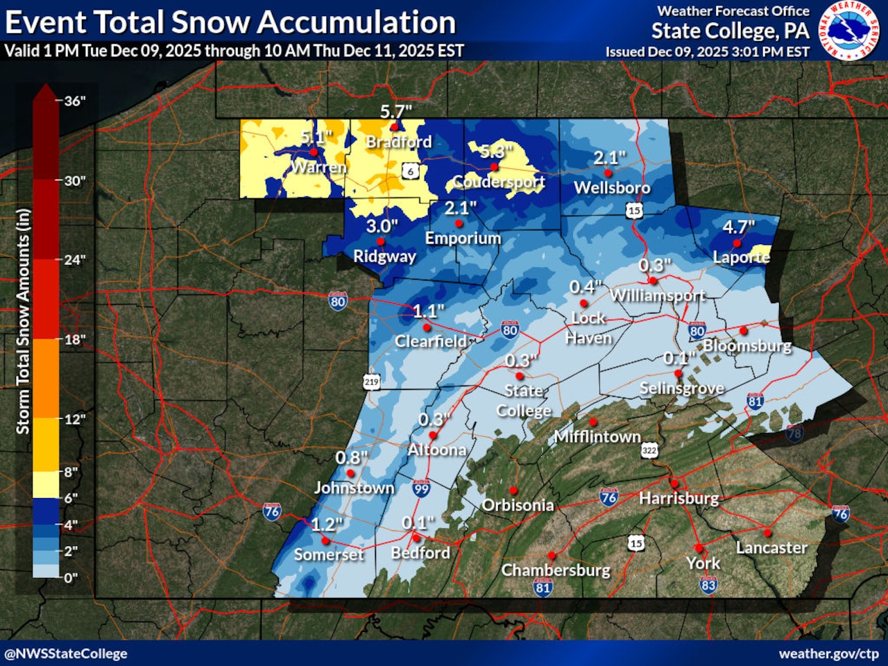
“It looks like amounts ranging from between 1 and 3 inches as soon as you go north of I-80,” said Michael Colbert, meteorologist with the National Weather Service in State College.
Areas such as northern Center and Clinton counties, he said, can expect amounts as high as 3 inches. Areas further north, such as Warren, McKean and Potter counties, and west towards Lake Erie, may receive as much as 6 inches.
The western portion of the state could also be subjected to wind gusts of up to 25 miles per hour, which might pick up snow as well.
These snow squalls “are notorious for producing very changeable road conditions,” Colbert said.
“You might be driving along, and the weather conditions are just fine, and then suddenly you end up in a snow squall,” he said. “And very suddenly, the visibility drops to less than a quarter mile, in kind of a mini blizzard that lasts anywhere from 10 to 30 minutes.”
Blizzard conditions may even be expected to the south of Pennsylvania’s border, in West Virginia and Maryland.
A hazardous weather outlook — meaning a lesser chance of severe weather — is in place further west towards the Pittsburgh region.
But the southwestern Laurel Highlands can still expect a few inches of snow, Colbert said, particularly at higher elevations.
For central and southeastern Pennsylvania, the outlook is much rosier, with only light precipitation expected south of I-80 and east of I-99.
Still, a chance remains of dangerous road conditions.
“It looks like maybe about a 30% chance of just a hundredth of an inch of ice from freezing rain,” Colbert said. “But we still want to mention it, just to be safe.”