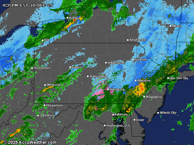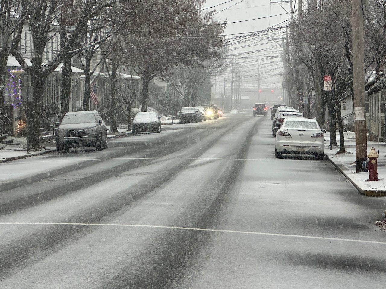
A rapidly changing winter weather system brought hazardous travel conditions to the Lehigh Valley and Pocono Mountains on Wednesday.
Emergency responders were dealing with numerous crashes and impassable roads mid-afternoon into dusk across Lehigh and Northampton counties, according to emergency radio broadcasts.
The National Weather Service lifted a Winter Weather Advisory for the Lehigh Valley but kept one in place until 6 p.m. for Carbon and Monroe counties in the Poconos region.
In the Lehigh Valley, a wintry mix that brought light rain, snow and sleet was expected to transition to a chance of plain rain until about midnight Wednesday. To the north, total snow accumulations of 1 to 3 inches were expected in the Poconos with ice accumulations amounting to a light glaze.
The Pennsylvania Department of Transportation announced about 4:30 p.m. it lifted speed limit and vehicle restrictions in place on several roadways in the Lehigh Valley region.
PennDOT crews were still treating state roads in the area until they are clear.
Conditions were dangerous enough for the Allentown City Clerk’s Office to announce the postponement of meetings Wednesday night to Tuesday, Dec. 16. The Winter Lights Spectacular at Lehigh Valley Zoo was canceled for Wednesday night due to potential hazardous driving conditions, with plans to reopen at 5 p.m. Thursday.
Looking ahead, temperatures will drop dramatically as a cold front moves through Wednesday night. Wind chills after midnight are expected in the single digits across the Poconos and into the teens and 20s, with Thursday’s highs struggling to reach the mid-30s in the Lehigh Valley.
Snow squalls, gusty wind and plummeting temperatures could create continued dangerous conditions Thursday, according to the National Weather Service.
While most of the region will see a dry, cold and windy Thursday, snow squalls are likely across the I-80 corridor and potentially extending into the Lehigh Valley. The highest risk is in Carbon and Monroe Counties. Total snowfall accumulation may be minimal, but the combination of gusty winds, low visibility, and potential for flash freezing makes these snow squalls extremely dangerous for drivers.
Westerly winds are forecast to gust up to 30-35 mph Thursday and Thursday night across the region.
Another winter system may bring light snow Saturday night into Sunday morning, with continued cold temperatures. Monday will remain very cold, with highs in the 20s and wind chills making it feel like the teens.
Residents should prepare for prolonged cold weather, dress in layers, protect pipes from freezing, and limit outdoor exposure during the most intense periods of cold and wind.
Current weather radar