
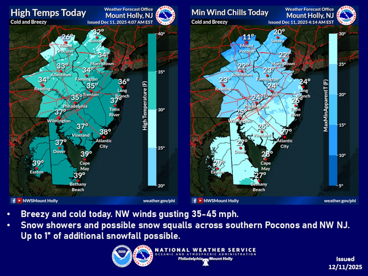
A cold front has ushered in a sharp drop in temperatures and the potential for snow showers, particularly in the Poconos and along the Interstate 80 corridor.
Residents should prepare for gusty winds Thursday and wind chills that could make it feel like the teens.
The National Weather Service forecasts snow showers and potential snow squalls Thursday afternoon, with the highest likelihood along the I-80 corridor and in the Poconos.
Wind gusts could reach 30 to 35 mph, especially in higher elevations, creating challenging travel conditions. Quick snow accumulations of about an inch and rapid reductions in visibility are possible.
At Lehigh Valley International Airport, a slight chance of snow showers is forecast after 4 p.m. Thursday, with no significant accumulation.
Temperatures will fall dramatically through Thursday, with daytime highs struggling to reach the mid-30s. Overnight lows are expected to drop into the low 20s, with northwest New Jersey and the southern Poconos potentially seeing teens. Wind chills could make it feel several degrees colder than actual air temperatures.
A clipper system moving through Saturday night could bring additional snow. Forecasts suggest 2 to 3 inches are possible south of the Lehigh Valley, across the Delaware Valley and into Philadelphia.
Sunday will bring another strong cold front, keeping temperatures in the mid to upper 20s north and west of the Fall Line, and low to mid-30s along the I-95 corridor.
The cold pattern is expected to persist into early next week, with overnight lows in the teens and daytime highs struggling to reach the 30s. Residents should be prepared for winter-like conditions and dress in layers when venturing outdoors.
Current weather radar