Holiday season snow is headed our way, which isn’t something we can say every year in Southeast PA. In places like Pittsburgh and Philadelphia, it’ll be the first moderate snowfall of the season. This comes after Philadelphia recorded a measly 8.1″ all of last winter. They may see half of that in the coming days.
A juiced Alberta clipper will swing across the Midwest into Western PA Saturday afternoon. It will transfer to the coast Sunday morning, producing snow along the coast. In the middle across Central PA, it’s better luck next time.
Temperatures will be very chilly with harsh northwest winds Sunday, meaning lake effect snow squalls will stream through Northwest PA. This forecast includes totals for that as well.
Future Radar Timing
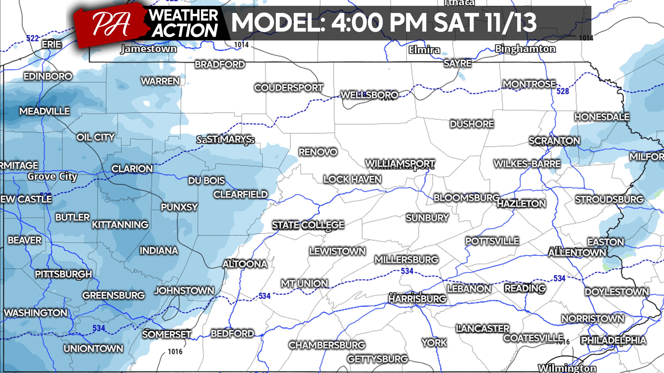
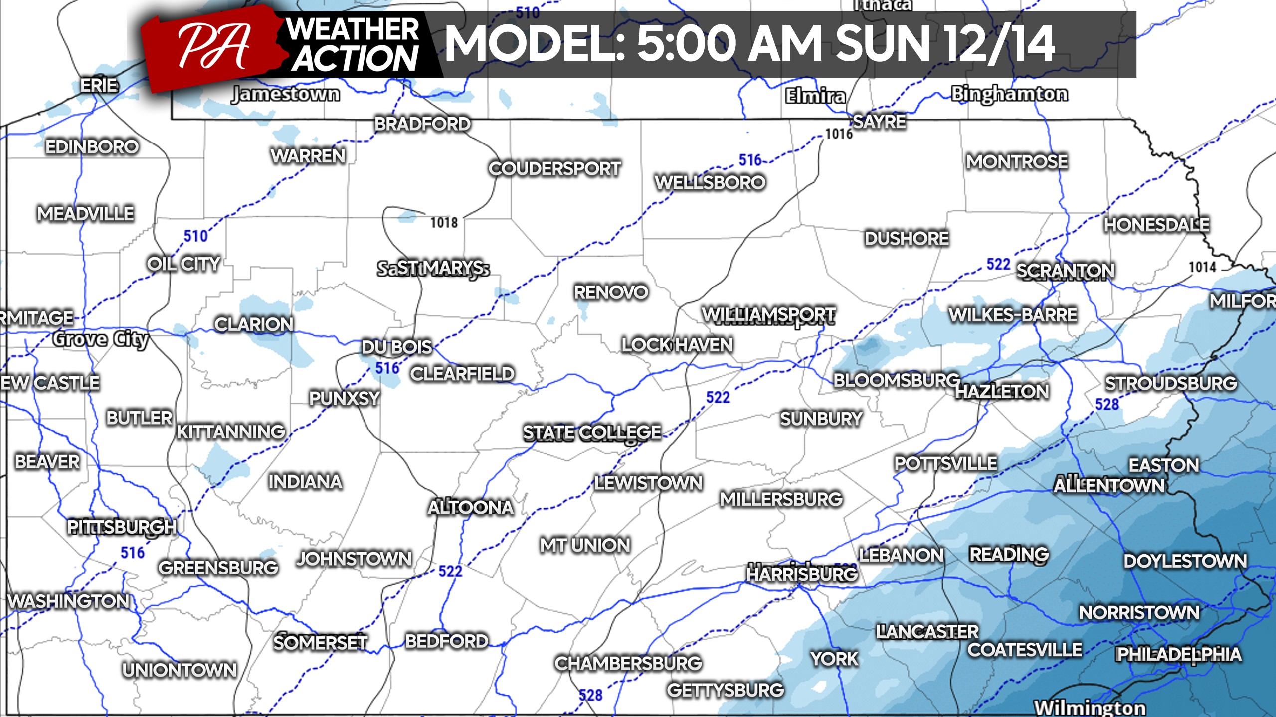
Light snow will begin in Western PA mid-Saturday afternoon. Temperatures in the 20s will mean higher ratio snow, instead of some of the slop we’ve seen recently. Below is the Hi-Res NAM model for 4:00 PM Saturday.
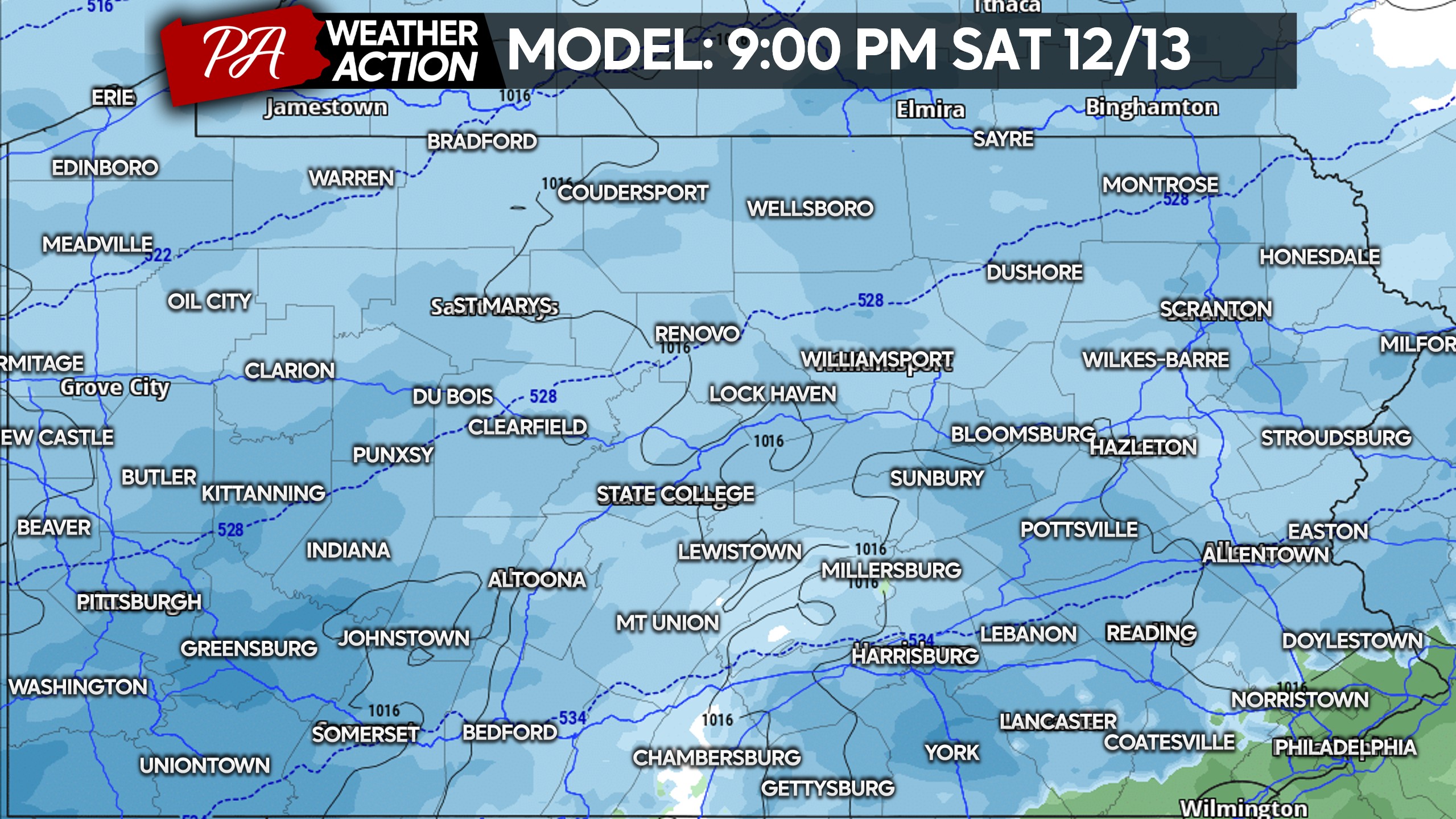
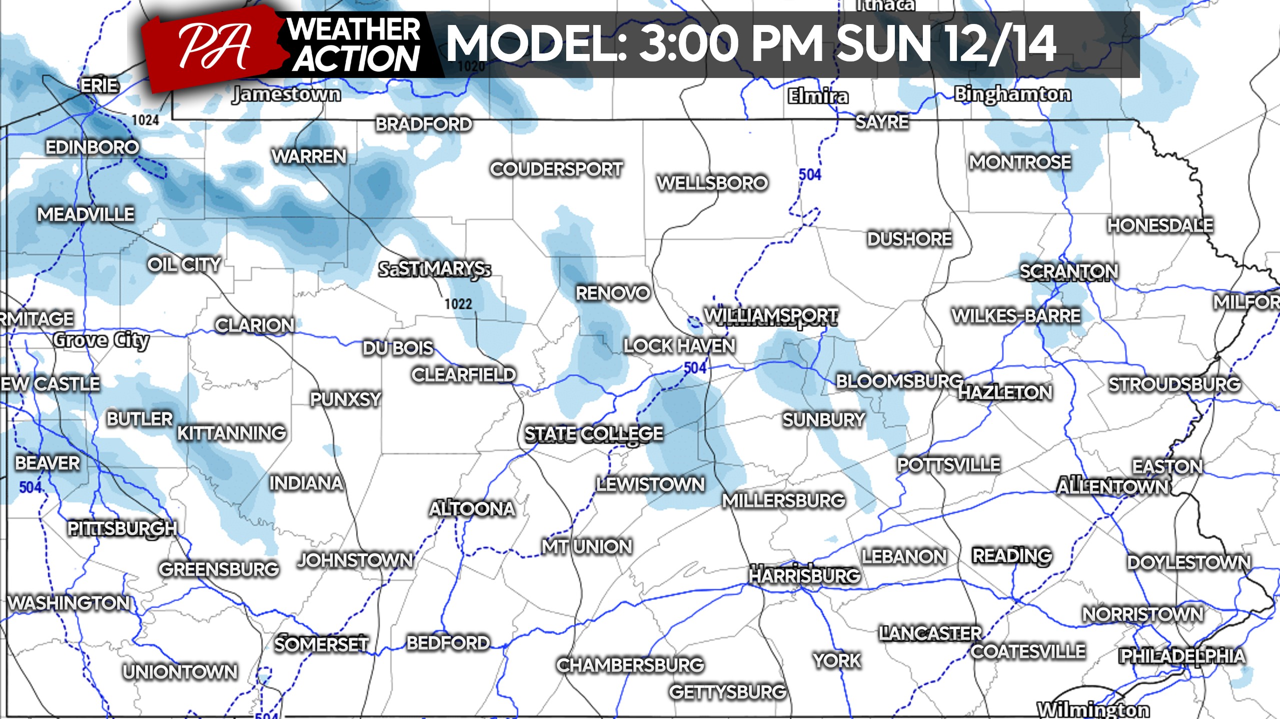
By late Saturday evening, snow will overspread Eastern PA with maybe some brief mixing near I-95. This model is pretty aggressive with the coastal and as a result, you get rain initially near Philly. We don’t think that will happen. Here’s the Hi-Res NAM for 9:00 PM Saturday.
Snow will clear out in Western PA around midnight, ending last in the Laurel Highlands. Meanwhile in Central and Eastern PA, snow will drift away from northwest to southeast. Meaning Southeast PA will be the last to see snow exit, likely around sunrise Sunday.
As northwest winds get flowing Sunday, lake effect snow showers and squalls will push in from Lake Erie. These squalls will be most persistent in the lake effect belts of Northwest PA. The lake effect snow should wrap up by late Sunday evening.
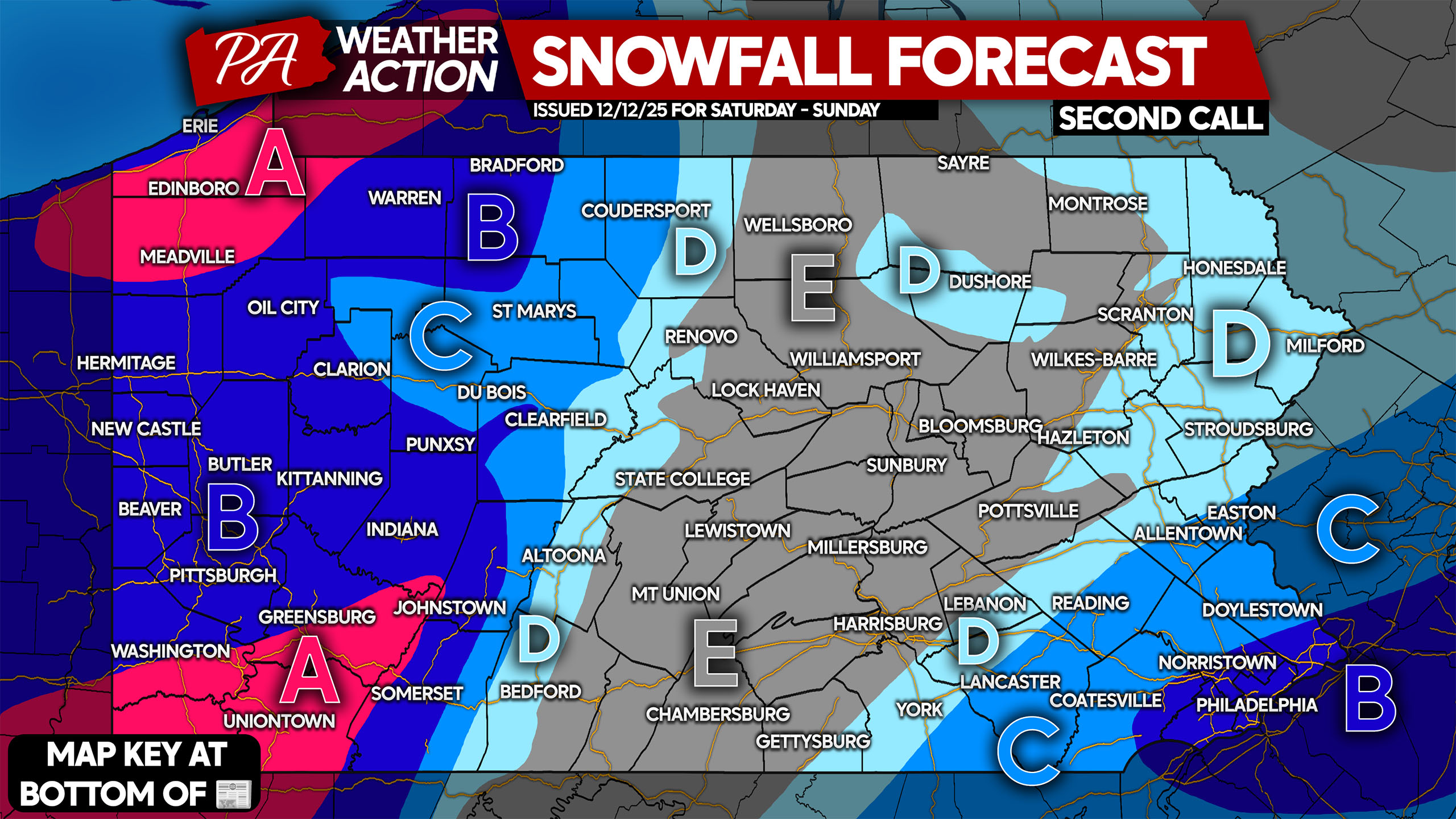
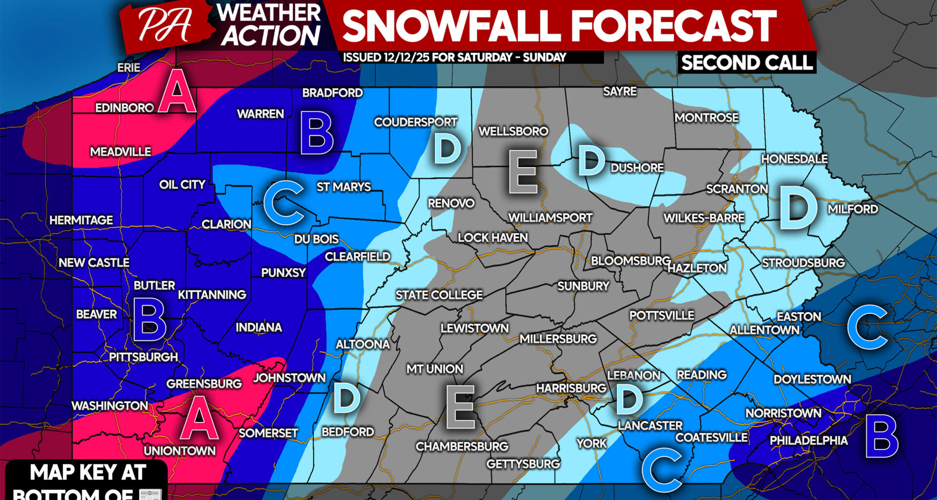
SECOND CALL SNOWFALL FORECAST FOR SATURDAY – SUNDAY
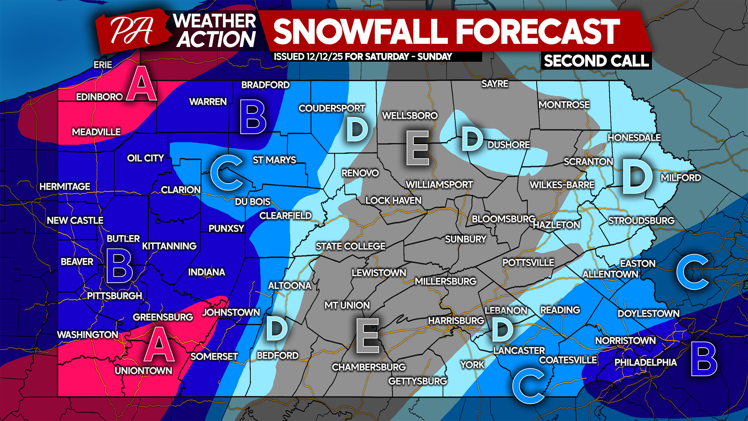
Area A: Snowfall accumulation of 6 – 8″ expected, with locally higher amounts near Seven Springs and in persistent lake effect bands south of Erie.
Area B: Snowfall accumulation of 4 – 6″ anticipated. Roads will be snow-covered and hazardous, refer to timing above for as to when.
Area C: Snowfall accumulation of 2 – 4″ expected. Roads will become covered and slippery.
Area D: Snowfall accumulation of 1 – 2″ anticipated. Roads may be slippery.
Area E: Snowfall accumulation of less than 1″ expected.
Our final update to the forecast will come early Saturday afternoon. Any changes will likely be in Eastern PA. Stay tuned!
Don’t forget to share this forecast with friends and family below!