
Another round of light snow is on the way for the weekend, and this time, the entire area should be blanketed with a thin layer of fresh powder.
It’s a quick moving system and a fairly weak one, so it won’t be a major or a long-lasting event. In fact, the current timing has it in here a little before midnight Saturday night, and out of here by or before sunrise Sunday morning for most of us. But when you wake up Sunday morning, you’ll likely have to sweep away a fresh inch or two of fluffy and powdery snow that fell overnight. And if you’re in the Delaware Valley and along the I-95 corridor, it could be a few extra inches of snow in far southeast PA and central and southern New Jersey.
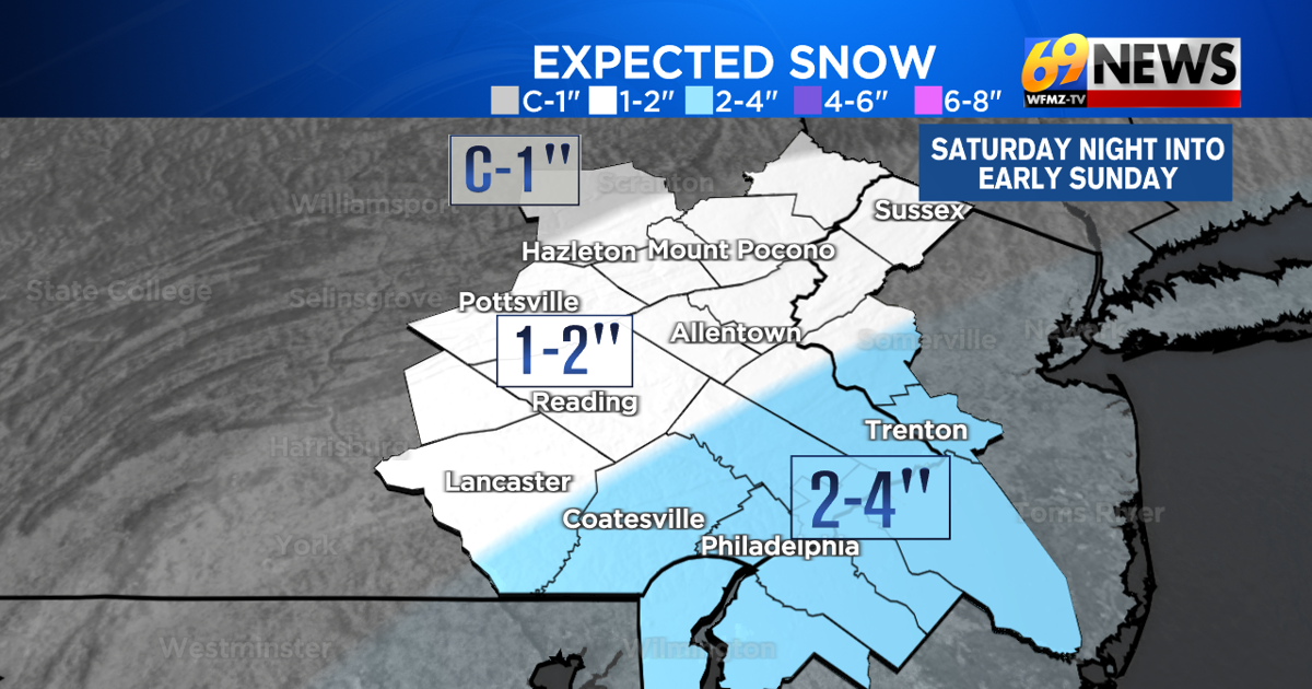
Winter weather advisories are in effect for Saturday night and Sunday morning for areas south and east of the Lehigh Valley and Berks County, where 2 to 4 inches of snow is currently expected. For Berks, the Lehigh Valley, the Poconos, and North Jersey, it’s closer to 1 to 2 inches of fluffy snow.
The ground will be cold and the air temperature will be well below freezing, so this will be all snow, with no wintry mix or rain that factors in this time. That also means the snow should stick to all cold and untreated surfaces, and slick travel will be likely Saturday night, but travel conditions should steadily improve on Sunday.
Come Sunday, winds will pick up and a bitter cold day is expected, with highs only in the mid 20s. There can be some blowing snow, since it will be powdery and winds increase to around 15-25mph and gusty. Wind chills will likely remain in the teens throughout the day on Sunday.
TRACK THE WEATHER:
LINKS: HOUR BY HOUR | RADAR | TRAFFIC