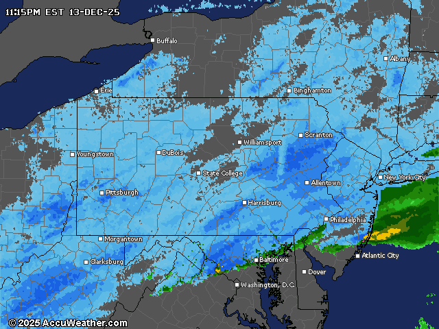
Parts of central Pennsylvania are under a hazardous weather outlook into Saturday night as forecasters call for up to 4 inches of snow in parts of the region.
The hazardous weather outlook, issued by the National Weather Service just after 3 p.m., includes Dauphin, Cumberland and Schuylkill counties.
Harrisburg and parts of Cumberland County are expected to receive “brief but heavy snow” Saturday evening into early Sunday morning. Temperatures Saturday night should hit the low 20s.
Most areas included in the weather outlook are forecast to receive 1 to 2 inches of snow, with a chance of 3 to 4 inches at higher elevations, the NWS said.
Other parts of central Pennsylvania could see even more snow by Sunday morning.
A winter weather message issued for Lancaster and York counties Saturday afternoon is predicting snow showers until early Monday morning.
The cities of York and Lancaster are forecast to receive between 3 and 5 inches of snow between 7 p.m. Saturday and 8 a.m. Sunday.
The heaviest snow, up to 1 inch per hour, is expected to fall on York and Lancaster between 11 p.m. Saturday and 4 a.m. Sunday.
In the Harrisburg area, forecasters are calling for snow showers from sometime after 4 p.m. Saturday to before 3 a.m. Sunday.
High temperatures in the region will stay frigid Sunday, with Harrisburg expected to see a high of 26 and a low of 17.
The National Weather Service warns of slippery road conditions throughout the weekend. Anyone driving during the snow showers should exercise caution and check 511PA.com for the latest on road conditions.
The NWS also recommends avoiding overnight travel from Saturday evening into Sunday morning.
Here is the live statewide weather radar: