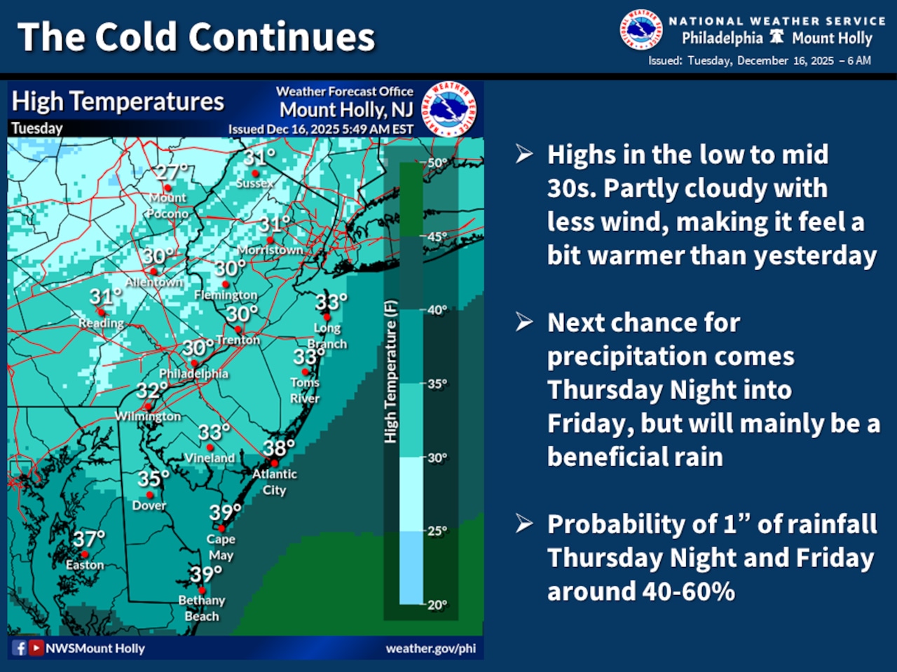
More frigid cold is forecast Tuesday and overnight into Wednesday in the Lehigh Valley ahead of a warming trend with significant rainfall.
High temperatures are forecast only around 30 degrees Tuesday, dipping to the upper teens early Wednesday morning ahead of daytime highs in the low 40s, according to the National Weather Service. Winds are forecast as calm to around 5 mph Tuesday and Tuesday night, shifting from the west to a more southerly flow. Gusts as high as 20 mph are forecast Wednesday as the weather pattern shifts.
A warm and wet weather system will bring temperatures into the 50s on Thursday, followed by a strong cold front that will dramatically drop temperatures and bring more gusty winds on Friday.
Residents should prepare for significant temperature swings and potential wind advisories.
The National Weather Service forecasts rain will develop Thursday night, with some precipitation potentially being heavy. Temperatures will climb into the 50s during the day, creating mild conditions ahead of the approaching weather system. At Lehigh Valley International Airport, the chance of rain is 100% Thursday night with half an inch to three-quarters of an inch possible.
A sharp cold front will move through early Friday, bringing wind gusts potentially reaching 30 to 40 mph. Temperatures will steadily decline throughout the day, with wind chills making it feel significantly colder.
The weekend outlook appears more stable, with high pressure returning and more seasonable temperatures. Saturday will be quiet, with temperatures returning to normal ranges. Winter arrives with the solstice at 10:03 a.m. EST Sunday, with slightly warmer conditions possible during the day before another weak cold front passes through Sunday night.
Long-term models suggest a return to near-normal temperatures to start next week, with minimal precipitation expected.
Current weather radar