
A warmup in the Lehigh Valley following a bitter cold spell won’t last long, but it won’t go out quietly.
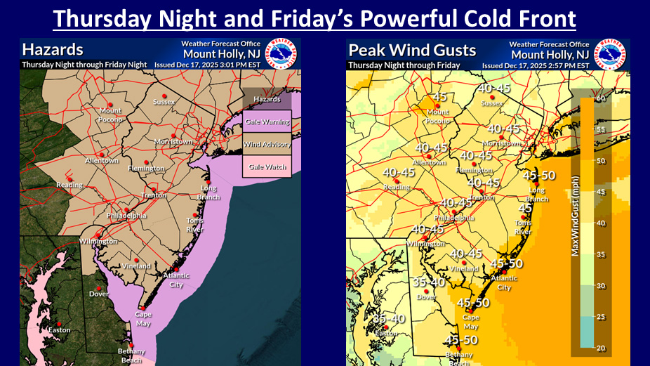
As a “powerful” cold front approaches the area Thursday into Friday, winds are set to gust, prompting the National Weather Service to issue a wind advisory for the region.
Powerful cold front Thursday night/Friday: Widespread rainfall & strong winds. Some downed trees and power outages possible. Warm air surges in Thursday night night/Friday AM, then temperatures tumble Friday PM. Some minor urban/roadway flooding possible. #njwx #pawx #mdwx #dewx pic.twitter.com/Xpb4XP2U7q
— NWS Mount Holly (@NWS_MountHolly) December 17, 2025
The wind advisory will be in effect from 1 a.m. Friday through 1 a.m. Saturday. Sustained winds will be 20 to 30 mph from the southwest, with gusts up to 45 mph Thursday night through Friday morning, the weather service warns.
Winds will turn to the northwest Friday afternoon as the cold front moves through. There could be a lull in the strongest gusts around midday Friday, according to the weather service.
High winds could blow around any unsecured objects, so make sure you have your holiday decorations locked down. Downed tree limbs and wires are possible, which could result in “a few power outages,” the weather service warned.
Motorists should also use caution, especially those driving high-profile vehicles, which can be difficult to drive in high winds.
The cold front will also bring much-needed rain, along with a chance of a thunderstorm Friday morning. After the front moves through Friday afternoon, temperatures will plummet to the 20s by late Friday night.
In the meantime, enjoy the warmer weather while it lasts. The high temperature Thursday will again be in the 40s, and on Friday it could reach the 50s.
How much rain will Lehigh Valley get? What to expect ahead of warmup