A powerful cold front is sweeping through the Lehigh Valley, bringing intense winds of up to 50 mph and rapidly dropping temperatures that could create dangerous conditions Friday evening.
The National Weather Service has issued a Wind Advisory for the entire region until 1 a.m. Saturday.
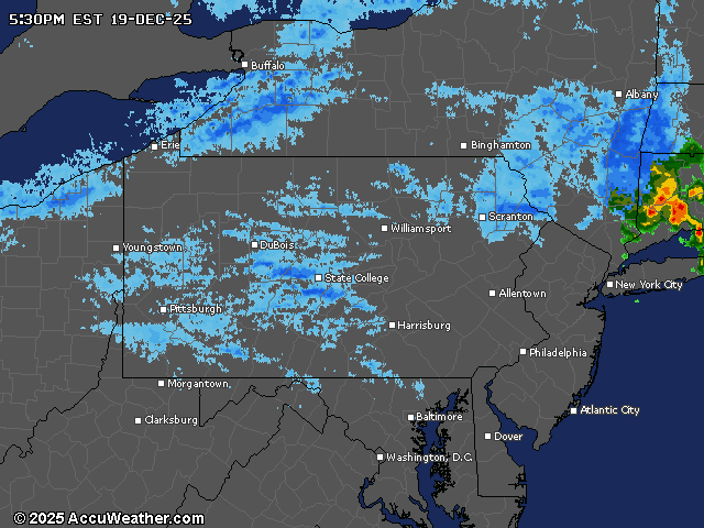
The wind event is expected to be most severe between 2 and 4 p.m. Friday, with gusts potentially reaching 55 to 60 mph across eastern Pennsylvania. These strong winds could cause tree damage, and local power companies were reporting tens of thousands of outages Friday afternoon.
Around 3 p.m. the nonprofit ArtsQuest announced the temporary closure of its holiday shopping village, Christkindlmarkt, on Southside Bethlehem.
“Due to the on-going weather-related power outage on the SouthSide of Bethlehem, Christkindlmarkt, the ArtsQuest Center and Bethlehem Visitors Center are closed for the evening,” ArtsQuest posted to Facebook.
PPL Electric Utilities around 3:20 p.m. reported 17,650 outages spread across Bucks, Carbon, Lehigh, Monroe and Northampton counties. FirstEnergy Corp.’s Met-Ed reported as many as 1,775 customers out in Northampton County, while its sister company JCP&L reported 3,308 outages in Warren County.
Weather service forecasters advised residents to secure loose outdoor items and be prepared for potential electrical interruptions.
There was even a thunderstorm rumbling through about 2:50 p.m., according to weather service observations at Lehigh Valley International Airport.
Temperatures were quickly falling Friday from a high of 59 around 5:50 a.m., dropping to the 40s in the afternoon and into the 20s and low 30s overnight.
Saturday will bring slightly calmer conditions, with highs ranging from the low 30s in northern areas to low 40s in southern regions. Winds will diminish to 5 to 10 mph, shifting from west to southwest during the day. Skies will feature a mix of sun and clouds, providing some relief after Friday’s turbulent weather.
The extended forecast indicates a series of cold fronts will move through the region Sunday and early Monday, maintaining cooler temperatures. By Tuesday, another weather system could bring potential precipitation, with temperatures potentially warming into the low 40s.
Looking ahead to Christmas Eve and Christmas Day, temperatures are expected to moderate to near 50 degrees, with a slight chance of light precipitation on Christmas Day.
Current weather radar