
Snow showers end this evening after sunset, and the wind will die down as well. We will be dry this weekend with temperatures dropping from Saturday to Sunday. A warm and wet Christmas week ahead.Quiet this weekend Temperatures will start off chilly on Saturday morning, but trend more seasonal in the afternoon with highs in the 40s.Plenty of sunshine on Sunday behind a weak cold front that brings back cold air to Western PA. While we will start warmer than Saturday morning, temperatures won’t go anywhere as colder air filters into the region. We will struggle to break freezing. Sunday is also the winter solstice; winter officially begins at 10:03 a.m.Rain Tuesday and again Christmas Eve nightAfter a chilly Monday, highs return to the 40s on Tuesday. Rain showers will overspread the area early Tuesday morning, perhaps even starting as flurries near midnight. Rain showers will be around at least through the morning. We will monitor the timing of this system, and if it holds, likely hoist an Impact Day for Tuesday.As you make your last-minute preps for Santa, it is going to get warmer as highs stay in the 4os through the week. Christmas morning will likely start above freezing with highs on Christmas Day well into the 50s. No white Christmas for us this year.The warmer air will last into the final weekend of 2025 as well. Clouds will linger behind the possible showers on Christmas Day into the weekend.TONIGHT: Turning Partly cloudy. low: 20°.SATURDAY: Mostly cloudy and warmer. High: 45°, low: 29°.SUNDAY: Partly sunny. High: 33°, low: 20°.MONDAY: Mostly sunny. High: 36°, low: 32°.
PITTSBURGH —
Snow showers end this evening after sunset, and the wind will die down as well. We will be dry this weekend with temperatures dropping from Saturday to Sunday. A warm and wet Christmas week ahead.
Quiet this weekend
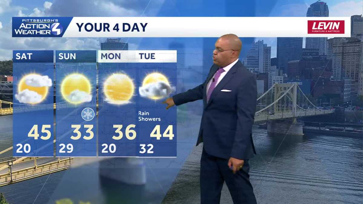
Temperatures will start off chilly on Saturday morning, but trend more seasonal in the afternoon with highs in the 40s.
Plenty of sunshine on Sunday behind a weak cold front that brings back cold air to Western PA. While we will start warmer than Saturday morning, temperatures won’t go anywhere as colder air filters into the region. We will struggle to break freezing. Sunday is also the winter solstice; winter officially begins at 10:03 a.m.
Rain Tuesday and again Christmas Eve night
After a chilly Monday, highs return to the 40s on Tuesday. Rain showers will overspread the area early Tuesday morning, perhaps even starting as flurries near midnight. Rain showers will be around at least through the morning. We will monitor the timing of this system, and if it holds, likely hoist an Impact Day for Tuesday.

Hearst Owned
Rain showers return Tuesday morning.
As you make your last-minute preps for Santa, it is going to get warmer as highs stay in the 4os through the week. Christmas morning will likely start above freezing with highs on Christmas Day well into the 50s. No white Christmas for us this year.

Hearst Owned
A warm Christmas Day this year.
The warmer air will last into the final weekend of 2025 as well. Clouds will linger behind the possible showers on Christmas Day into the weekend.

Hearst Owned
A much more seasonal week with the warmest air in time for Christmas.
TONIGHT: Turning Partly cloudy. low: 20°.
SATURDAY: Mostly cloudy and warmer. High: 45°, low: 29°.
SUNDAY: Partly sunny. High: 33°, low: 20°.
MONDAY: Mostly sunny. High: 36°, low: 32°.