
The weekend will be warming up as our NEXT Weather maker approaches, set to arrive and have some impacts late Sunday night into early Monday morning.

CBS News Philadelphia.
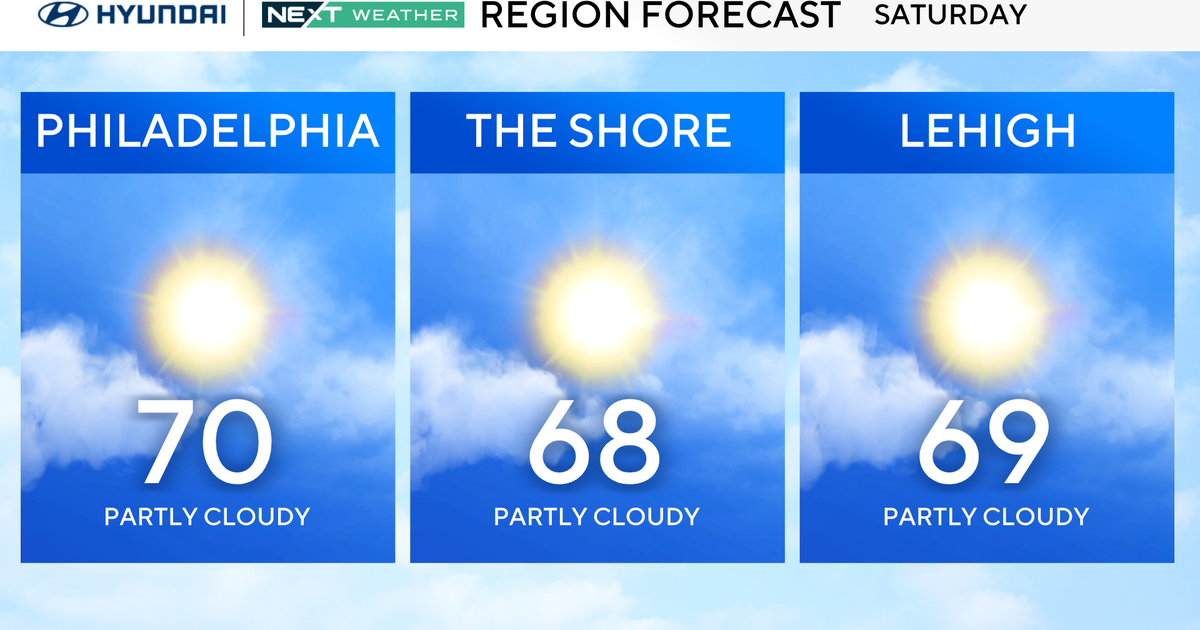
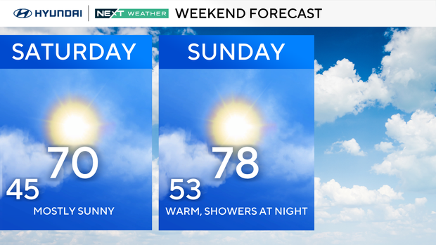
Saturday will be near 70, while Sunday will feature increasing clouds, southerly winds and temps in the mid-upper 70s.
CBS News Philadelphia.
Sunday night into early Monday morning will bring our next round of showers and possibly a thunderstorm or two.
Most should be during the overnight hours, but we will update you as the system moves closer.
The most impactful will likely occur between 11 p.m. – 3 a.m., so be aware that thunder could wake you from your sleep, meaning you may be a bit tired come Monday morning. It’s possible that we could have some Monday commute impacts, but most of the energy should pass by then with lingering showers.

CBS News Philadelphia.
Monday will be about 15° cooler than Sunday with the passing of that front, but still shaping up to be a moderately nice fall day, followed by another string of dry days next week.
We really do need the rain, though, as of Friday, we have a deficit of nearly 1.5″, with much of the area in the “abnormally dry” area of the drought monitor released this past Thursday.
Here’s your 7-day forecast:

CBS News Philadelphia.
Saturday: Beautiful. High 70, Low 45.
Sunday: Sun, rain at night. High 78, Low 53.
Monday: Showers to sun. High 65, Low 56.
Tuesday: Mostly sunny. High 71, Low 48.
Wednesday: Sunny. High 64, Low of 51.
Thursday: sunny. High 64, Low 47.
Friday: Mostly sunny. High 63, Low 47.