

If it feels like Erie’s Christmas weather has become harder to predict, the numbers back that up. Using local data from two 10-year windows—2000–2009 and 2015–2024—a clear pattern emerges: temperatures are warmer overall, and Christmas Day snow is less frequent, but the years that do produce snow can deliver much bigger totals.
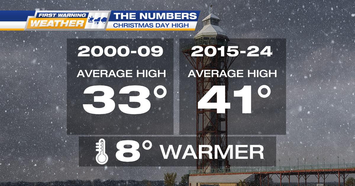
Temperatures: A Noticeable Jump
Across the 10 years in each period, the average temperature in the more recent window (2015–2024) came in at 41.1°F, compared to 33.4°F from 2000–2009—a rise of roughly 7–8 degrees.
That matters for Christmas because small temperature shifts near freezing can flip precipitation between snow, mix, and rain.
Christmas Day Snow: Less Common, More Extreme
For new snowfall on December 25th, the early 2000s had more “small snow” years, while the more recent decade featured more zero-snow Christmases—but also much larger spikes.
That higher recent average is driven by a couple of standout years—most notably 20.9″ and 12.5″—rather than steady, consistent snowfall every Christmas.
What This Can Mean (and How Climate Fits In)
This pattern is consistent with what meteorologists often describe in a warming climate around the Great Lakes: warmer average conditions reduce the number of cold-enough snow days, but open water can supply extra moisture when cold air does arrive—setting the stage for occasional high-impact lake-effect events.
Bottom Line
Erie’s Christmas weather story isn’t simply “less snow.” It’s closer to this: warmer overall, fewer snowy Christmases, but a higher ceiling for big snow when conditions line up.