
(WBRE/WYOU) — Several counties in the area can expect winter weather, including snow and wintery mix, Friday into Saturday.
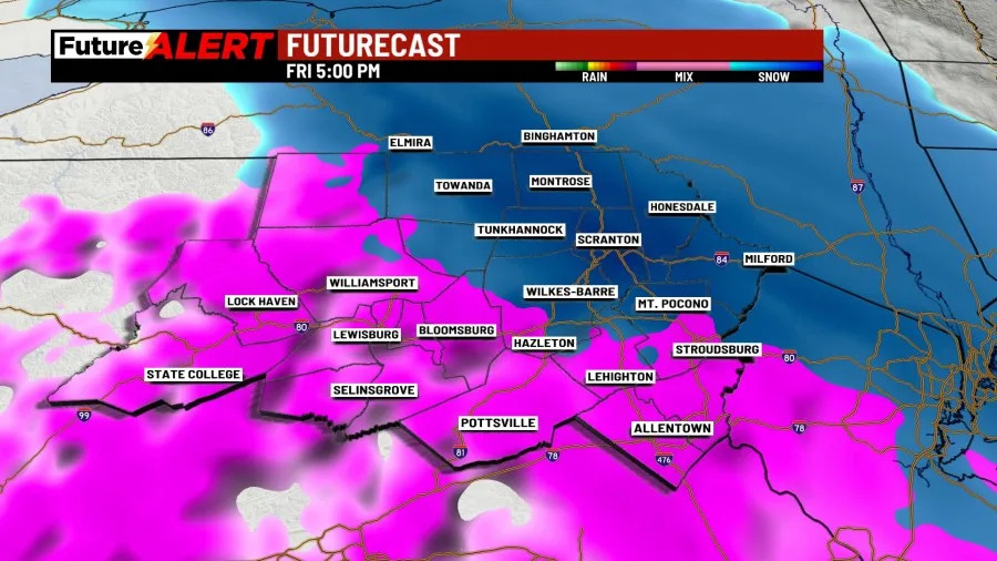
Friday’s high is in the 20s with snow expected to start around 12:00 p.m. and wintery mix starting around 8:00 p.m.
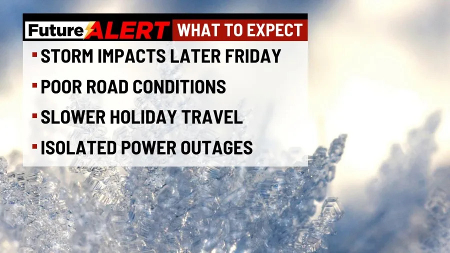
The storm is expected to cause poor road conditions, slower holiday travel, and isolated power outages.
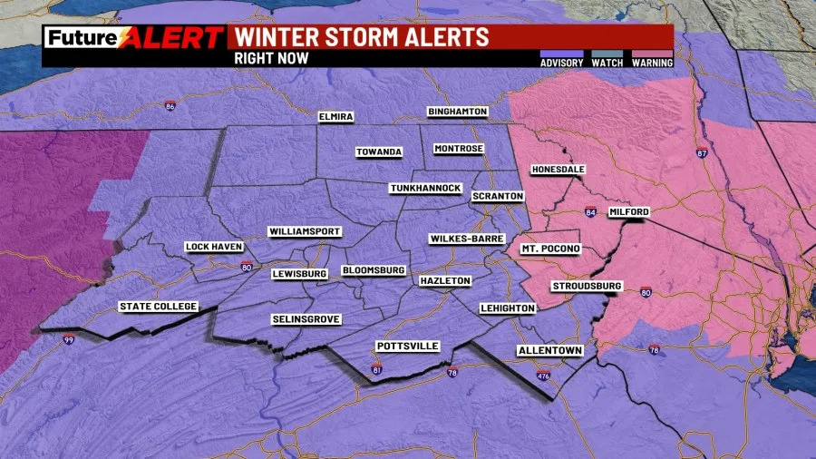
Currently, the following counties are under a severe winter weather warning:
The following counties are under a moderate winter weather advisory:
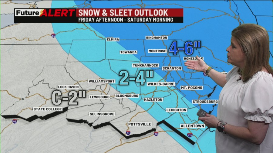
By Friday afternoon, northeast counties will experience snow, and more southern counties will experience sleet and freezing rain, but the wintery mix will disappear around the end of the night.
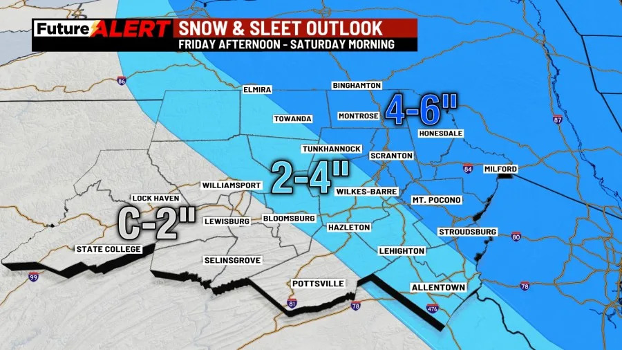
In those northern counties, people can expect up to 6 inches of snow, with that number decreasing further south.
After Saturday morning, conditions should ease, although they won’t begin to warm up quite yet.
Saturday’s high will only be 32 degrees, but it will warm up to 38 degrees on Sunday and 42 degrees on Monday. While warmer, both those days could experience some rain.
Temperatures will then cool to below freezing Tuesday through Thursday, with highs all being below freezing and cloudy.
You can stay current on all the latest weather alerts and track the storm using the Future Alert Interactive Radar.
Copyright 2025 Nexstar Media, Inc. All rights reserved. This material may not be published, broadcast, rewritten, or redistributed.
For the latest news, weather, sports, and streaming video, head to 28/22 News.