
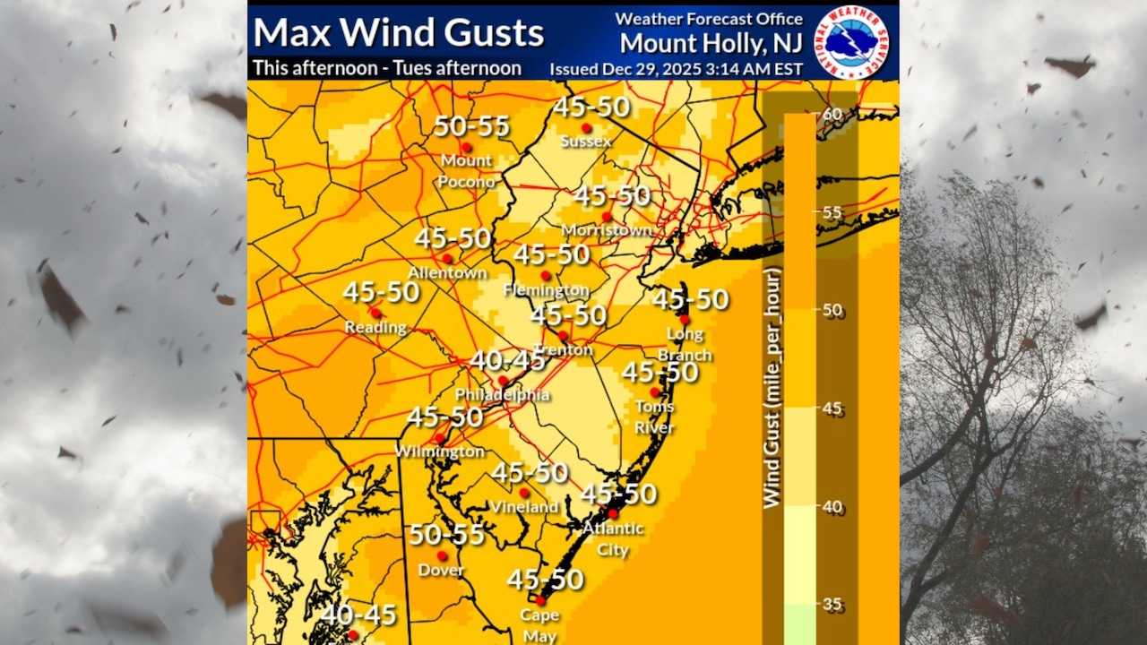
A powerful cold front is sweeping through the Lehigh Valley, bringing dangerous wind gusts up to 50 mph and rapidly dropping temperatures into the 20s and teens into Monday night.
The National Weather Service has issued a Wind Advisory for the entire region until 1 p.m. Tuesday.
The cold front will clear the coastal areas by early evening, with west winds developing strong gusts between 40-50 mph across the Lehigh Valley and Poconos.
Wind chill values will drop dramatically, with morning temperatures expected to feel like single digits in the southern Poconos and teens elsewhere.
Residents should secure loose outdoor items and dress in multiple layers when venturing outside.
Temperatures will struggle to reach the mid-30s on Tuesday, with overnight lows plunging into the low 20s and upper teens. The southern Poconos may see even colder temperatures in the teens.
A series of weak upper-level disturbances could bring light snow to the region on Wednesday, particularly in the Lehigh Valley and southern Poconos, with minimal accumulation of around one inch expected.
The cold pattern will persist through the end of the week, with temperatures remaining well below normal. Highs will mostly stay in the 30s, and overnight lows will consistently range from the teens to low 20s. No significant precipitation is anticipated, though a slight chance of snow remains possible on Thursday.
Looking ahead to the weekend, low pressure may approach the Mid-Atlantic region, but current forecasts suggest minimal chances of significant precipitation.
Residents should continue to prepare for cold conditions and potentially gusty winds through the upcoming weekend.