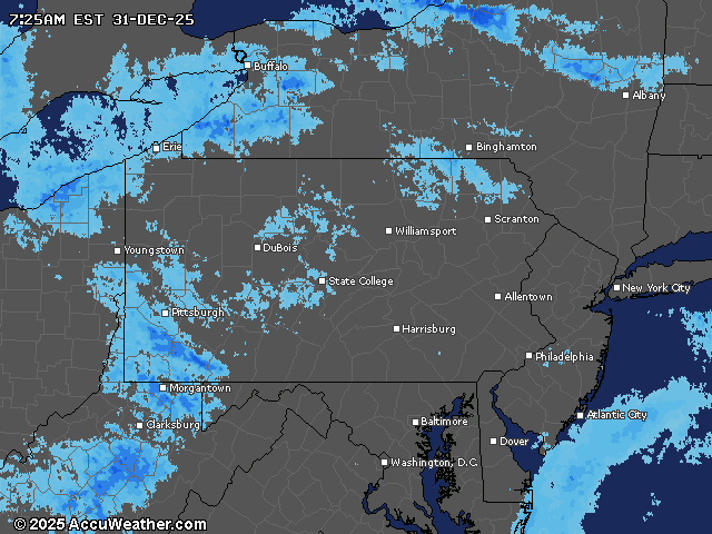
A powerful arctic front will sweep through parts of Pennsylvania this evening, bringing dangerous snow squalls and significant snowfall to the western side of the state.
Travelers should be prepared for rapidly changing conditions and potential whiteout conditions on New Year’s Eve.
The National Weather Service has issued a winter storm warning for Somerset County from 4 p.m. Wednesday through 10 a.m. Thursday, with more than 6 inches of snow possible in higher elevations. Similiar advisories are in effect for other western counties, where 3 to 5 inches of snow are likely, especially west of US-219.
In central Pennsylvania, today will be mostly cloudy and windy, with a high near 34. The new year will arrive with a chance of scattered snow showers, mainly before 1 a.m., and temperatures in the 20s.
Snow squalls pose the most significant hazard Wednesday evening; they’re expected to move into northwest Pennsylvania between 6-8 p.m., cross the I-99 corridor between 10 p.m. and midnight, and reach the Lower Susquehanna Valley between midnight and 2 a.m.
The squalls have prompted a hazardous weather note for the Harrisburg area.
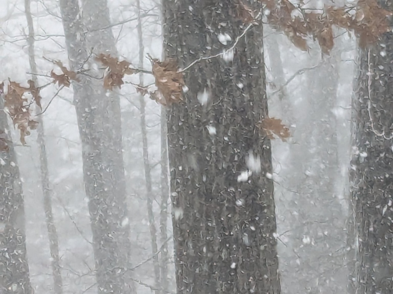
Squalls can produce blizzard-like conditions with gusty winds, heavy snow and significantly reduced visibility.
Behind the cold front, temperatures will plummet into the single digits across northern areas early Thursday, with wind chills dropping below zero.
Thursday will be the coldest day of the week, with a high in the Harrisburg area of 28 and a low around 20. The high temps the rest of the week and into the weekend will be in the 30s.
Current weather radar