
Chilly & Brisk Weekend; Warming Trend Next Week In South Central Pennsylvania
It’s crisp and chilly for the first weekend of 2026 with highs in the 30s. Winds are much calmer by Saturday. Temperatures finally warm up next week.
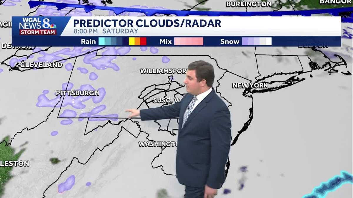
IT’S GOING TO BE IN THE 50S BECAUSE IT’S BEEN SO COLD. YES. IT’S BEEN SO COLD. YEAH. GUYS, I KNOW A LOT OF FOLKS ARE HAPPY ABOUT THE WARMER WEATHER THAT WE CAN EXPECT NEXT WEEK HERE, BUT BEFORE THAT HAPPENS, WE DO HAVE A CHILLY WEEKEND WITH TEMPERATURES GOING TO BE AROUND FREEZING REALLY ALL WEEKEND HERE, BUT THAT MILDER TREND OF TEMPERATURES BEGINS NEXT WEEK, ESPECIALLY ON WEDNESDAY AND HEADING INTO THE FOLLOWING WEEKEND. BUT IT ALSO REINTRODUCES RAIN CHANCES LATER IN THE WEEK. HERE WE ACTUALLY DO NEED THE RAIN. WE DID FINISH THE MONTH OF DECEMBER WELL BELOW AVERAGE, SO WE ARE KIND OF IN A DEFICIT, SO WE DO NEED IT AND WE’LL TAKE IT. LANCASTER RIGHT NOW THOUGH, WE’VE GOT MAINLY CLEAR SKY AND GOOD VIEWING CONDITIONS RIGHT NOW FOR THE NEARLY FULL MOON, 22 DEGREES RIGHT NOW IN LANCASTER. FEELS LIKE 13 THOUGH, BECAUSE WE STILL HAVE A LITTLE BIT OF A WIND. AND THAT’S THE SAME THING ACROSS THE SUSQUEHANNA VALLEY. WHILE THE AIR TEMPERATURE ITSELF RIGHT NOW IS IN THE LOW TO MID 20S, WE DO HAVE A LITTLE BIT OF A WIND, AND THAT IS GOING TO MAKE IT FEEL OBVIOUSLY A LITTLE BIT COLDER OUT THERE. SO YOU’RE GOING TO FEEL LIKE YOU’RE IN THE TEENS AT THE MOMENT. STORM TEAM LIVE RADAR NETWORK, THOUGH, IS FAIRLY QUIET. WE DO HAVE A FEW FLURRIES UP BY LEWISTOWN THERE IN PARTS OF MIFFLIN COUNTY AND NEAR STATE COLLEGE IN CENTER COUNTY, BUT OTHERWISE IT IS GOING TO BE QUIET NOT ONLY IN THE SUSQUEHANNA VALLEY, BUT ACROSS PENNSYLVANIA OVERNIGHT. TONIGHT, PARTLY CLOUDY WITH THOSE CLOUDS REALLY STARTING TO BUILD IN LATE HERE AS WE HEAD TOWARDS SUNRISE TOMORROW. 20 THE OVERNIGHT LOW WILL DROP OR INCREASE TO 26 BY TOMORROW MORNING, BUT IT’S GOING TO FEEL LIKE THE TEENS ARE STILL A LITTLE BIT OF A BREEZE, AND THAT’S GOING TO MAKE IT FEEL A LITTLE BIT COLDER NOW. TOMORROW IT’S THE AFTERNOON THE WINDS DIE DOWN AND THAT WILL MAKE IT FEEL A LITTLE BIT BETTER. 32 DEGREES FOR THE HIGH UNDER A MOSTLY CLOUDY SKIES FOR TOMORROW. SO LET’S TIME THIS OUT FOR YOU HERE AS WE GO THROUGH THE NIGHT, HIGH PRESSURE BUILDS IN THAT IS GOING TO HELP CALM THE WINDS DOWN AS WE GO INTO TOMORROW AFTERNOON. BUT IT DOES BRING IN THE CLOUD COVER AS WE HEAD TOWARDS SATURDAY EVENING. TOMORROW NIGHT WE COULD SEE A FEW FLURRIES THERE BY PITTSBURGH THAT WILL BE MOVING THEIR WAY INTO THE SUSQUEHANNA VALLEY. DOESN’T LOOK LIKE IT’S GOING TO ACCUMULATE TO ANYTHING HERE, BUT DON’T BE SURPRISED TOMORROW NIGHT IF YOU’RE OUT, YOU MAY SEE A FEW FLURRIES ACROSS PARTS OF THE AREA HERE AS WE GO INTO SUNDAY MORNING. SUNDAY STARTING OFF WITH A LITTLE BIT OF SUNSHINE HERE. THEN THE CLOUDS BEGIN TO TRY TO BUILD BACK IN AS WE HEAD TOWARDS THE AFTERNOON. IT’S GOING TO BE KIND OF ON AND OFF WITH THE CLOUD COVER AS WE GO THROUGH THE DAY. ON SUNDAY. JANUARY IS FULL. MOON WILL BE OVERNIGHT TONIGHT INTO TOMORROW MORNING AT 503 ON SATURDAY. VIEWING CONDITIONS ARE FAIR AGAIN BECAUSE THOSE CLOUDS INCREASE OVERNIGHT TONIGHT. WE ALSO HAVE THE QUADRANTID METEOR SHOWER HERE THAT WILL BE PEAKING ON THE FOURTH, SO THAT WILL BE TOMORROW NIGHT INTO THE FOURTH HERE. UP TO 100 METEORS PER HOUR ACTUALLY, THAT YOU MIGHT BE ABLE TO SEE EVEN TONIGHT. YOU COULD GO OUTSIDE AND YOU MAY SEE A FEW OF THOSE. SO YOU MAY SEE SOME SHOOTING STARS ACROSS THE AREA TONIGHT. FAIR CONDITIONS. BECAUSE AGAIN, THOSE CLOUDS INCREASING ACROSS THE AREA, CLOUDS EARLY TOMORROW NIGHT. BUT THEN CLEAR OUT LATE TOMORROW. IT’S ACTUALLY A GOOD NIGHT TO SEE, ESPECIALLY BECAUSE YOU’LL HAVE THE PEAK HAPPENING AS WELL AS YOU GO INTO SUNDAY MORNING. SUNDAY ITSELF PARTLY SUNNY, CHILLY WITH A LIGHT BREEZE. IT WILL FEEL LIKE THE LOW 20 OR FEEL LIKE YOU’RE IN THE 20S WITH TEMPERATURES IN THE LOW TO MID 30S THROUGHOUT THE DAY, AND HIGHS WILL BE AROUND 34 ON MONDAY AS WELL. BUT THEN WE GET INTO THE 40S AS WE GO TO TUESDAY, WEDNESDAY AND THURSDAY. CHECK OUT THAT 50 THOUGH BY THE TIME WE GET TO NEXT FRIDAY, MORE THAN TEN DEGREES ABOVE WHERE WE SHOULD BE FOR THIS TIME OF YEAR. SO IT IS GOING TO BE VERY WARM. LAST TIME WE HIT 50 DEGREES WAS BACK ON CHRISTMAS DAY. HERE WE HAD A HIGH OF 54 AND WE’RE GOING TO BE ABLE TO HIT THAT NEXT WEEK. YOUR TEN DAY FORECAST AFTER A CHILLY WEEKEND IN MONDAY. AGAIN, THOSE TEMPERATURES INCREASE IN THE 44 BY TUESDAY. A FEW MORNING SHOWERS WEDNESDAY GUYS. BEFORE THA
Chilly & Brisk Weekend; Warming Trend Next Week In South Central Pennsylvania
It’s crisp and chilly for the first weekend of 2026 with highs in the 30s. Winds are much calmer by Saturday. Temperatures finally warm up next week.

Updated: 11:23 PM EST Jan 2, 2026
Good evening A system passing by to our south will increase the cloud cover overnight into Saturday. Temperatures continue below average in the low 30s. There will also be an upper-level disturbance crossing the area from the northwest during the late evening. It may trigger a few light snow showers or snow flurries.Sunshine increases on Sunday, as high pressure builds in from the west. Winds pick up a little, about 10 to 15 mph. Highs are still running below the average of 40 degrees in the low to mid 30s.There are plenty of clouds for the first couple of days of the new week; however, temperatures turn around, going from the 30s on Monday to the 40s on Tuesday.It becomes unsettled towards the end of the week. A few showers are possible on Wednesday with temperatures staying in the 40s. There will be a series of fronts that bring showers late Thursday into Friday and again Saturday. Unfortunately for snow lovers, it will be wet, not white. High temperatures will hover in the mid to upper 40s, maybe even a few 50s.Have a good night!
Good evening
A system passing by to our south will increase the cloud cover overnight into Saturday. Temperatures continue below average in the low 30s. There will also be an upper-level disturbance crossing the area from the northwest during the late evening. It may trigger a few light snow showers or snow flurries.
Sunshine increases on Sunday, as high pressure builds in from the west. Winds pick up a little, about 10 to 15 mph. Highs are still running below the average of 40 degrees in the low to mid 30s.
There are plenty of clouds for the first couple of days of the new week; however, temperatures turn around, going from the 30s on Monday to the 40s on Tuesday.
It becomes unsettled towards the end of the week. A few showers are possible on Wednesday with temperatures staying in the 40s. There will be a series of fronts that bring showers late Thursday into Friday and again Saturday. Unfortunately for snow lovers, it will be wet, not white. High temperatures will hover in the mid to upper 40s, maybe even a few 50s.
Have a good night!