
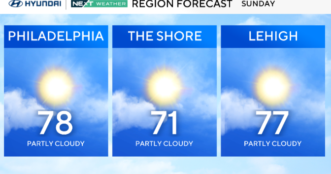
High pressure moves offshore on Sunday, allowing a strong cold front to approach from the west. The day will start dry and mild under increasing clouds, with highs reaching the 70s and dew points climbing into the 60s.

CBS News Philadelphia
It will feel noticeably more humid and breezy by afternoon, with gusts near 30 mph possible. Showers are expected to hold off until late Sunday night as the front moves closer.
Bottom line: rain is likely to move in by bedtime and move out by the early commute on Monday.

CBS News Philadelphia
The front sweeps through overnight into Monday morning, bringing a period of rain and a few gusty showers or isolated storms. Instability looks limited, but a few stronger wind gusts could mix down with heavier showers.
Rainfall totals between a quarter inch and just over an inch are possible, but flooding is not expected. Behind the front, temperatures drop sharply with highs Monday in the mid-50s to mid-60s and lingering clouds and light showers through the day.

CBS News Philadelphia
A second, weaker cold front arrives Tuesday night into Wednesday with only scattered showers. Behind it, colder and drier air settles in, setting up potential frost or freeze conditions in some inland areas by Thursday night. High pressure returns by late week, bringing calmer weather and a gradual warming trend into Friday.
Here’s your 7-day forecast:

CBS News Philadelphia
Sunday: Warm, rain at night. High 78, Low 52.
Monday: Rain exits. High 64, Low 57.
Tuesday: Sunny and breezy. High 72, Low 46.
Wednesday: Partly cloudy. High 66, Low of 53.
Thursday: Partly cloudy. High 63, Low 47.
Friday: Sunny skies. High 63, Low 44.
Saturday: Partly cloudy. High 62, Low 44.