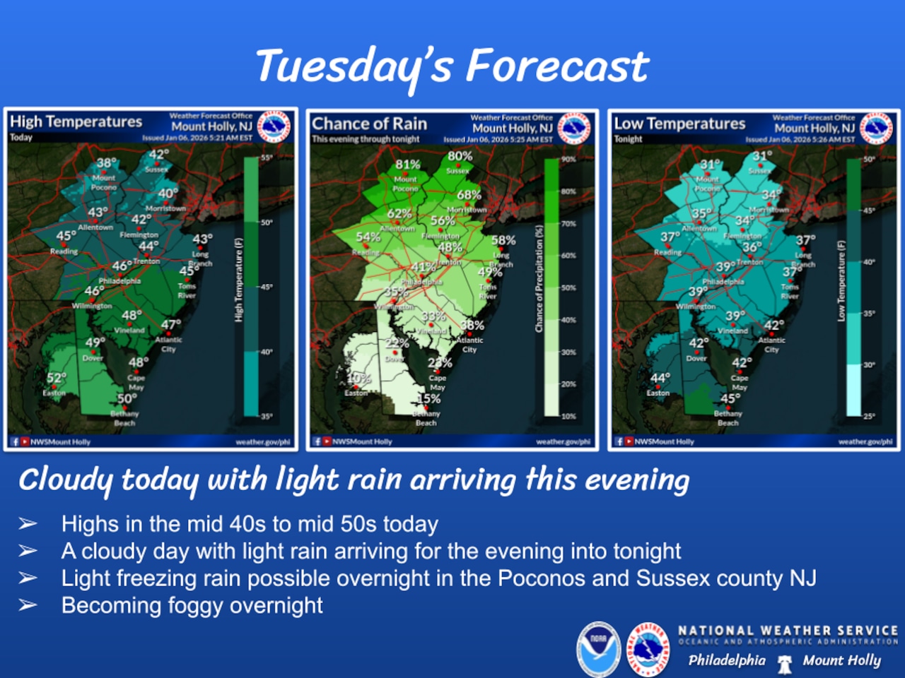
A warming trend will bring mild temperatures to the Lehigh Valley on Tuesday, with highs reaching the 40s and cloud cover preceding potential rainfall later in the week.
The National Weather Service forecast indicates temperatures will climb above freezing Tuesday, with areas near Interstate 78 likely reaching the low to mid-40s. A warm front approaching Tuesday evening could bring low clouds, fog and light drizzle, particularly impacting northern areas like the Poconos.
The chance for light rain arrives mainly after 5 p.m. Tuesday in the Lehigh Valley, with light rain likely from 8 p.m. to midnight.
Wednesday will see continued mild conditions with temperatures in the 40s and 50s, accompanied by gusty winds across the region — potentially reaching 35 mph in the Poconos. There is a slight chance for some additional light rain until about 10 a.m. Wednesday. Wind speeds will decrease by Wednesday evening as high pressure builds into the region.
Thursday is forecast as mostly sunny with highs in the upper 40s and winds calm to around 5 mph.
A more unsettled weather pattern is expected Friday and Saturday, with temperatures potentially reaching the mid-50s. Multiple rounds of rain and showers are likely, followed by a cold front that will bring blustery and colder conditions by Sunday. Temperatures are expected to return to more seasonable levels early next week.
Residents should be prepared for changing conditions, with potential for fog and drizzle Tuesday night and increasing chances of rain toward the weekend.
Current weather radar