
SCRANTON, Pa. — It is known as the North American Blizzard of 1996, a major nor’easter that formed on the morning of January sixth in the Gulf. Later that afternoon, it started snowing in the DC area, and by the next day, this is what the massive storm looked like on infrared satellite imagery.

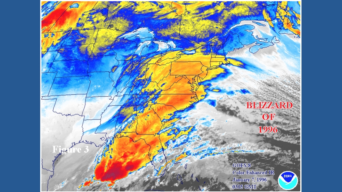
To this day, it is still one of the only snowstorms to be labeled ‘extreme’ on the Northeast Snowfall Impact Scale, along with the March Superstorm of ’93.
Here in Pennsylvania, it hadn’t started snowing yet on this day 30 years ago, but it was bitterly cold. The high that day was only 10 degrees, and morning lows were below 0.
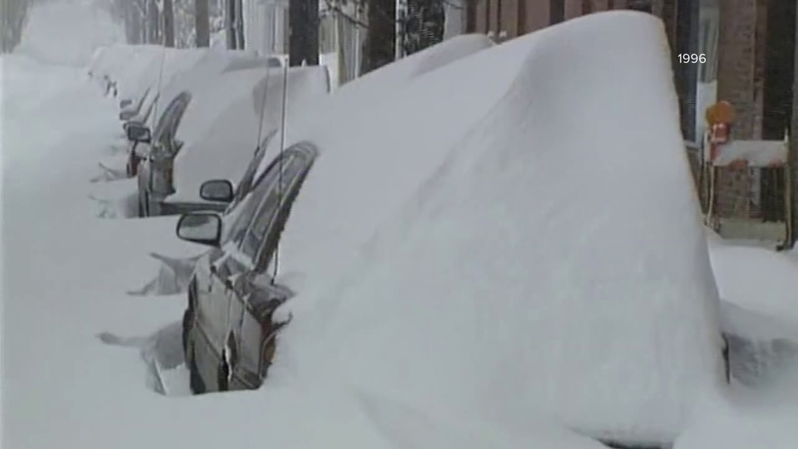
Within the next two days, the nor’easter moved north. The Wilkes-Barre/Scranton International Airport reported 5.5″ of snow fell on the 7th and then 15.5″ on the 8th, a two-day storm total of 21 inches here in the Scranton area.
In Philadelphia, the storm total was more than 30″ of snow. It is still the biggest snowstorm in the city’s history. Pennsylvania was under a state of emergency.
In the WNEP Archive, we found video of the National Guard out picking up essential employees like doctors and nurses to take them to work. It wasn’t just the amount of snow that fell that made the storm so historic, but the wind, too.
Four days later, on January 12, another storm dumped about 8″ of snow on the Scranton area. But 1996 is the 2nd snowiest January on record; 1994 takes the top spot.
Two weeks after the blizzard of ’96 came another disaster, when temperatures warmed into the 60s, several inches of rain fell, and all of that snow melted.