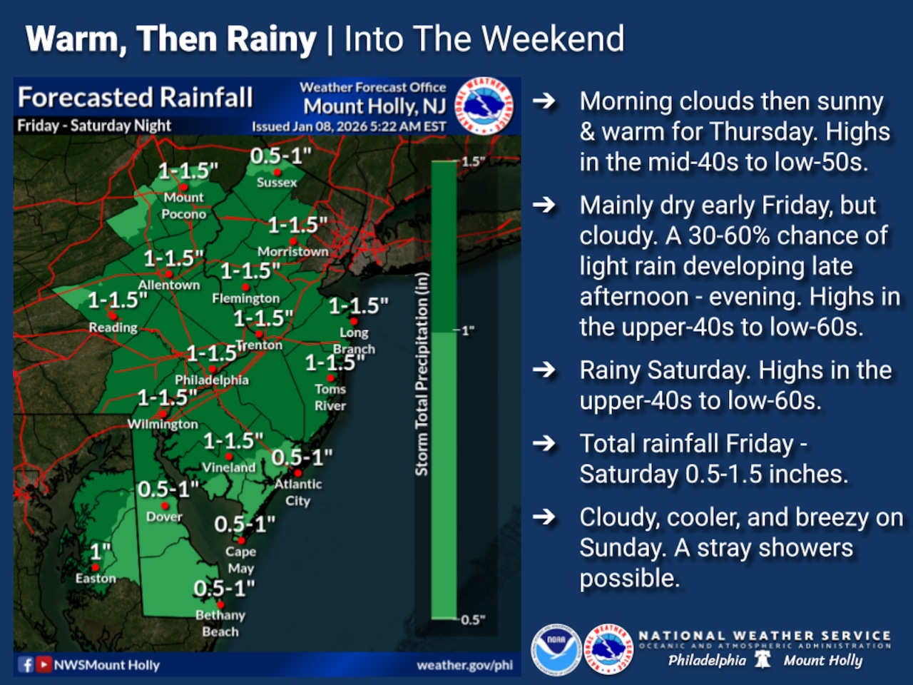
Lehigh Valley residents can expect a wet and unusually warm weekend with periods of rain from Friday afternoon through Sunday morning. Temperatures will rise well above normal into the low 50s.
Up first, Thursday is forecast as mostly sunny with unseasonably warm highs in the upper 40s and calm winds.
The National Weather Service forecast indicates clouds will increase overnight ahead of a series of weather systems moving through the region — bringing consistent rainfall.
The first system arrives late Friday, with precipitation continuing into Friday night. A warm front will slowly lift through the area on Saturday, creating conditions for steady rain and mild temperatures.
Rainfall amounts across the region are expected to range between half an inch and potentially two inches over the 36-to-48-hour period. While heavy rain is possible, flooding concerns are minimal due to breaks between precipitation rounds. Model predictions suggest a 40-to-60% probability of receiving at least one inch of rain, with a low chance of exceeding two inches.
Wind speeds will increase Sunday as skies clear, with potential gusts reaching 20-30 mph as a cold front passes through.
The extended forecast suggests a return to more typical winter conditions after the weekend, with no significant weather events anticipated in the following week. Residents should be prepared for intermittent rain and unusually warm temperatures through early Sunday.
Current weather radar