
A warm front will move toward the Susquehanna Valley today, leading to increasing clouds this morning, and scattered showers this afternoon. Showers will move out of southeastern counties early this evening. Our mild stretch continues for one more day, as highs reach 52 degrees. It will also be breezy, with southerly winds at 10-20 mph.Tonight, a cold front will drift south of the state line and linger over Maryland. Expect cloudy skies and temperatures in the upper 30s.If you need to get anything done outdoors, early Saturday morning is your best bet. Rain will return from south to north by lunchtime Saturday. A soaking rain is expected through the afternoon, wrapping up by evening. Two-day rain totals will range between 0.25″ to 0.75″ for most of the area. Higher totals near 1″ are possible southeast. Saturday’s highs will reach the low 40s, much cooler than the stretch of 50s we’ve seen over the past few days.Sunday will be the drier half of the weekend. Highs will reach the low 40s, but with a stiff 15-25 mph wind, it will feel like the 30s. Look for a mix of clouds and sunshine.More sunshine is in store Monday, as high pressure builds to our south. Temperatures will remain a few degrees above average, near 40. However, the wind will make it feel like the low 30s. Winds diminish Monday evening.After a dry and calmer Tuesday, a chance of rain showers returns Wednesday. A chance of rain/snow showers may linger into Thursday. Highs will fall to the mid-30s at the end of the week, more typical for mid-January.Looking into the upcoming holiday weekend, highs will stay in the 30s with a chance of snow showers Sunday.Have a great Friday!~ Ryan
A warm front will move toward the Susquehanna Valley today, leading to increasing clouds this morning, and scattered showers this afternoon. Showers will move out of southeastern counties early this evening. Our mild stretch continues for one more day, as highs reach 52 degrees. It will also be breezy, with southerly winds at 10-20 mph.
Tonight, a cold front will drift south of the state line and linger over Maryland. Expect cloudy skies and temperatures in the upper 30s.
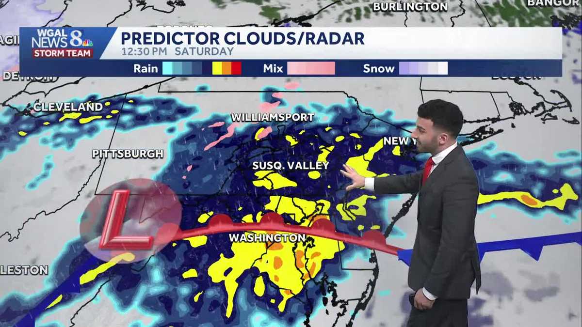
If you need to get anything done outdoors, early Saturday morning is your best bet. Rain will return from south to north by lunchtime Saturday. A soaking rain is expected through the afternoon, wrapping up by evening. Two-day rain totals will range between 0.25″ to 0.75″ for most of the area. Higher totals near 1″ are possible southeast. Saturday’s highs will reach the low 40s, much cooler than the stretch of 50s we’ve seen over the past few days.
Sunday will be the drier half of the weekend. Highs will reach the low 40s, but with a stiff 15-25 mph wind, it will feel like the 30s. Look for a mix of clouds and sunshine.
More sunshine is in store Monday, as high pressure builds to our south. Temperatures will remain a few degrees above average, near 40. However, the wind will make it feel like the low 30s. Winds diminish Monday evening.
After a dry and calmer Tuesday, a chance of rain showers returns Wednesday. A chance of rain/snow showers may linger into Thursday. Highs will fall to the mid-30s at the end of the week, more typical for mid-January.
Looking into the upcoming holiday weekend, highs will stay in the 30s with a chance of snow showers Sunday.
Have a great Friday!
~ Ryan