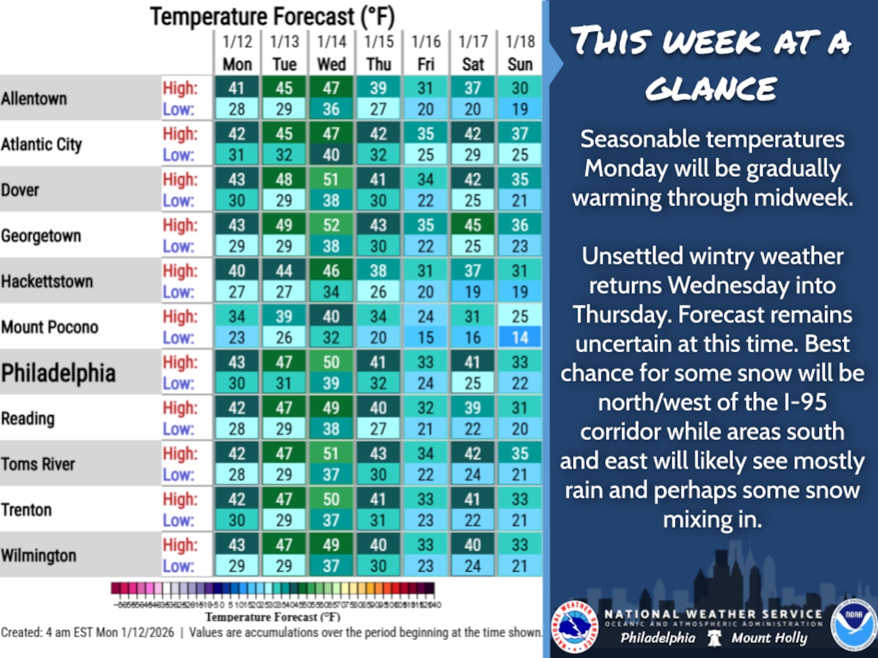
A brief period of seasonable and tranquil weather will prevail through Tuesday before an unsettled winter system approaches the Lehigh Valley region for Wednesday and Thursday, potentially bringing mixed precipitation and changing conditions.
The National Weather Service forecast indicates temperatures will remain near seasonal averages Monday, with highs in the low 40s and overnight lows in the 20s to around 30 degrees. Skies will be mainly clear with diminishing westerly winds throughout the day.
By Wednesday and Thursday, weather conditions are expected to become more uncertain, with increasing chances of precipitation. Northern and western portions of the Lehigh Valley region may see snow, while areas to the southeast are more likely to experience rain.
Temperatures during this period are forecast above normal, with highs in the upper 40s on Wednesday night before a cooldown begins Thursday. This change could support a mixed precipitation scenario, creating potential travel disruptions.
The extended outlook suggests continued unsettled weather through Thursday night, with temperatures potentially supporting different precipitation types across different parts of the region. Residents should monitor updated forecasts for specific details about timing and potential accumulations.
Temperatures are forecast to dip below seasonal averages Thursday night through the weekend.
Residents are advised to stay informed about changing weather conditions and be prepared for potential winter weather impacts mid to late week.
Current weather radar