
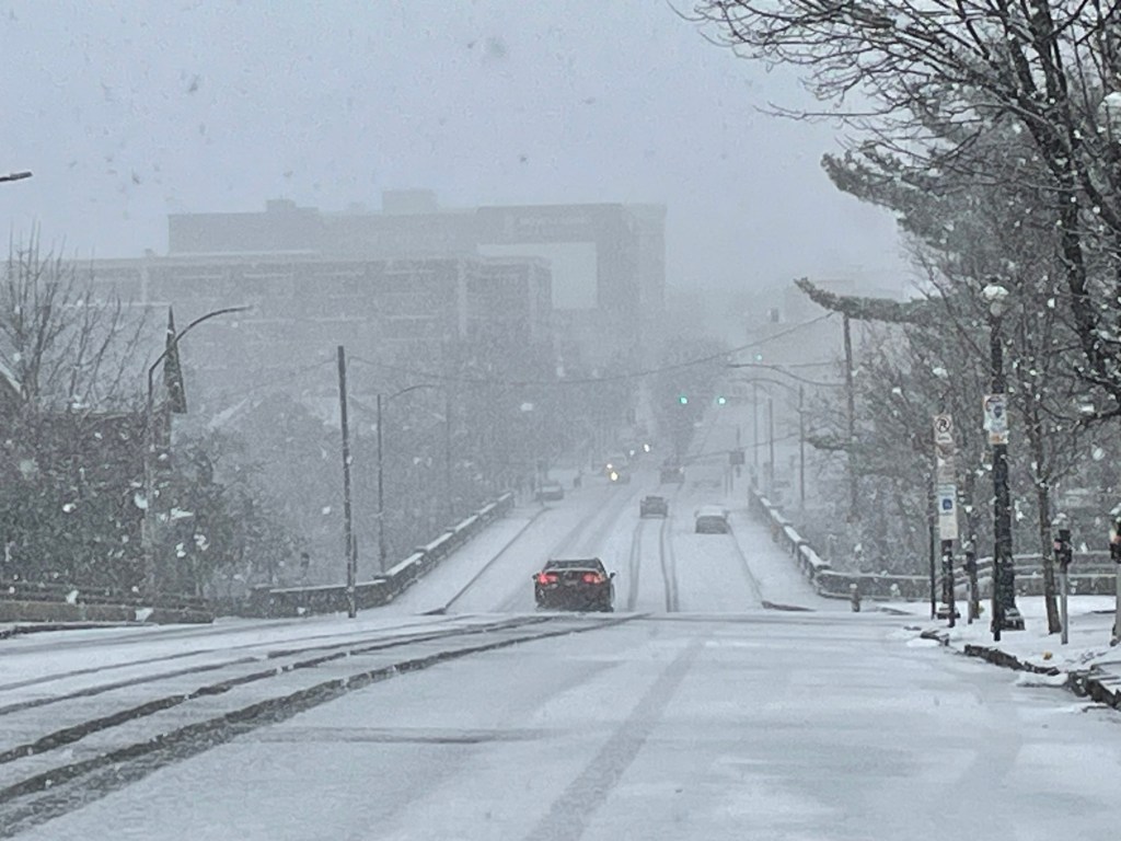
Snow is set to make a return to the Lehigh Valley to start off the weekend, and while it’s not expected to create major disruptions, it will be just enough to make a nuisance.
Light snow will begin to fall after midnight Friday as a system moves across the region and will continue through Saturday morning, according to the National Weather Service forecast.
❄️ We continue to monitor two systems expected to bring the potential for snow this weekend. While some snow accumulation is likely, significant snowfall is not currently expected. Head to https://t.co/5xLdUq2Muz for the latest snow forecast information. #PAwx #NJwx #DEwx #MDwx pic.twitter.com/dpczVgQOGn
— NWS Mount Holly (@NWS_MountHolly) January 16, 2026
“Confidence is increasing that there will be accumulating snow Saturday morning northwest of the I-95 corridor,” the weather service noted Friday morning in it’s forecast discussion.
While there will be little to no accumulation in areas to our south and east, the Lehigh Valley and areas to the north could get anywhere from a dusting to an inch of snow. North of the Lehigh Valley, snowfall between 1 and 2 inches are possible in the Poconos, and the highest elevations could see up to 3 inches, according to forecasters.
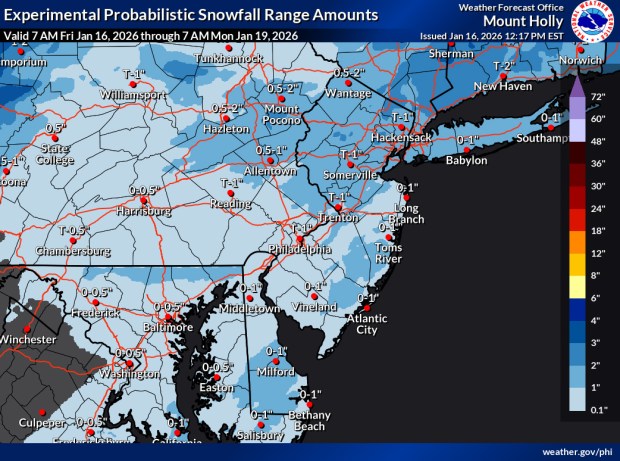 The latest snowfall projections from the National Weather Service’s forecast office in Mount Holly, New Jersey. (NWS)
The snow is expected to end around midday Saturday as temperatures warm, but the precipitation will continue as a mix of rain and snow, then all snow throughout the afternoon and early evening.
Forecasters had been watching a second, coastal storm on Saturday, but that system is no longer expected to bring any snow to the region outside of coastal areas, according to the forecast discussion.
As the precipitation from Saturday’s storm ends, temperatures will drop into the upper 20s overnight. Temperatures will remain below freezing until next Thursday, with some of the coldest weather of the season expected Monday night into Tuesday. Monday night’s low is expected to plunge to around 9 degrees, while Tuesday’s high will be around 19, according to the weather service forecast.
Here is the extended forecast from the National Weather Service:
Friday Night: A chance of snow after 1 a.m. Increasing clouds, with a low around 27. South wind around 5 mph. Chance of precipitation is 40%. New snow accumulation of less than a half inch possible.
Saturday: Snow likely before 1 p.m., then a chance of rain and snow between 1pm and 4pm, then a chance of rain after 4 p.m. Mostly cloudy, with a high near 39. South wind around 5 mph. Chance of precipitation is 70%. New snow accumulation of less than one inch possible.
Saturday Night: Mostly cloudy, with a low around 27. Southwest wind around 5 mph becoming calm.
Sunday: A slight chance of snow. Mostly cloudy, with a high near 33. West wind around 5 mph. Chance of precipitation is 20%.
Sunday Night: Partly cloudy, with a low around 18.
Monday: Mostly sunny, with a high near 32.
Monday Night: Mostly clear, with a low around 9.
Tuesday: Sunny, with a high near 19.
Tuesday Night: Mostly clear, with a low around 9.
Wednesday: Partly sunny, with a high near 28.
Wednesday Night: Mostly cloudy, with a low around 22.
Thursday: Partly sunny, with a high near 37.