
Snow showers return overnight into Saturday, prompting an Impact Day.Cold returns as we close out the weekend. Frigid air arrives next week.Watch the forecast by Pittsburgh’s Action Weather in the video aboveImpact Day Saturday Limited accumulation is expected. Can’t rule out an isolated snow squall setting up in the afternoon that could briefly drop visibility. If you end up underneath a snow squall, winds will turn gusty and a quick half inch of snow is possible.A winter weather advisory is in effect for Clarion and Forest counties, along with the Laurel Highlands for eastern Indiana, Westmoreland, Fayette, eastern Monongalia, Preston, and western Garrett counties through Saturday night.Two to four inches of snow is possible in areas under the advisory. Everyone else will see 1 to 2 inches. Locally higher amounts are possible everywhere if you see a snow squall.Arctic blast next week, Impact Day TuesdayThe coldest air so far this season will filter in after Saturday’s system.High temperatures on Sunday and Martin Luther King Jr. Day on Monday only reach the 20s. Wind chills will drop into the single digits on Monday.Tuesday is a Severe Weather Alert Day as wind chills will likely reach 10 below zero and stay subzero through the day.Temperatures will improve as we head through the end of next week. OVERNIGHT: Snow developing. Low: 30.SATURDAY: Impact Day. Cloudy with scattered light snow showers. High: 37.SUNDAY: Mostly cloudy and cold. High: 24, low: 16.MONDAY: Mostly cloudy and windy. High: 23, low: 4.
PITTSBURGH —
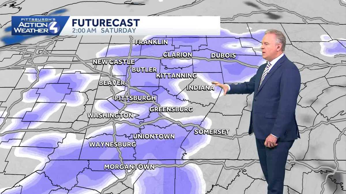
Snow showers return overnight into Saturday, prompting an Impact Day.
Cold returns as we close out the weekend. Frigid air arrives next week.
Watch the forecast by Pittsburgh’s Action Weather in the video above

Impact Day Saturday
Limited accumulation is expected. Can’t rule out an isolated snow squall setting up in the afternoon that could briefly drop visibility. If you end up underneath a snow squall, winds will turn gusty and a quick half inch of snow is possible.

A winter weather advisory is in effect for Clarion and Forest counties, along with the Laurel Highlands for eastern Indiana, Westmoreland, Fayette, eastern Monongalia, Preston, and western Garrett counties through Saturday night.
Two to four inches of snow is possible in areas under the advisory. Everyone else will see 1 to 2 inches. Locally higher amounts are possible everywhere if you see a snow squall.

Hearst Owned
Winter Weather Advisory for parts of Western PA Saturday.
Arctic blast next week, Impact Day Tuesday
The coldest air so far this season will filter in after Saturday’s system.
High temperatures on Sunday and Martin Luther King Jr. Day on Monday only reach the 20s. Wind chills will drop into the single digits on Monday.

Hearst Owned
Impact Day Tuesday for subzero wind chills that could last all day.
Tuesday is a Severe Weather Alert Day as wind chills will likely reach 10 below zero and stay subzero through the day.
Temperatures will improve as we head through the end of next week.

Hearst Owned
Seasonal weekend with some snow Saturday then bitterly cold to start next week.
OVERNIGHT: Snow developing. Low: 30.
SATURDAY: Impact Day. Cloudy with scattered light snow showers. High: 37.
SUNDAY: Mostly cloudy and cold. High: 24, low: 16.
MONDAY: Mostly cloudy and windy. High: 23, low: 4.