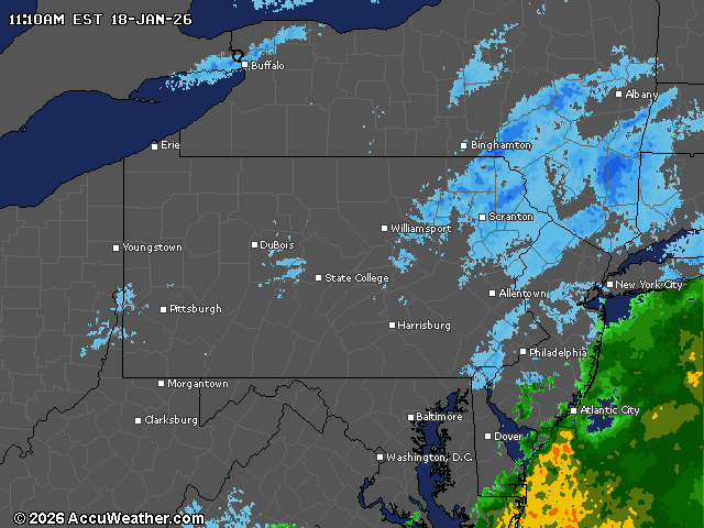
Light to moderate snow continues across eastern Pennsylvania this morning as an arctic cold front approaches, bringing dangerous sub-zero wind chills to the region by Monday night.
The National Weather Service (NWS) has expanded its winter weather advisory to include Lebanon County, along with previously included York and Lancaster counties.
The snow is expected to taper off by midday for most areas, possibly lingering slightly longer in eastern Lancaster County.
The best chance for accumulations of 2 inches or more will occur southeast of Interstate 81, where the winter weather advisory remains in effect until 3 p.m. today. A sharp gradient in snow accumulations will be visible across the Middle Susquehanna Valley and South Central Mountains.
Monday brings a significant arctic cold front that will sweep through central Pennsylvania with limited moisture but potentially some light snow.
Behind the front, winds will intensify considerably, with sustained speeds of 15 to 25 mph and gusts reaching 25 to 40 mph, with the highest gusts expected on ridgetops in the Laurel Mountains.
Wind chills Monday night into Tuesday morning will range from zero degrees in the Lower Susquehanna Valley to as low as minus 20 degrees over portions of the Alleghenies.
Tuesday’s high temperatures will range from single digits to around 20 degrees, running 15 to 25 degrees below historical averages.
Wind chills will likely remain below zero west of Interstate 99 and north of Interstate 80 through Wednesday morning. As low-level flow becomes more westerly by Wednesday, lake effect snow bands may return to northwestern Pennsylvania.
The longer-term outlook shows colder-than-normal temperatures continuing through the end of January, with storm chances occurring every few days. A persistent west coast ridge and east coast trough pattern will ensure below-normal temperatures persist, with periodic waves of low pressure bringing opportunities for precipitation throughout the remainder of the month.
Current weather radar