
There’s been a lot of talk and chatter on social media about the potential of a major winter storm this weekend for Western PA and most of the Mid-Atlantic. For snow lovers, it’s a dream come true. For snow haters, it’s a nightmare situation. However, what can we know for sure this far out?Forecasting snow: timeline of confidence Even though it is winter, that does not mean every system is the same. A lot of variable come into play, and if one of those variables is wrong, it can change our precipitation from snow to a wintry mix to even rain.7-10 Days Out – Pattern Recognition. This is where we see if winter weather is even possible.5-7 Days Out – Watching the Trends. This is where we see if models are leaning one way or the other in terms of winter weather.3-5 Days Out – Timing and Storm Type. This is where we see what type of precipitation will fall and general timing of the event.1-3 Days Out – Forecast Details. This is where we start to get specific on amounts, timing, and precipitation. At this point, we are in the 5-7 days out range, and we are closely monitoring the trends.Weekend forecast: current thoughtsWe are seeing two camps within our forecast models at this point. The first is where we see snow arrive potentially as early as late Saturday with snow through the day Sunday. Even within this camp, there are timing differences as some models keep snow from starting until late Sunday. This solution would produce the most amounts of snow across Western PA. Even here, the highest amounts would likely be about half a foot, not the foot of snow some social media posts are showing.The second camp is where the system stay off to our south and we see little if any snow across Western PA. This is due to an area of high pressure to our north producing a north wind and shunting the system south of us. This camp has more support in our ensemble models – multi-run models that change conditions to simulate different effects. Overall, it is still too early for sure to say we see snow, especially significant snow, in Western PA. Now is the time to simply monitor the forecast and stay with Pittsburgh’s Action Weather for the latest changes in the forecast.
PITTSBURGH —
There’s been a lot of talk and chatter on social media about the potential of a major winter storm this weekend for Western PA and most of the Mid-Atlantic.
For snow lovers, it’s a dream come true. For snow haters, it’s a nightmare situation. However, what can we know for sure this far out?
Forecasting snow: timeline of confidence
Even though it is winter, that does not mean every system is the same. A lot of variable come into play, and if one of those variables is wrong, it can change our precipitation from snow to a wintry mix to even rain.
7-10 Days Out – Pattern Recognition. This is where we see if winter weather is even possible.
5-7 Days Out – Watching the Trends. This is where we see if models are leaning one way or the other in terms of winter weather.
3-5 Days Out – Timing and Storm Type. This is where we see what type of precipitation will fall and general timing of the event.
1-3 Days Out – Forecast Details. This is where we start to get specific on amounts, timing, and precipitation.
At this point, we are in the 5-7 days out range, and we are closely monitoring the trends.
Weekend forecast: current thoughts
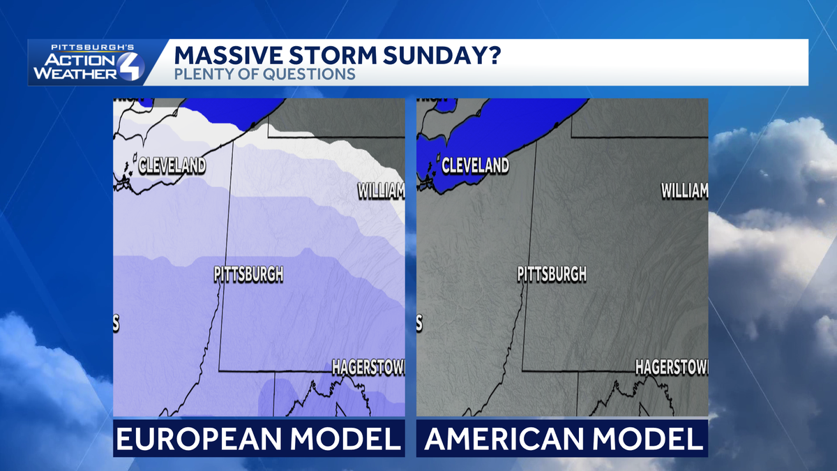
We are seeing two camps within our forecast models at this point. The first is where we see snow arrive potentially as early as late Saturday with snow through the day Sunday. Even within this camp, there are timing differences as some models keep snow from starting until late Sunday.
This solution would produce the most amounts of snow across Western PA. Even here, the highest amounts would likely be about half a foot, not the foot of snow some social media posts are showing.

Hearst Owned
Still plenty of questions for the weekend, but something we are watching closely.
The second camp is where the system stay off to our south and we see little if any snow across Western PA.
This is due to an area of high pressure to our north producing a north wind and shunting the system south of us. This camp has more support in our ensemble models – multi-run models that change conditions to simulate different effects.
Overall, it is still too early for sure to say we see snow, especially significant snow, in Western PA. Now is the time to simply monitor the forecast and stay with Pittsburgh’s Action Weather for the latest changes in the forecast.