
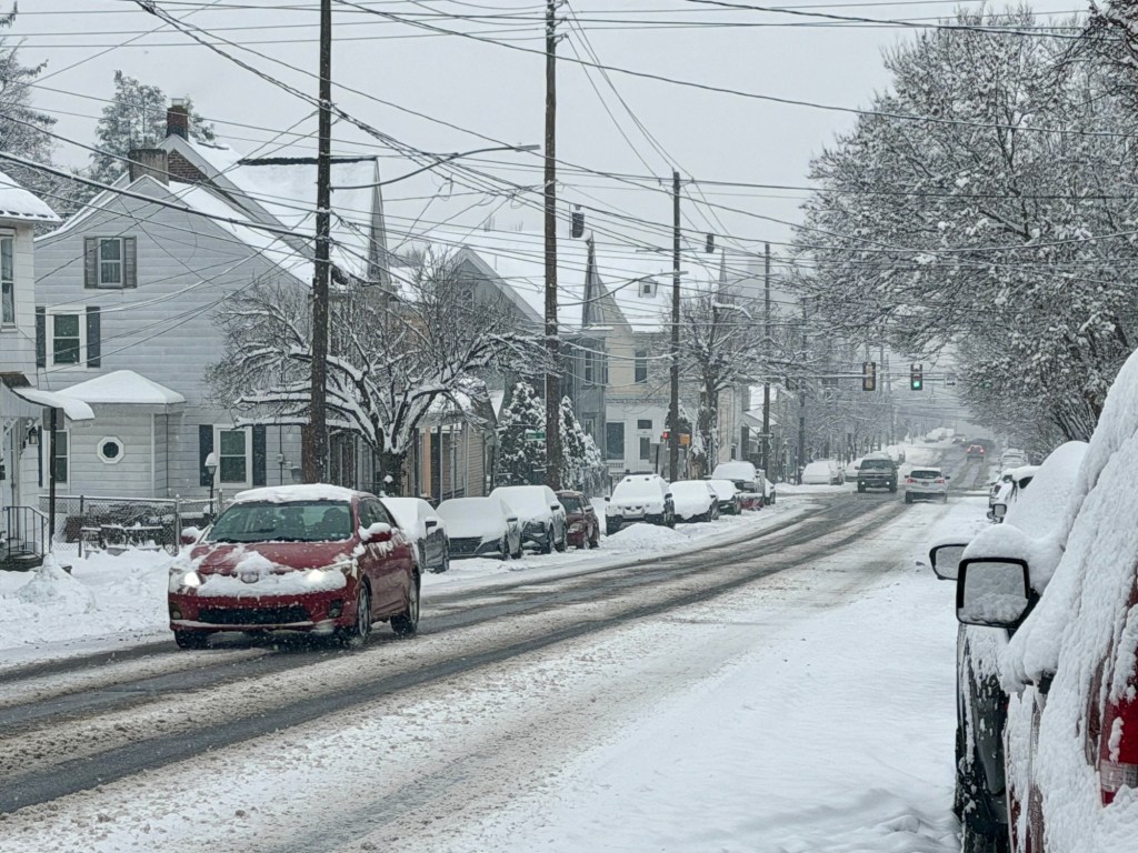
In less than two months, the Lehigh Valley has already gotten almost as much snow this winter as it did the entirety of last.
With this past weekend’s snowfall of 8.7 inches, the total snowfall for the region so far this winter is 16.7 inches, according to the National Weather Service in Mount Holly, New Jersey. That’s about 1 inch less than the total for all of last year’s winter, which had 17.8 inches of snow.
The normal for this time of year is also 10.9 inches, according to weather service meteorologist Mike Lee.
“We are running a little bit above normal,” he said.
The total snowfall so far this winter is also just a few inches behind the total snowfall for 2023-24, when 25.2 inches fell, according to weather service data. Should the region get more snow than that, it will be the snowiest winter since 2020-21, which had a total of 58.1 inches. That was the snowiest winter of the past 10 years.
Here’s some stats for our official airport climate stations which measure snow, including the weekend storms, season-to-date, and comparison to normal and recent history. For some areas, this is the snowiest first half of winter in over 10 years. pic.twitter.com/YyxCcqyteb
— NWS Mount Holly (@NWS_MountHolly) January 19, 2026
Snow also started a little earlier this year. The first measurable snowfall this season happened on Nov. 30 at .2 inches. About 5 inches of snow fell roughly two weeks later, in mid-December.
More than 7 inches of snow fell in December, making it he snowiest December in the Lehigh Valley since 2020, when 13 inches fell, according to weather service data.
Winter is now at its halfway point, with Jan. 21 marking the middle of what’s known as “meteorological winter.” That refers to the coldest period of the year based on climate data, as opposed to astronomical winter, which refers to the period with the fewest hours of daylight and the lowest angle of the sun in the sky. Meteorological winter begins Dec. 1 and continues through the end of February, while astronomical winter begins with the winter solstice on Dec. 21 and lasts until the spring equinox on March 20.
“It doesn’t mean that we’ve definitely seen the coldest air of winter, but it does mean averages will start going up,” the weather service’s Mount Holly forecast office noted in a post on its social media channels.
With more than a month left to go in meteorological winter, there is still plenty of time for more snow, including a potentially significant snowfall this weekend. Forecasters are keeping an eye on a potential major storm that could bring snow to the area Saturday into Sunday. A map from the weather service Tuesday showed the Lehigh Valley, Berks County and the Poconos as having a 40% chance of getting 5 inches of snow more.
AccuWeather said a far-reaching storm is expected to swing out of the Rocky Mountains into the Plains before hitting the eastern United States, and that wintry impacts are “likely.”
However, the long-term forecast is showing some signs of relief. The National Oceanic and Atmospheric Administration said that there is a below normal chance of precipitation from late January into early February for eastern Pennsylvania. Additionally, NOAA said precipitation and temperatures should be about normal for the next few months.
How much snow does the Lehigh Valley get in a season? How do we compare with other Pa. counties?